
MyTopo
Classic USGS Portal Georgia 7.5'x7.5' Topo Map
Couldn't load pickup availability
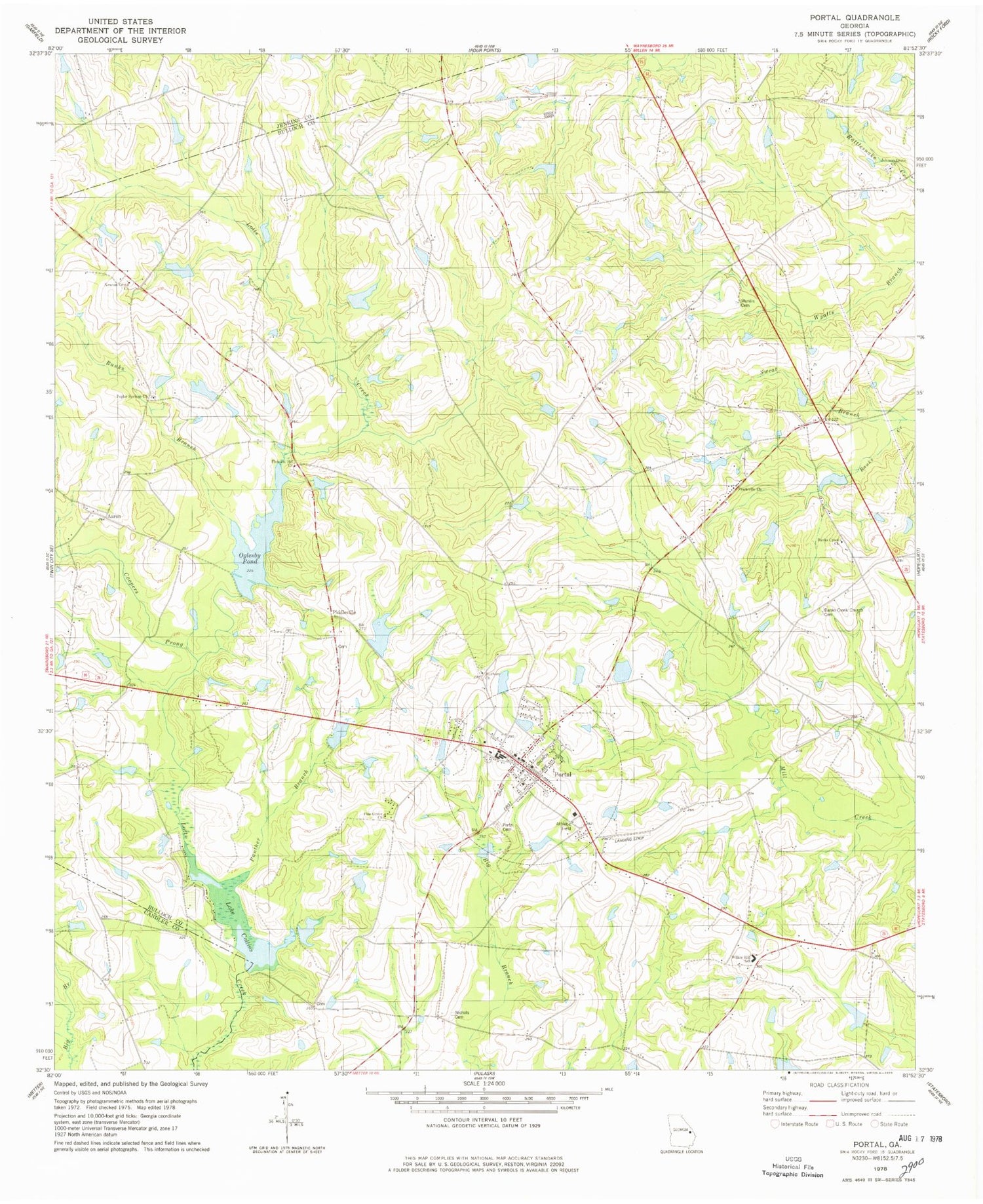
Historical USGS topographic quad map of Portal in the state of Georgia. Map scale may vary for some years, but is generally around 1:24,000. Print size is approximately 24" x 27"
This quadrangle is in the following counties: Bulloch, Candler, Jenkins.
The map contains contour lines, roads, rivers, towns, and lakes. Printed on high-quality waterproof paper with UV fade-resistant inks, and shipped rolled.
Contains the following named places: Aaron, Aaron Church, Banks Creek Church, Banks Creek Church Cemetery, Bland, Bradwell School, Bunks Branch, Clark Pond, Coopers Prong, DeLoach Mill, East Oglesby Pond, East Oglesby Pond Dam, Engleside School, Enterprise School, Fields Pond, Fields Pond Dam, Franklin Cemetery, Frankville Church, Hendrix Pond, Hendrix Pond Dam, Johnson Grove Cemetery, Johnson Grove Church, Kites Spur, Lake Collins, Lanier Pond, Lanier Pond Dam, Mincy Cemetery, Munlin Cemetery, Nessmith Pond Dam, Newton Grove Church, Nichols Cemetery, Oglesby Pond, Oglesby Pond Dam, Panther Branch, Parrish Lake, Parrish Lake Dam, Piddleville, Pine Grove Church, Pleasant Hill Cemetery, Pleasant Hill Church, Poplar Springs Cemetery, Poplar Springs Church, Portal, Portal Cemetery, Portal Division, Portal High School, Portal Police Department, Portal Post Office, Portal Primary School, Portal Volunteer Fire Department, Rock Hill School, Scarboro Church, Scarboro Grove Cemetery, Town of Portal, Willow Hill School, Womack Airport, ZIP Code: 30450


