MyTopo
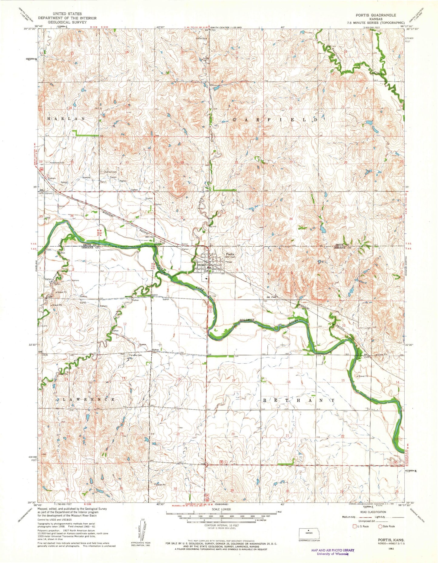
Classic USGS Portis Kansas 7.5'x7.5' Topo Map
Couldn't load pickup availability
Historical USGS topographic quad map of Portis in the state of Kansas. Map scale may vary for some years, but is generally around 1:24,000. Print size is approximately 24" x 27"
This quadrangle is in the following counties: Osborne, Smith.
The map contains contour lines, roads, rivers, towns, and lakes. Printed on high-quality waterproof paper with UV fade-resistant inks, and shipped rolled.
Contains the following named places: City of Portis, East Branch Twelvemile Creek, Fairview Cemetery, Garrett Cemetery, Grace Brethren Church of Portis, Hammond Cemetery, Joy Creek, Lawrence Creek, Lindley Creek, Midway Co - Operative Association Grain Elevator Number 11, Osborne Rural Fire Department Station 2, Portis, Portis Post Office, Township of Bethany, Township of Garfield, Twelve Mile, West Branch Twelvemile Creek, ZIP Code: 67474