MyTopo
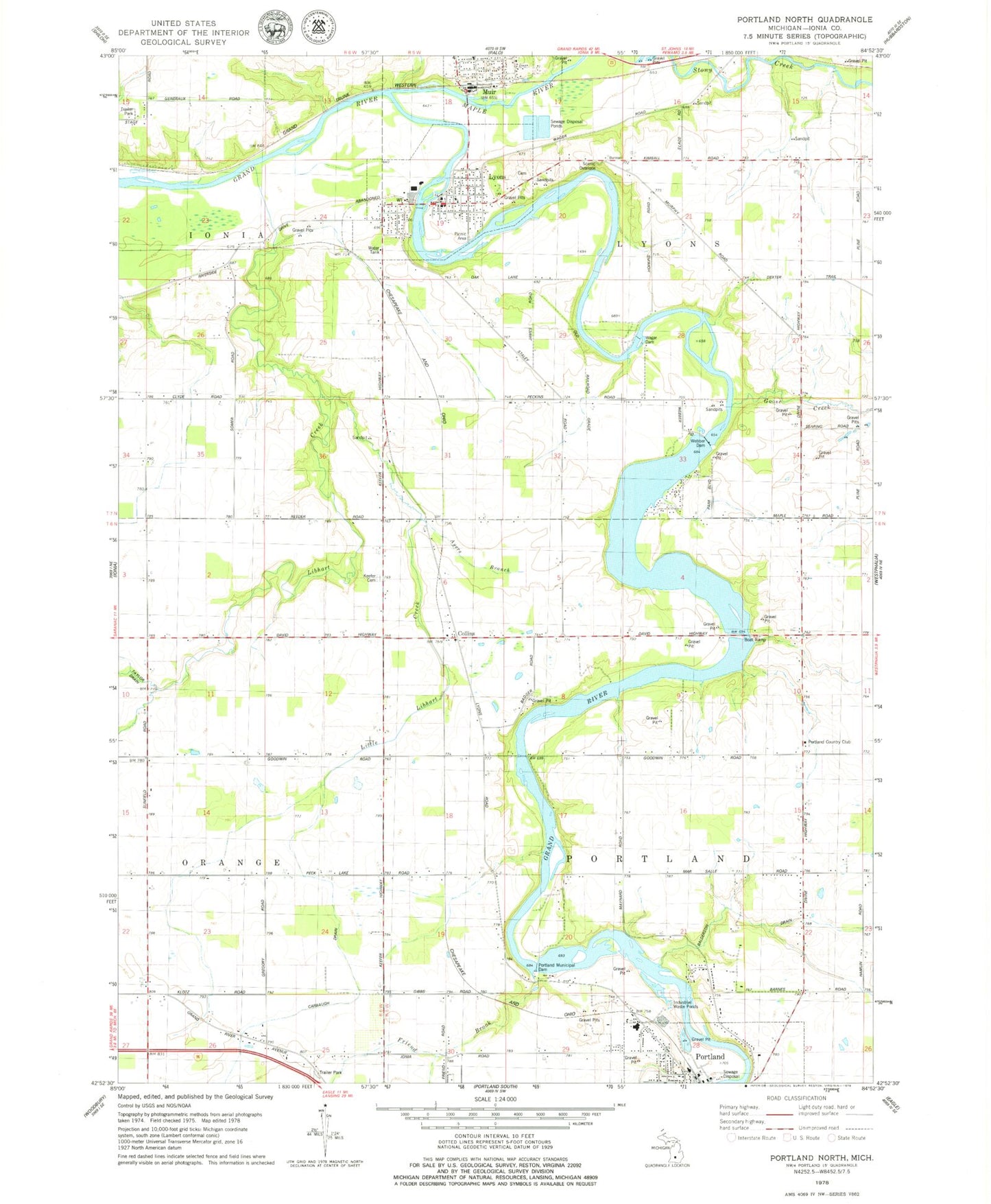
Classic USGS Portland North Michigan 7.5'x7.5' Topo Map
Couldn't load pickup availability
Historical USGS topographic quad map of Portland North in the state of Michigan. Map scale may vary for some years, but is generally around 1:24,000. Print size is approximately 24" x 27"
This quadrangle is in the following counties: Ionia.
The map contains contour lines, roads, rivers, towns, and lakes. Printed on high-quality waterproof paper with UV fade-resistant inks, and shipped rolled.
Contains the following named places: Ayers Branch, Balderson Drain, Bogue Flats Recreation Area, Brown Grave, Carbaugh Drain, Church of Christ Historical Marker, Collins, Collins Post Office, Collins Station, First Christian Church, Friend Brook, Goose Creek, Joe Tichvon Park, Keefer Cemetery, Kossuth Post Office, Libhart Creek, Little Libhart Creek, Lyons, Lyons - Muir Fire Department, Lyons Clinic Family Medicine, Lyons Post Office, Lyons Public Library, Lyons Station, Lyons Township Cemetery, Maple Post Office, Maple River, Mount Hope Church Portland, Muir, Muir Post Office, Muir Station, Portland Country Club, Portland High School, Portland Municipal Dam, Portland Station, Stoney Creek Pit, Township of Lyons, Township of Portland, Union Burial Ground, Village of Lyons, Village of Muir, Wagar Dam, Weber Dam, Westwood Elementary School, ZIP Code: 48851