
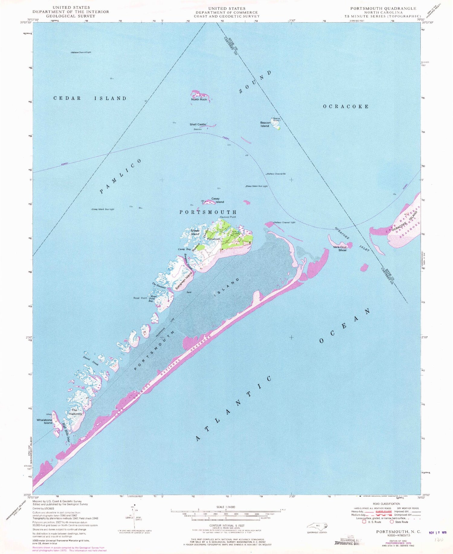
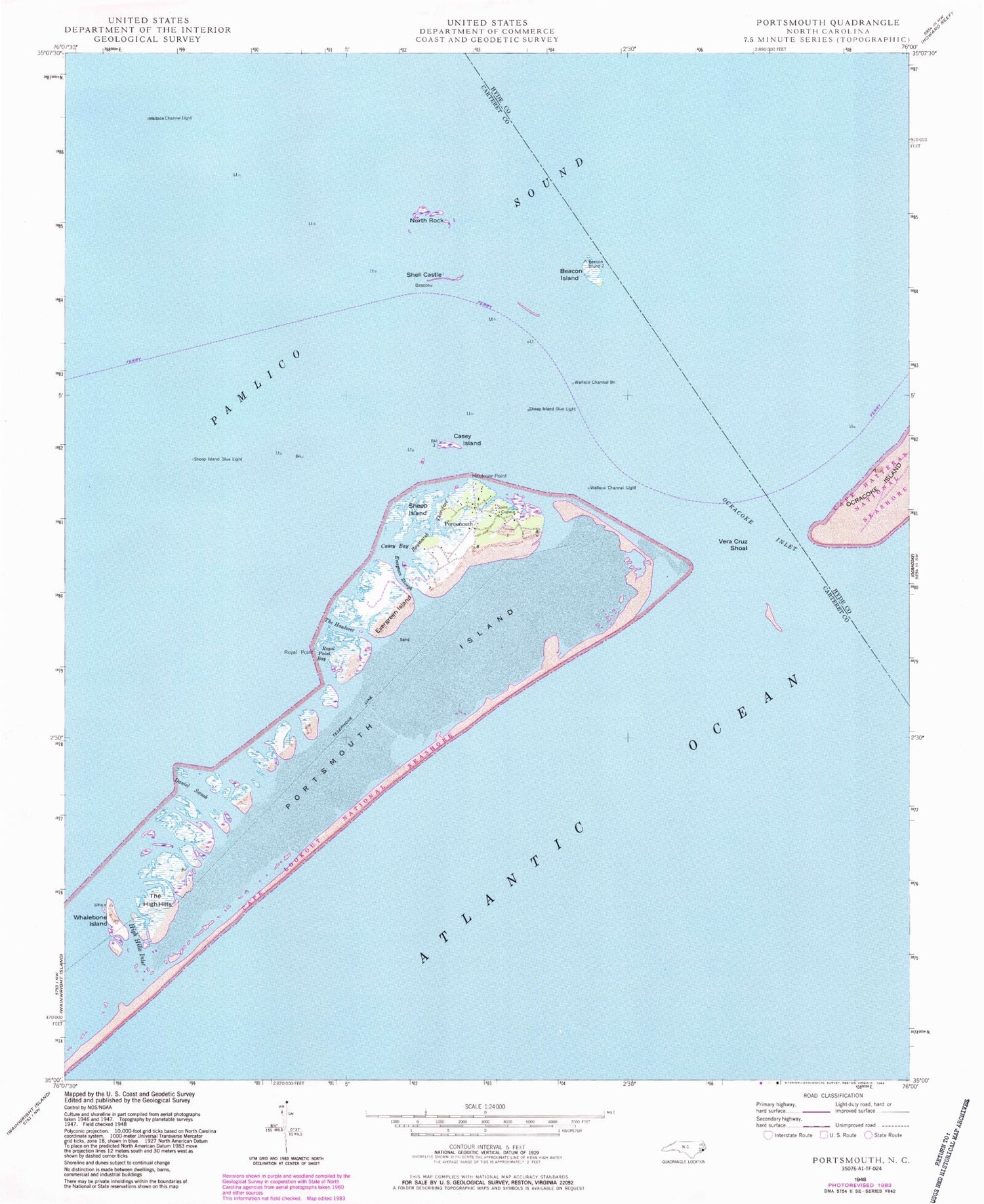
MyTopo
Classic USGS Portsmouth North Carolina 7.5'x7.5' Topo Map
Couldn't load pickup availability
Historical USGS topographic quad map of Portsmouth in the state of North Carolina. Map scale may vary for some years, but is generally around 1:24,000. Print size is approximately 24" x 27"
This quadrangle is in the following counties: Carteret, Hyde.
The map contains contour lines, roads, rivers, towns, and lakes. Printed on high-quality waterproof paper with UV fade-resistant inks, and shipped rolled.
Contains the following named places: Amity Shoal, Ayers Rock, Babb-Dixon Cemetery, Bay Marsh, Baymarsh Thorofare, Beacon Island, Beacon Island Roads, Blair Channel, Casey Bay, Casey Island, Community Cemetery, Daniel Swash, Evergreen Island, Evergreen Slough, Ferry Landing, Flounder Rock, Grace Cemetery, Haulover Point, High Hills Inlet, Horse Island Channel, Life Saving Service Station, Methodist Church, Mount Vernon Rock, North Rock, Ocracoke Inlet, Oyster Rocks, Portsmouth, Portsmouth Cemetery, Portsmouth Island, Portsmouth Village, Portsmouth Village Ranger Station, Royal Point, Royal Point Bay, Schoolhouse, Sheep Island, Sheep Island Slue Light, Shell Castle, The Haulover, The High Hills, Vera Cruz Shoal, Wallace Cemetery, Wallace Channel, Wallace Channel Beacon, Wallace Channel Light, Warren Gilgos Creek, Whalebone Inlet, Whalebone Island


