
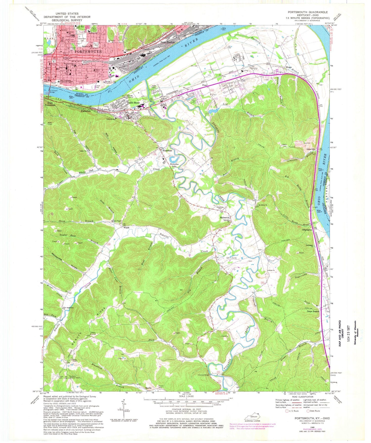
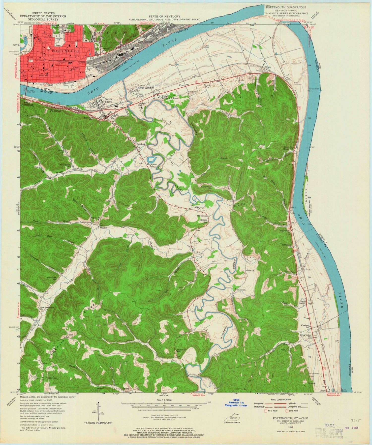
MyTopo
Classic USGS Portsmouth Ohio 7.5'x7.5' Topo Map
Couldn't load pickup availability
Historical USGS topographic quad map of Portsmouth in the states of Ohio, Kentucky. Typical map scale is 1:24,000, but may vary for certain years, if available. Print size: 24" x 27"
This quadrangle is in the following counties: Greenup, Scioto.
The map contains contour lines, roads, rivers, towns, and lakes. Printed on high-quality waterproof paper with UV fade-resistant inks, and shipped rolled.
Contains the following named places: Bannon Park, Brewery Hollow, Garfield School, Greenlawn Cemetery, Holy Redeemer School, Mabert Hollow, Mound Park, Washington School, York Park, Barretts Landing, Pratters Landing, Branch Rickey Park, Bonanza Bar, Portsmouth High School, McKinley Middle School, Mercy Hospital, Southern Hills Hospital, Portsmouth City Hall, Labold Field, Hitchcock Landing, Portsmouth, Ohio Avenue Christian Church, Mount Lebanon Baptist Chapel, Mabert Road Baptist Church, Apostolic Tower of Faith Church, First Lutheran Church, Church of Christ, Franklin Avenue United Methodist Church, Central Church of Christ, Calvary Baptist Church, Kingdom Hall Jehovahs Witnesses, Pleasant Green Baptist Church, House of God, Greater Emmanuel Temple, Findlay Street United Methodist Church, Apostolic Gospel Church, First Church of the Nazarene, Portsmouth Church of God, Wesley United Methodist Church, Holy Redeemer Catholic Church, Temple Baptist Church, Second Presbyterian Church, First Christian Church, Shadow of the Almighty Church, First United Methodist Church, Evangel Temple Assembly of God Church, Evangelical United Church of Christ, Ohio University Portsmouth Branch, Boneyfiddle Commercial Historic District, Bigelow Church, Patton Run, Portsmouth Public Library, Highland Elementary School, Lincoln Elementary School, Stanton Elementary School, Wilson Elementary School, U S Grant Middle School, Portsmouth Post Office, Portsmouth Fire Department Hilltop Fire Station, Portsmouth Fire Department Central Fire Station, American Ambulance, Life Ambulance Services Station 1, Healthnet Aeromedical Services Healthnet 4, Portsmouth Emergency Ambulance Services, Lawson Run Wastewater Treatment Plant, Portsmouth Police Department, Scioto County Sheriff's Office, Bear Branch, Beauty Ridge, Bennett Chapel, Bethlehem Church, Big Rocky Branch, Craycraft Branch, Dry Branch, Dry Fork, Fairview Church, Fannin Cemetery, Flat Hollow, Fullerton, Fullerton School, Globe Church Of Christ, Grays Branch, Horseshoe Lake, Howe Cemetery, Hunt Branch, Legion Park, Lick Branch, Limeville Branch, Little Rocky Branch, Lower White Oak Creek, McKell High School, McKell School, Mount Oliver Church, New Bethlehem Church, Newberry Branch, Peter Cave Branch, Plum Fork, Rattlesnake Hollow, Buck Creek, Schultz Creek, Sheep Branch, Siloam Branch, South Shore, Still Hollow, Sunshine, Taylor Hunt Branch, Town Branch, Valley Church, Wingo Creek, Edgington, Frost, Limeville, Maloneton, Siloam, Walsh, Tygarts Creek, Reed Landing Post Light, Howland Lookout Tower, South Shore Division, South Shore Post Office, City of South Shore, Siloam Census Designated Place, South Shore Volunteer Fire Protection District, Maloneton Volunteer Fire Department, South Shore Police Department


