MyTopo
Classic USGS Possum Run Creek Montana 7.5'x7.5' Topo Map
Regular price
$16.95
Regular price
Sale price
$16.95
Unit price
per
Couldn't load pickup availability
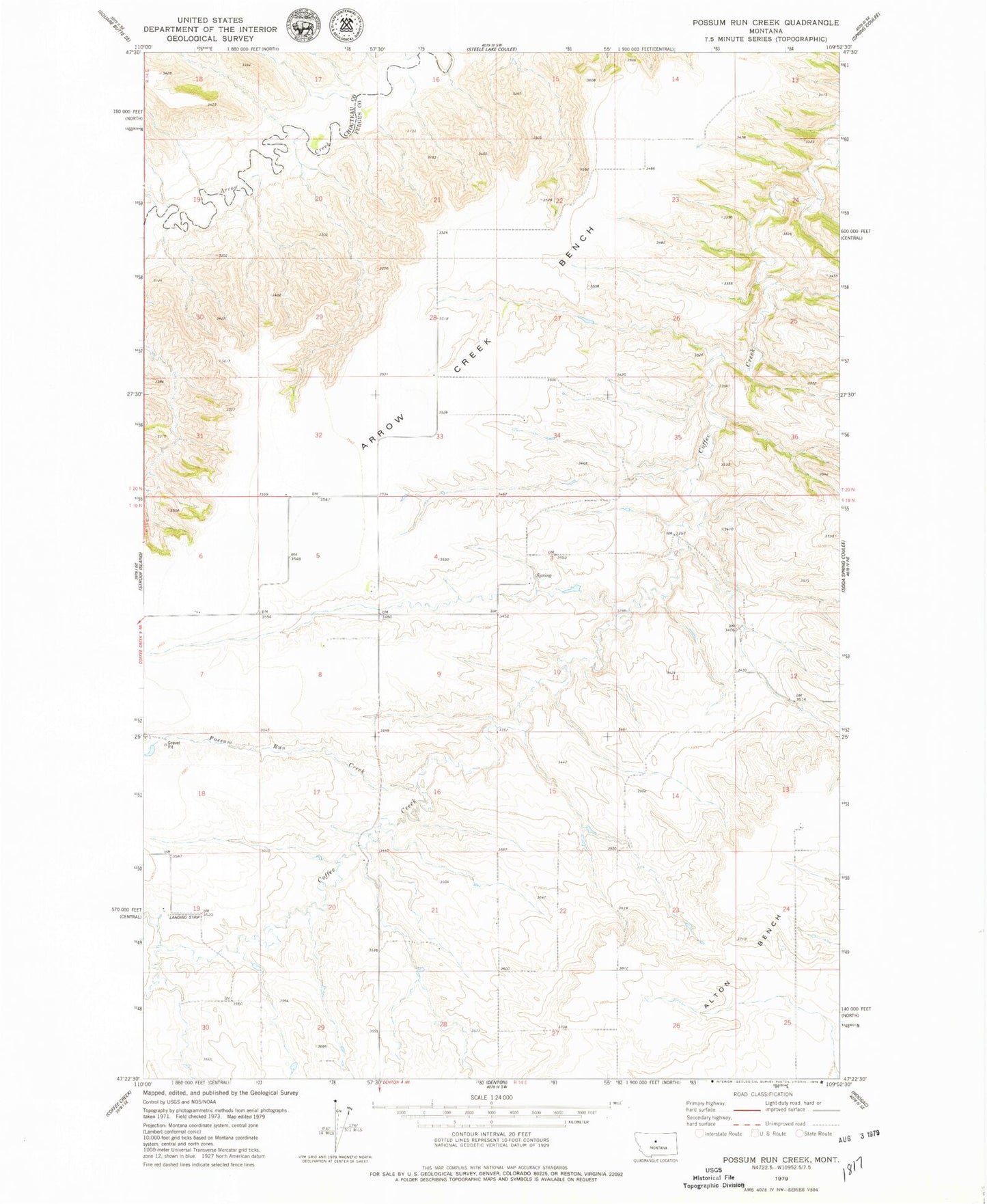
Historical USGS topographic quad map of Possum Run Creek in the state of Montana. Map scale may vary for some years, but is generally around 1:24,000. Print size is approximately 24" x 27"
This quadrangle is in the following counties: Chouteau, Fergus.
The map contains contour lines, roads, rivers, towns, and lakes. Printed on high-quality waterproof paper with UV fade-resistant inks, and shipped rolled.
Contains the following named places: 19N14E03CAC_01 Spring, 19N14E05DDA_01 Well, 19N14E06CDD_01 Well, 19N14E07BAA_01 Well, 19N14E12BBB_01 Well, 19N14E12BC__01 Well, 19N14E17ADC_01 Well, Alton Bench, Babbitt School, Cavanaugh School, Kingsbury Number 1 Dam, Matthews School, Possum Run Creek