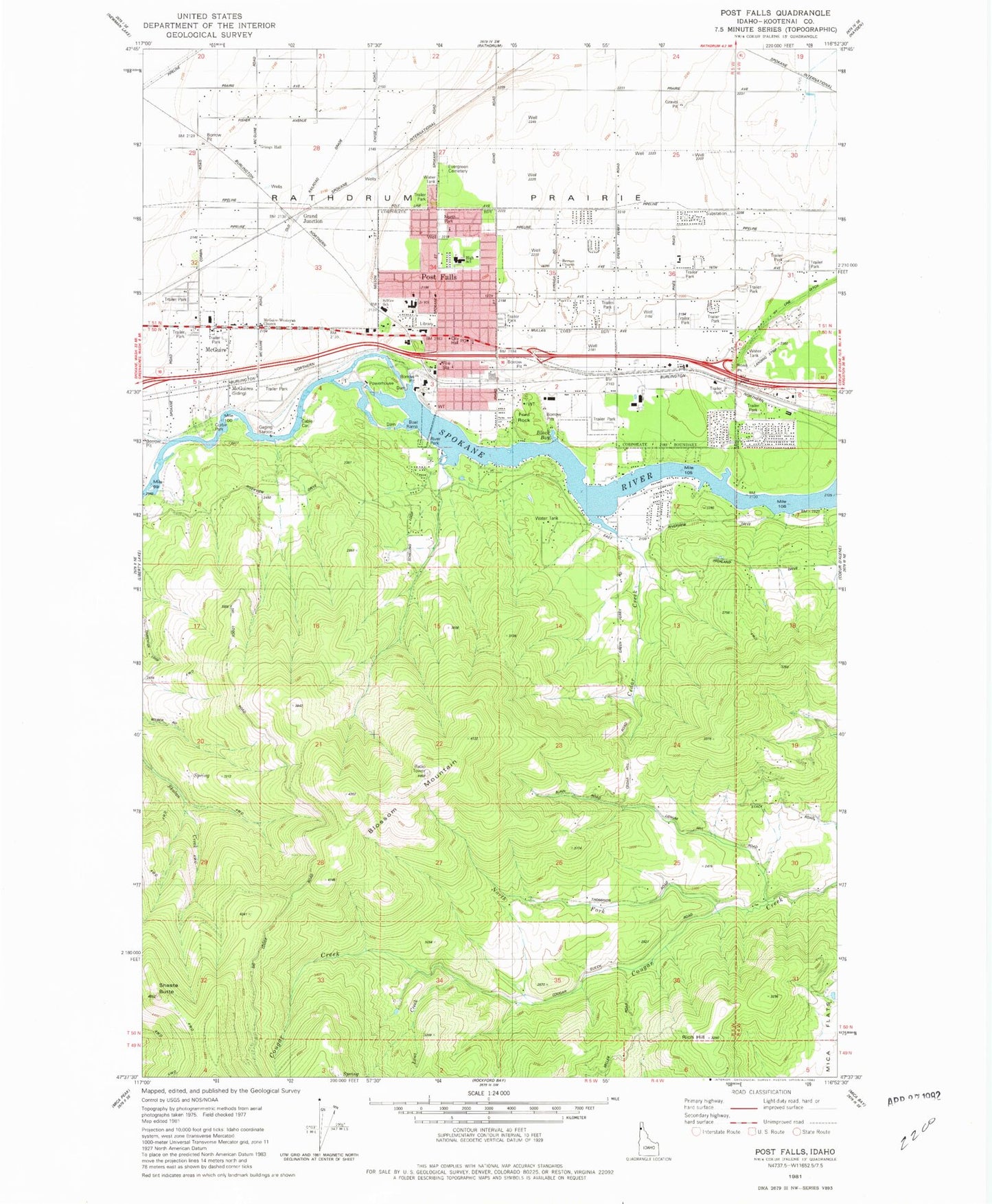
MyTopo
Classic USGS Post Falls Idaho 7.5'x7.5' Topo Map
Couldn't load pickup availability
Historical USGS topographic quad map of Post Falls in the state of Idaho. Typical map scale is 1:24,000, but may vary for certain years, if available. Print size: 24" x 27"
This quadrangle is in the following counties: Kootenai.
The map contains contour lines, roads, rivers, towns, and lakes. Printed on high-quality waterproof paper with UV fade-resistant inks, and shipped rolled.
Contains the following named places: Black Bay, Blossom Mountain, Cloverleaf Grange, Corbin Park, East Greenacres School, Evergreen Cemetery, Ford Rock, Lenz Creek, McGuire School, McGuires, North Fork Cougar Creek, Ross Point, Shasta Butte, Grand Junction, North Park, Post Falls High School, Mullan Trail Elementary School, Post Falls Square Shopping Center, River Park, Berean Church, Cedar Creek, Hy Line Ditch, McGuire-Wesleyan Church, East Greenacres East Ditch, McGuire, Post Falls, Rich Hill, Post Falls Dam, Otterson Ranch Airport (historical), Hubofs Heliport, Ponderosa Elementary School, Ross Point Bird Farm, Seltice Elementary School, Frederick Post Kinder Center, Falls Christian Academy, Immaculate Conception Academy, KETB-FM (Coeur D'Alene), KCDA-FM (Coeur D'Alene), Schetkwe' (historical), City of Post Falls, Kootenai County Fire and Rescue Station 1, Kootenai County Fire and Rescue Station 3, Northern Idaho Advanced Care Hospital, Northwest Specialty Hospital, Post Falls City Police, Post Falls Post Office