MyTopo
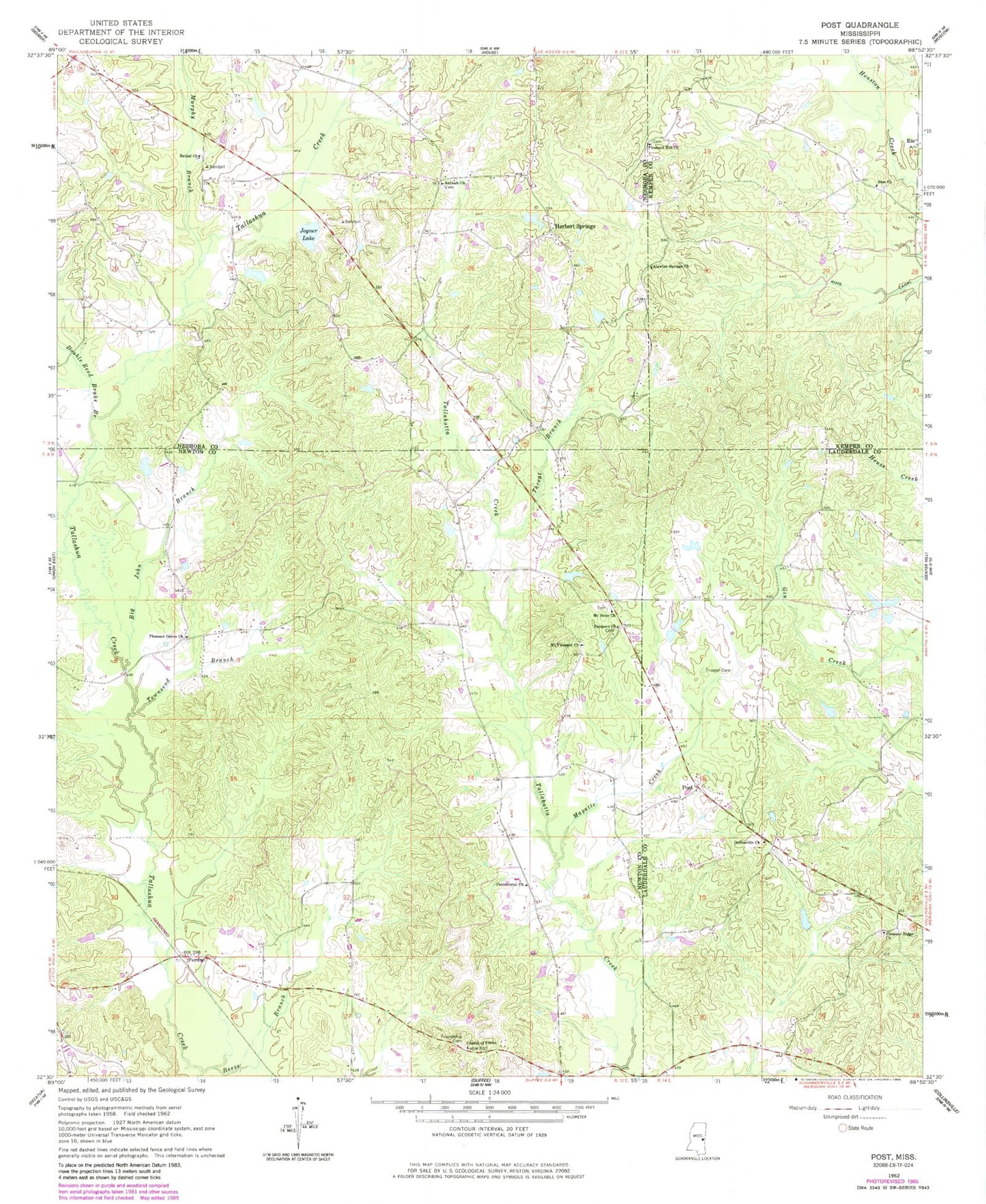
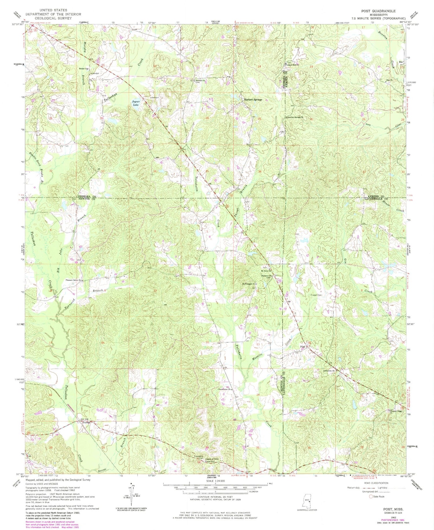
Classic USGS Post Mississippi 7.5'x7.5' Topo Map
Couldn't load pickup availability
Historical USGS topographic quad map of Post in the state of Mississippi. Map scale may vary for some years, but is generally around 1:24,000. Print size is approximately 24" x 27"
This quadrangle is in the following counties: Kemper, Lauderdale, Neshoba, Newton.
The map contains contour lines, roads, rivers, towns, and lakes. Printed on high-quality waterproof paper with UV fade-resistant inks, and shipped rolled.
Contains the following named places: Alawine Springs Church, Antioch Cemetery, Antioch Church, Battlefield, Battlefield School, Bethel Church, Big John Branch, Calverts Store, Church of Christ, Collinsville Church, Double Reed Brake Branch, Friendship Cemetery, Herbert Springs, Joiner Lake Dam, Joyner Lake, King Canal, Lee Pond Dam, Liberty School, Mayatte Creek, Mount Nebo Church, Mount Pleasant Church, Murphy Branch, Nelson Creek, Perdue, Pleasant Grove Church, Pleasant Hill Church, Pleasant Ridge Cemetery, Pleasant Ridge Church, Post, Prospect Church, Reese Branch, Rio, Texas, Threat Branch, Townsend Branch, Trussel Cemetery, Zion Cemetery, Zion Church, ZIP Codes: 39325, 39337