MyTopo
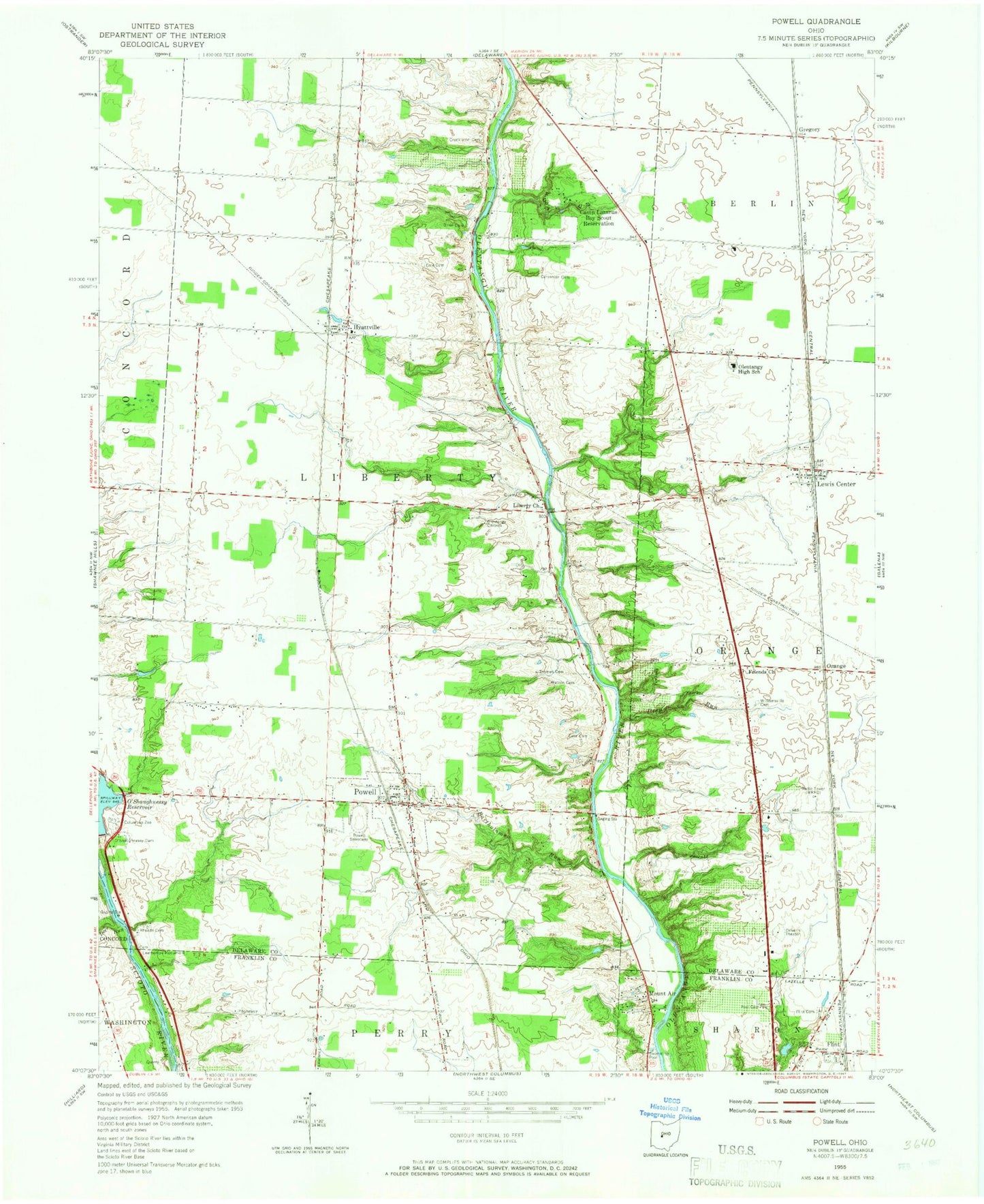
Classic USGS Powell Ohio 7.5'x7.5' Topo Map
Couldn't load pickup availability
Historical USGS topographic quad map of Powell in the state of Ohio. Typical map scale is 1:24,000, but may vary for certain years, if available. Print size: 24" x 27"
This quadrangle is in the following counties: Delaware, Franklin.
The map contains contour lines, roads, rivers, towns, and lakes. Printed on high-quality waterproof paper with UV fade-resistant inks, and shipped rolled.
Contains the following named places: Bartholomew Run, Camp Lazarus, Cole Cemetery, Deep Run, Fairview Memorial Park, Flint, Flint Cemetery, Friends Church, Liberty Church, Liberty Union School, Mount Air, Olentangy High School, Thomas Cemetery, Williamsville Cemetery, Tylers Run, Tanglewood Golf Course, Lewis Center, Worthington Hills Country Club, Worthington Hills, High Banks Metropolitan Park, Olentangy High Bluffs, Northwoods, Wingsong Country Club, Columbus Zoo, Powell, Gregory, Powell Community Church, Huffman Industrial Park, Liberty Township Park, Hyatt United Methodist Church, Delaware Country Club, Green Meadows Corporate Center, Orange, Deer Run, Bluff Run, Jacks Run, McKinney Run, Mohawk Run, Wild Cat Run, Worthington Christian Church, Double Duros Country Club, Wolf Run, WRFD-AM (Columbus-Worthington), Hyatts, Township of Liberty, Township of Perry, Liberty Cemetery, Powell Cemetery, Rhodes Cemetery, Big Meadows Picnic Area, Oak Coves Picnic Area, Edward F Hutchins Nature Preserve, Leatherlips Cemetery, Pool Family Cemetery, Gregory Post Office (historical), Lewis Center Post Office, Powell Post Office, Flint Post Office (historical), Liberty Township Community Building, Powell Village Hall, City of Powell, Worthington Arms, Orange Township Fire Department Station 361, Liberty Township Fire Department Station 321, Liberty Township Fire Department Station 322, Big Run, Lick Run, Weeping Rock Creek, Liberty Run, Reed Run, Powell Police Department, Glen Oak, Hidden Springs, Northport Meadows, Oldfield Estates, Olentangy Glade, Olentangy Meadows, Wynstone, Braumiller Woods, Bridlespur, Cheshire Crossing, Dornoch Estates, Estates At Braumiller, Glenross, Nelson Farms, North Orange, Olentangy Crossings, Olentangy Falls, Trails End, Village At North Falls, Wingate Farms