MyTopo
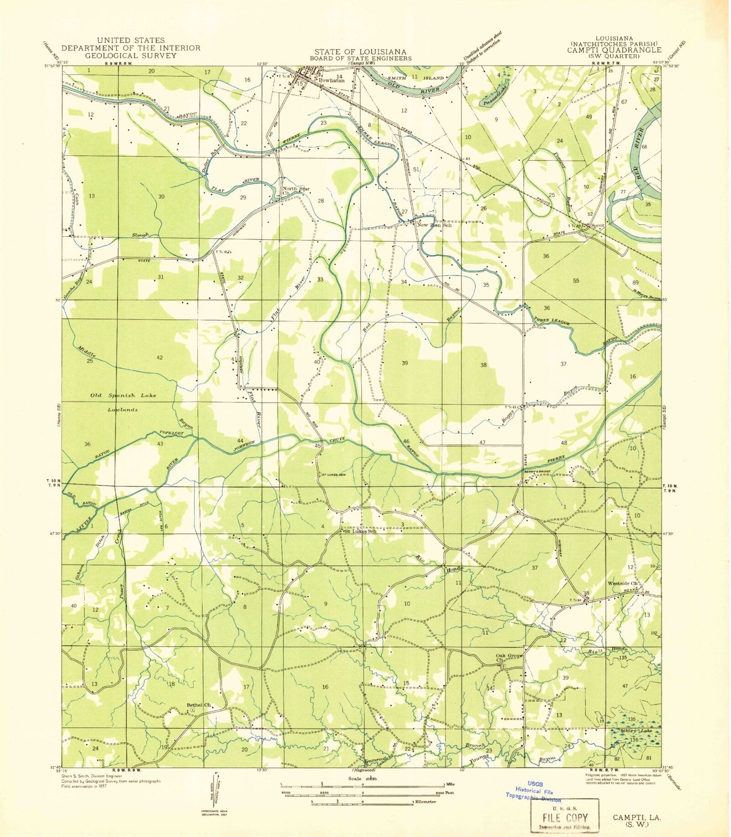
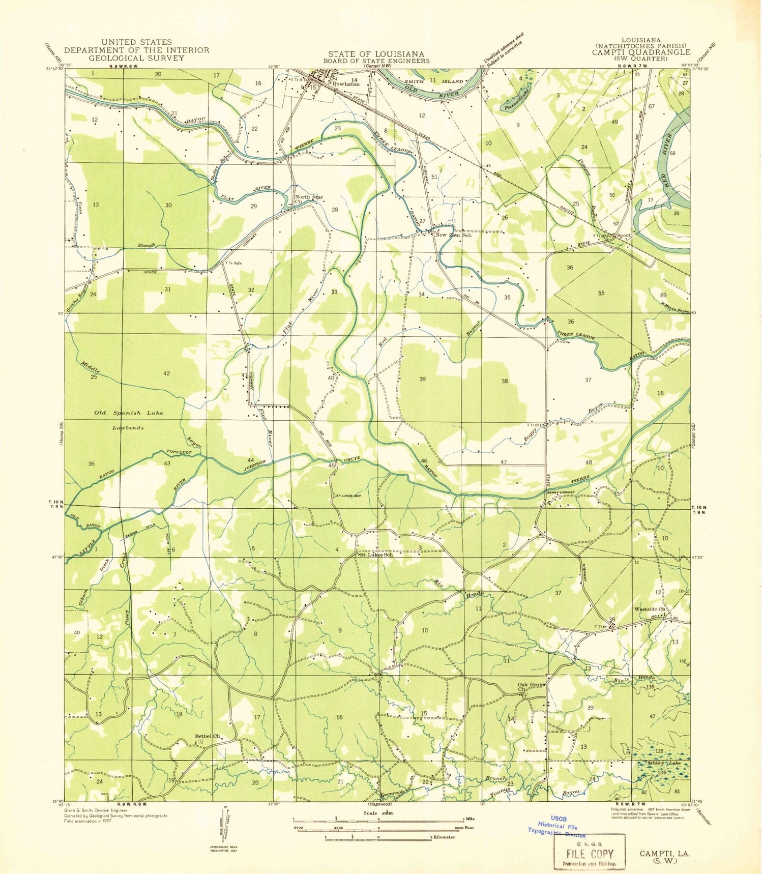
Classic USGS Powhatan Louisiana 7.5'x7.5' Topo Map
Couldn't load pickup availability
Historical USGS topographic quad map of Powhatan in the state of Louisiana. Map scale may vary for some years, but is generally around 1:24,000. Print size is approximately 24" x 27"
This quadrangle is in the following counties: Natchitoches.
The map contains contour lines, roads, rivers, towns, and lakes. Printed on high-quality waterproof paper with UV fade-resistant inks, and shipped rolled.
Contains the following named places: Bayou Pierre, Berean Church, Berry Bridge, Bethel Church, Boggy Bayou, Breedlove Branch, Calvary Church, Calvert Acres, Chute Bridge, Coon Slough, Fairview Acres, Flat River, Forest, Gibson Ditch, Gooch School, Greenwood Park, Gumroot Branch, Highland Acres, House of Faith Church, Johnson Chute, KSBH-FM (Coushatta), Little River, Lost Bayou, Middle Bayou, Natchitoches Country Club, Natchitoches Fire Protection District 10, New Zion Church, North Star Church, Oak Grove, Oak Grove Church, Oakhill, Oakleaf Estates, Old Spanish Lake Lowlands, Oldriver Red River, Parish Governing Authority District 4, Passoit Lake, Posey Branch, Powhatan, Red Bayou, Rio Hondo, Saint Francis Church, Saint John Church, Saint Lukes Cemetery, Saint Lukes Church, Stephens, Tabernacle School, Three League Bayou, Village of Powhatan, Westlake