MyTopo
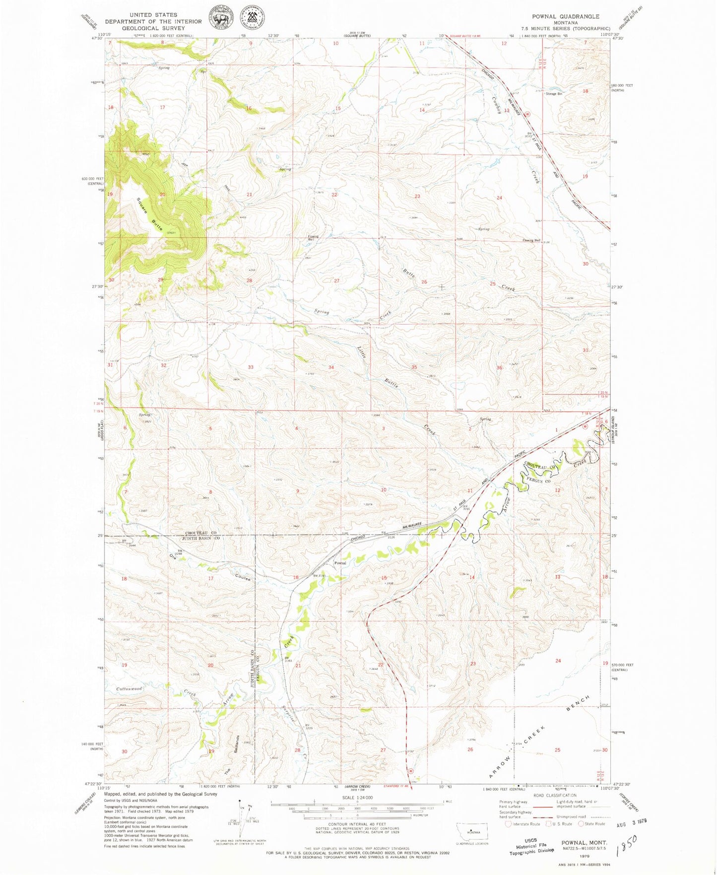
Classic USGS Pownal Montana 7.5'x7.5' Topo Map
Couldn't load pickup availability
Historical USGS topographic quad map of Pownal in the state of Montana. Map scale may vary for some years, but is generally around 1:24,000. Print size is approximately 24" x 27"
This quadrangle is in the following counties: Chouteau, Fergus, Judith Basin.
The map contains contour lines, roads, rivers, towns, and lakes. Printed on high-quality waterproof paper with UV fade-resistant inks, and shipped rolled.
Contains the following named places: 19N12E14DBA_01 Well, 19N12E28DCD_01 Well, 20N12E10CCCA01 Well, 20N12E13BCDB01 Well, 20N12E14BBD_01 Well, 20N12E24CCC_01 Well, 20N12E24DDD_01 Well, 20N13E18CDCB01 Well, Cottonwood Creek, Davis Creek, Little Battle Creek, Ole Coulee, Pownal, Spring Creek, Square Butte, Surprise Creek