MyTopo
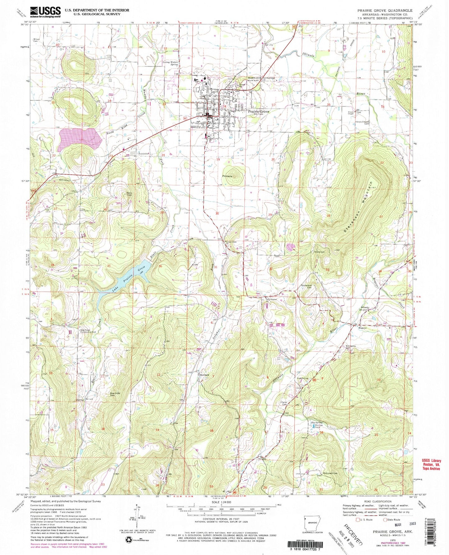
Classic USGS Prairie Grove Arkansas 7.5'x7.5' Topo Map
Couldn't load pickup availability
Historical USGS topographic quad map of Prairie Grove in the state of Arkansas. Map scale may vary for some years, but is generally around 1:24,000. Print size is approximately 24" x 27"
This quadrangle is in the following counties: Washington.
The map contains contour lines, roads, rivers, towns, and lakes. Printed on high-quality waterproof paper with UV fade-resistant inks, and shipped rolled.
Contains the following named places: Big Spring, Big Spring Church, Billingsley Cemetery, Billingsley Church, Blair Creek, Budd Kidd Creek, Budd Kidd Lake, Cane Hill Mountain, Center Point Church, Centre Point School, City of Prairie Grove, Hickory Creek, Hogeye, Hogeye Creek, Howell Cemetery, Hubbard, Hubbard Post Office, Illinois Chapel, Illinois Chapel Cemetery, Lake Prairie Grove, Liberty School, Living Waters Spring, Mc Donald Cemetery, Moffit Post Office, Muddy Fork of Illinois Site Number 3 Dam, New Hope Cemetery, New Hope Community Hall, New Hope School, New Sulphur Church, North Mayberry Mountain, Parks Cemetery, Pinnacle, Prairie Grove, Prairie Grove Battlefield State Park, Prairie Grove Elementary School, Prairie Grove Fire Department, Prairie Grove High School, Prairie Grove Lake Dam, Prairie Grove Middle School, Prairie Grove Post Office, Prairie Grove Upper Elementary School, Prarie Grove Police Department, Rutherford Cemetery, Sharp Cemetery, South Mayberry Mountain, Stevenson Mountain, Sulphur Fork, Sweetwater Creek, Township of Prairie Grove, Township of Valley, Wolf Mountain, ZIP Code: 72753