MyTopo
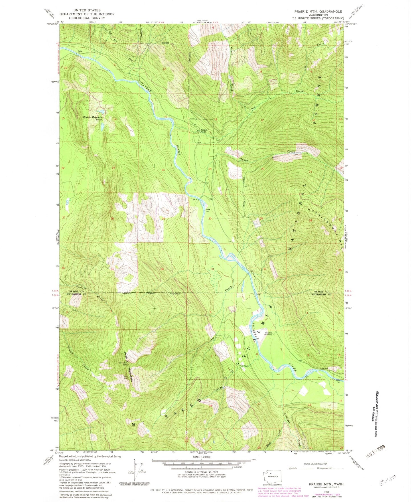
Classic USGS Prairie Mountain Washington 7.5'x7.5' Topo Map
Regular price
$16.95
Regular price
Sale price
$16.95
Unit price
per
Couldn't load pickup availability
Historical USGS topographic quad map of Prairie Mountain in the state of Washington. Map scale may vary for some years, but is generally around 1:24,000. Print size is approximately 24" x 27"
This quadrangle is in the following counties: Skagit, Snohomish.
The map contains contour lines, roads, rivers, towns, and lakes. Printed on high-quality waterproof paper with UV fade-resistant inks, and shipped rolled.
Contains the following named places: All Creek, Big Creek, Black Creek, Conrad Creek, Dearinger Campground, Grade Creek, Jug Creek, Prairie Mountain, Prairie Mountain Lakes, Straight Creek, Suiattle Cemetery, Target Lake, Teepee Falls, Tenas Creek