MyTopo
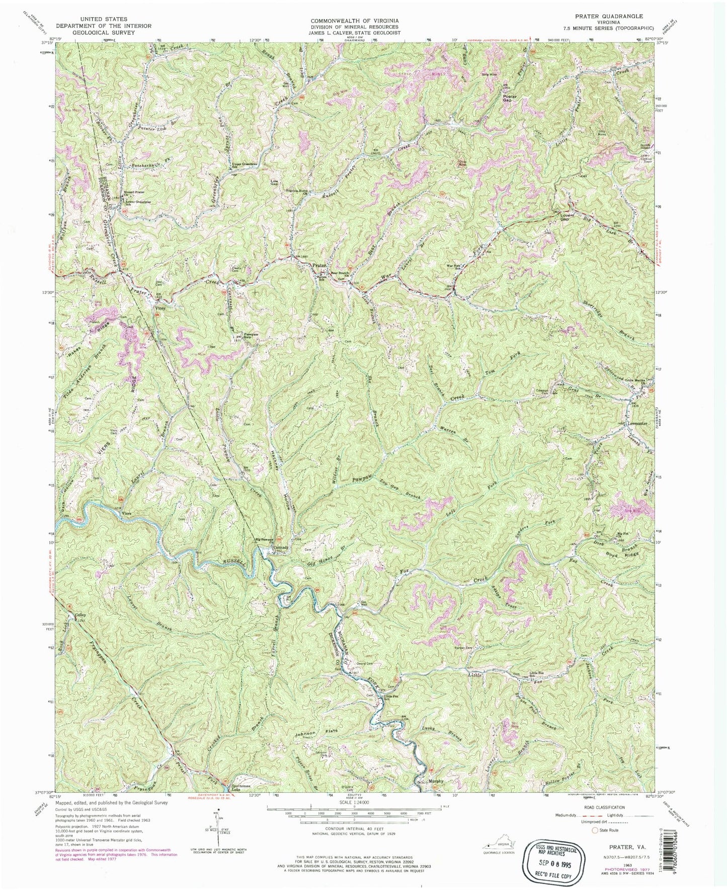
Classic USGS Prater Virginia 7.5'x7.5' Topo Map
Couldn't load pickup availability
Historical USGS topographic quad map of Prater in the state of Virginia. Map scale may vary for some years, but is generally around 1:24,000. Print size is approximately 24" x 27"
This quadrangle is in the following counties: Buchanan, Dickenson.
The map contains contour lines, roads, rivers, towns, and lakes. Printed on high-quality waterproof paper with UV fade-resistant inks, and shipped rolled.
Contains the following named places: Adkins Trace, Bear Branch, Bear Branch Church, Belcher Fork, Big Fox Church, Big Pawpaw Church, Boyd Ridge, Butcherknife Fork, Cannady, Cindy Fork, Coleman Cemetery, Colley, Cranenest Branch, Crooked Branch, Dark Hollow, Deel Branch, Deel Cemetery, Dick Branch, Farrell Branch, Fox Creek, Gent Branch, Greenbrier Creek, Grundy Municipal Airport, Hackney Hollow, Jackson Fork, Johnson Cemetery, Johnson Flats, Laurel Branch, Laurel Branch School, Leemaster, Left Fork Fox Creek, Lick Branch, Little Fox Creek, Little Fox School, Little Greenbrier Creek, Little Martha Church, Little Pawpaw Creek, Looney Fork, Lovers Gap, Low Gap, Low Gap Branch, Lower Greenbrier School, Lucky Branch, Murphy, Old House Branch, O'Quinn Cemetery, Owens Cemetery, Owens School, Painter Lick Branch, Pawpaw Creek, Pawpaw Gap, Pawpaw School, Pilgrims Home Church, Poplar Gap, Prater, Prater District, Priest Fork, Raines School, Rakes Ridge, Rock Lick, Rough Branch, Runyan Cemetery, Russell Prater Church, Russell Prater Elementary School, Russell Prater Fire Department - Rescue Squad, Sanders Fork, She Branch, Spicewood Branch, Sportsman Lake, Spruce Pine Branch, Tom Fork, Upper Greenbrier School, Upper Rakes Branch, Vicey, Viers, Viers Cemetery, Viers Ridge, War Fork, War Fork School, Warren Branch, Wildcat Branch, ZIP Code: 24220


