MyTopo
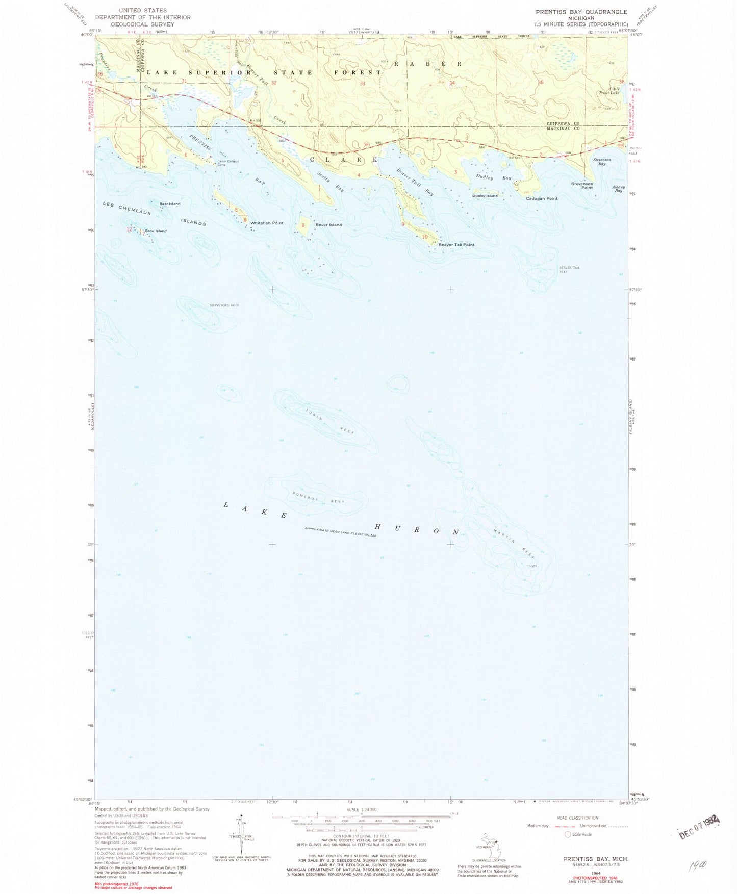
Classic USGS Prentiss Bay Michigan 7.5'x7.5' Topo Map
Couldn't load pickup availability
Historical USGS topographic quad map of Prentiss Bay in the state of Michigan. Map scale may vary for some years, but is generally around 1:24,000. Print size is approximately 24" x 27"
This quadrangle is in the following counties: Chippewa, Mackinac.
The map contains contour lines, roads, rivers, towns, and lakes. Printed on high-quality waterproof paper with UV fade-resistant inks, and shipped rolled.
Contains the following named places: Bear Island, Beaver Tail Bay, Beaver Tail Creek, Beaver Tail Point, Beaver Tail Reef, Cadogan Point, Cedar Campus Camp, Crow Island, Dudley Bay, Dudley Island, Loon Lake, Martin Reef, Pomeroy Reef, Prentis Bay Post Office, Prentiss Bay, Prentiss Creek, Rover Island, Scotty Bay, Stevenson Bay, Stevenson Point, Surveyors Reef, Tobin Reef, Whitefish Point