MyTopo
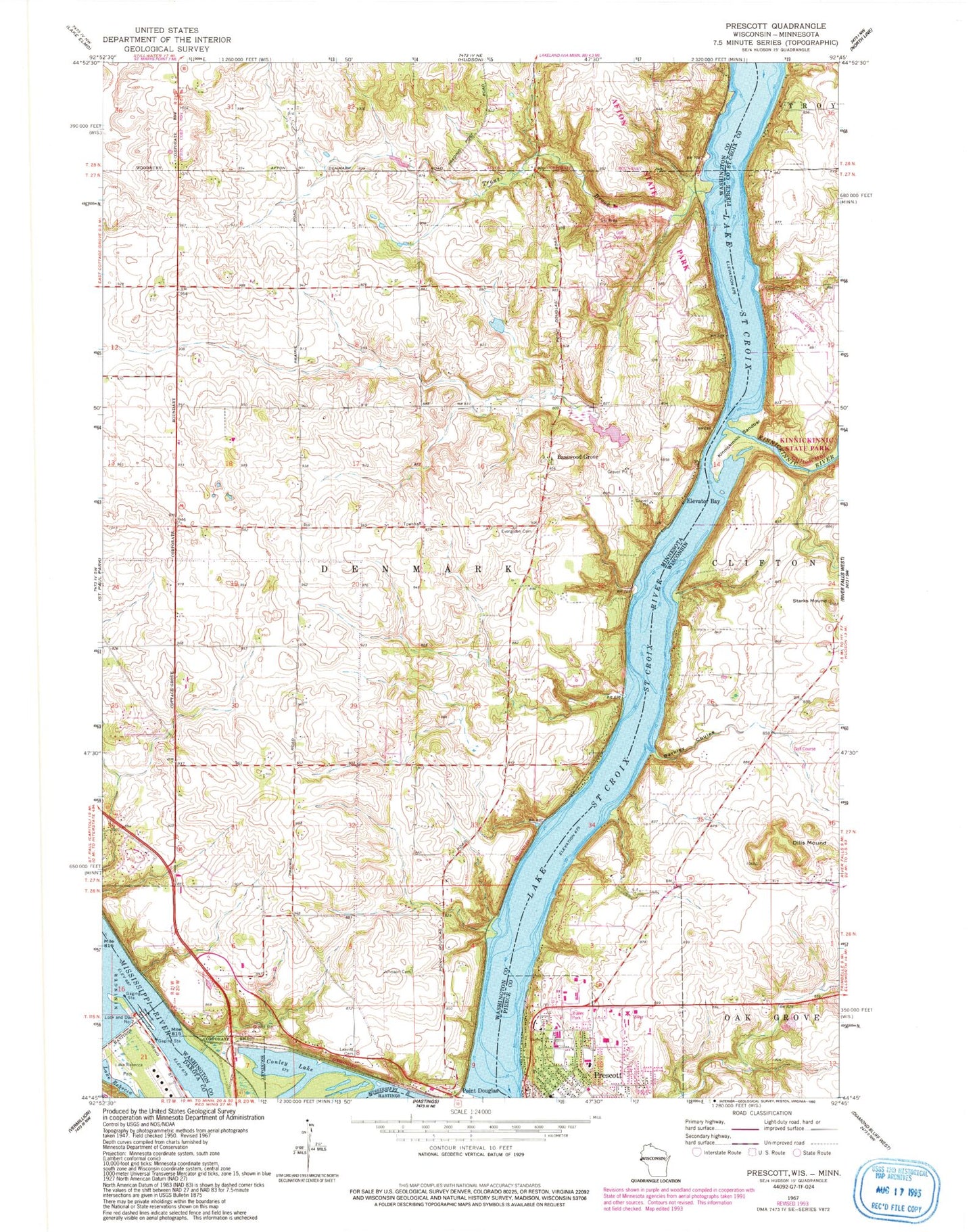
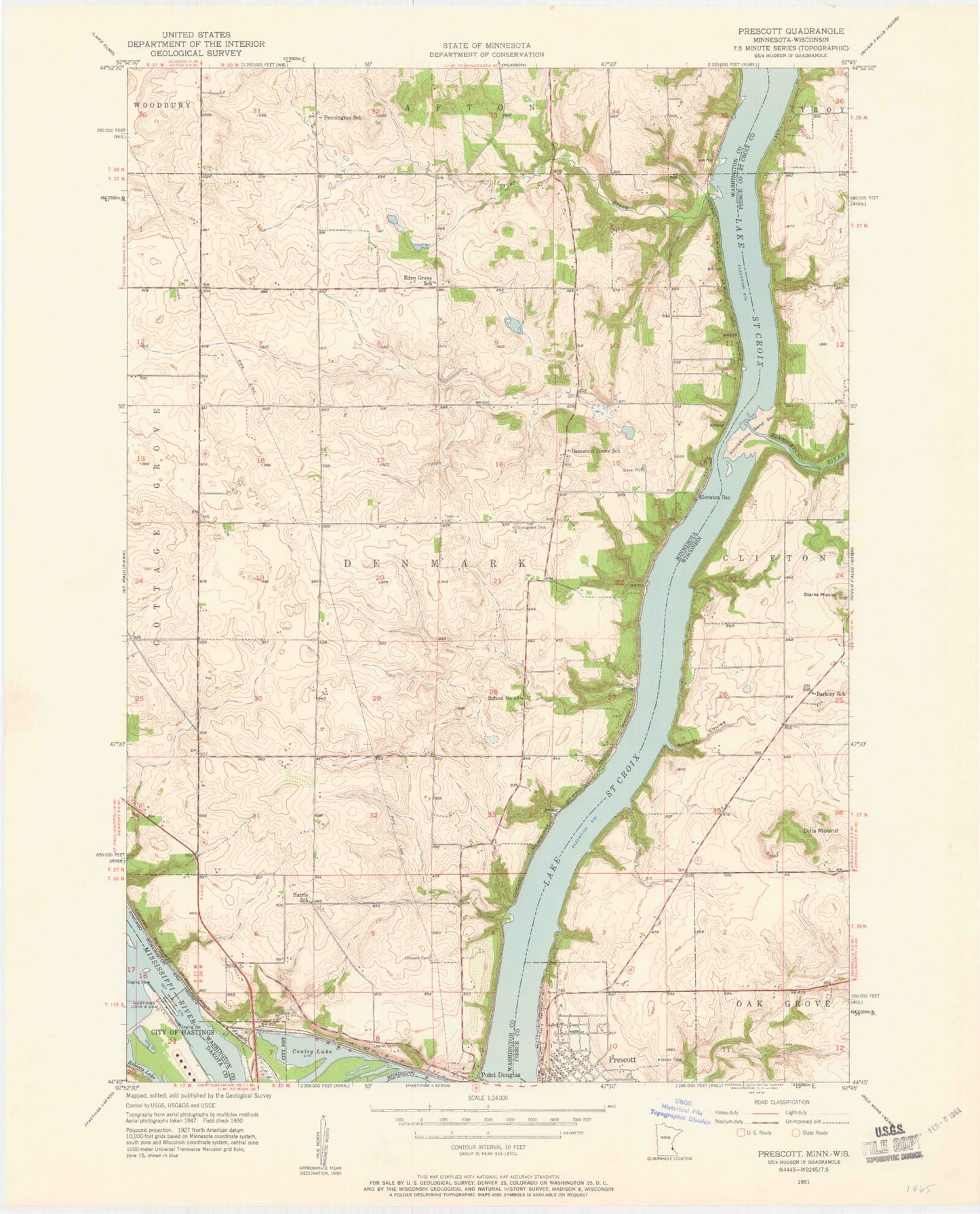
Classic USGS Prescott Wisconsin 7.5'x7.5' Topo Map
Couldn't load pickup availability
Historical USGS topographic quad map of Prescott in the states of Wisconsin, Minnesota. Typical map scale is 1:24,000, but may vary for certain years, if available. Print size: 24" x 27"
This quadrangle is in the following counties: Dakota, Pierce, St. Croix, Washington.
The map contains contour lines, roads, rivers, towns, and lakes. Printed on high-quality waterproof paper with UV fade-resistant inks, and shipped rolled.
Contains the following named places: Barkley Coulee, Clifton Hollow, Dills Mound, Kinnickinnic Sandbar, Starks Mound, Kinnickinnic River, St Croix Riviera Airport, City of Prescott, Andrea Park, Highlands Golf Club, Joy Lutheran Church, Malone Elementary School, Prescott High School, Riverhills Hospital, Saint Pauls Lutheran Church, Kinnickinnic River Gorge and Delta State Natural Area, Prescott Area Fire and Rescue Department, Prescott Police Department, Prescott Post Office, Conley Lake, Elevator Bay, Evergreen Cemetery, Johnson Cemetery, Lake Rebecca Park, Leavitt Cemetery, Lock and Dam 2, Point Douglas, Lake Rebecca, Trout Brook, Basswood Grove, Afton State Park, Township of Denmark, Schuester Pond Dam, Couwette Group Pond Dam, Locks and Dam Number 2, Saint Mary's Episcopal Cemetery, Point Douglas Post Office (historical), Afton Alps Golf Course, Afton Alps Ski Area, Afton Apple Orchards, Fischer's Croix Farm Orchard, Whistling Well Farm