MyTopo
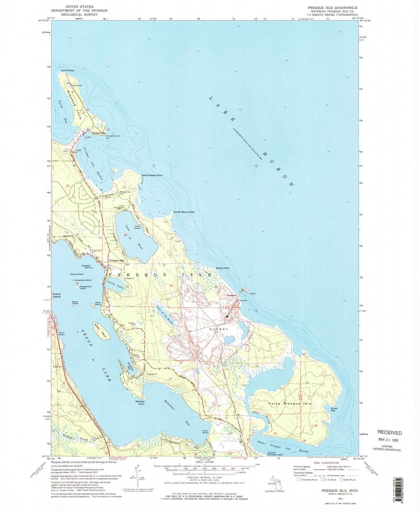
Classic USGS Presque Isle Michigan 7.5'x7.5' Topo Map
Couldn't load pickup availability
Historical USGS topographic quad map of Presque Isle in the state of Michigan. Typical map scale is 1:24,000, but may vary for certain years, if available. Print size: 24" x 27"
This quadrangle is in the following counties: Presque Isle.
The map contains contour lines, roads, rivers, towns, and lakes. Printed on high-quality waterproof paper with UV fade-resistant inks, and shipped rolled.
Contains the following named places: Bell River, Brown Island, Burnt Island, Camp Chickagami, Cedar Island, Crescent Island, Lake Esau, False Presque Isle, False Presque Isle Harbor, Harbor View, Horseshoe Island, Kauffman Bay, Knight Bay, Lotus Lake, Metzelaar Bay, North Albany Point, North Point, Old Lighthouse, Presque Isle, Presque Isle, Presque Isle Cemetery, Presque Isle Harbor, Round Island, South Albany Point, Tanglewood Island, Warren Creek, Whiskey Point, Lake of the Woods, Wreck Point, Stoneport, Preque Isle Light, Larks Harbor Lodge, Presque Isle Corporation, Presque Isle Post Office, Township of Presque Isle, Grand Lake Community Chapel, Grand Lake Branch Library, East Grand Lake Fire Department, Presque Isle Township Museum, Presque Isle Rear Range Lighthouse, Old Presque Isle Lighthouse, Presque Isle Lighthouse, Adeline Sims Grave, Old Presque Isle Lighthouse Historical Marker, Presque Isle Light Station Historical Marker, Presque Isle Harbor Census Designated Place, Stoneport Quarry