MyTopo
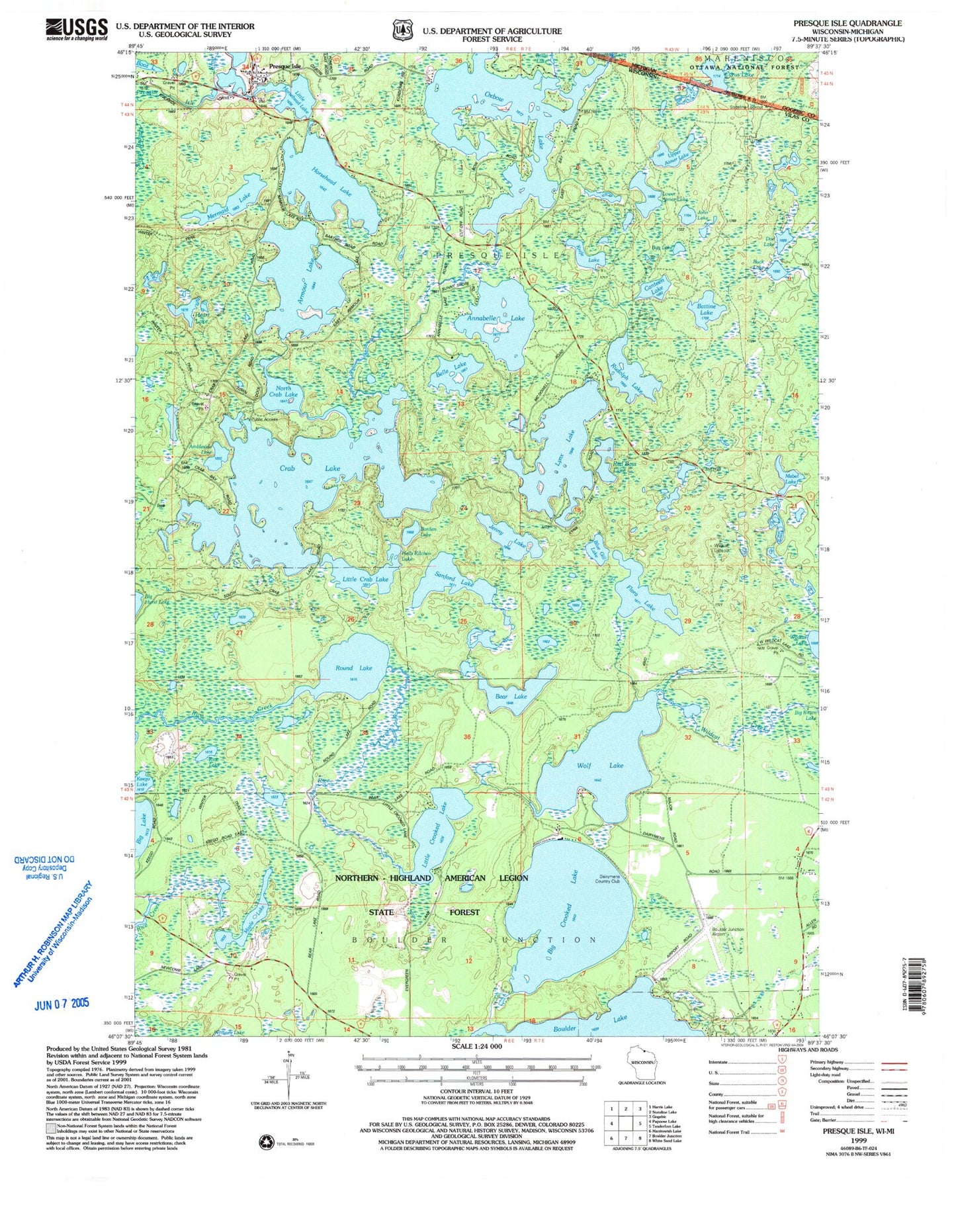
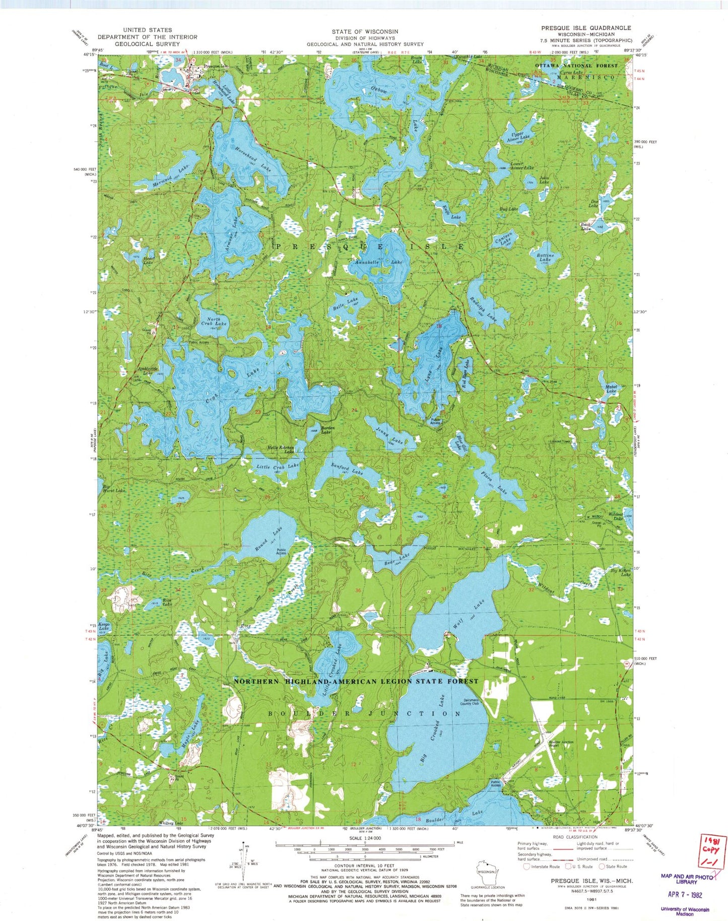
Classic USGS Presque Isle Wisconsin 7.5'x7.5' Topo Map
Couldn't load pickup availability
Historical USGS topographic quad map of Presque Isle in the states of Wisconsin, Michigan. Typical map scale is 1:24,000, but may vary for certain years, if available. Print size: 24" x 27"
This quadrangle is in the following counties: Gogebic, Vilas.
The map contains contour lines, roads, rivers, towns, and lakes. Printed on high-quality waterproof paper with UV fade-resistant inks, and shipped rolled.
Contains the following named places: Ambleside Lake, Annabelle Lake, Armour Lake, Battine Lake, Bear Lake, Belle Lake, Big Crooked Lake, Blue Gill Lake, Borden Lake, Buck Lake, Bug Lake, Canteen Lake, Crab Lake, Doe Lake, Flora Lake, Heart Lake, Hells Kitchen Lake, Horsehead Lake, Jenny Lake, John Lake, Keego Lake, Knife Lake, Little Crab Lake, Little Crooked Lake, Little Horsehead Lake, Lower Aimer Lake, Lynx Lake, Mabel Lake, Maple Lake, Mermaid Lake, North Crab Lake, Oxbow Lake, Red Bass Lake, Rice Lake, Round Lake, Rudolph Lake, Sanford Lake, Upper Aimer Lake, Wildcat Creek, Presque Isle, Wolf Lake, Wildcat Lookout, Boulder Junction Payzer Airport, Stateline Lookout Tower, Town of Presque Isle, Dairymens Country Club, Border Lakes State Natural Area, Presque Isle Volunteer Fire Department, Helmet Lake, Presque Isle Post Office, Cyrus Lake, Oxbow Lake, Stateline Lookout Tower