MyTopo
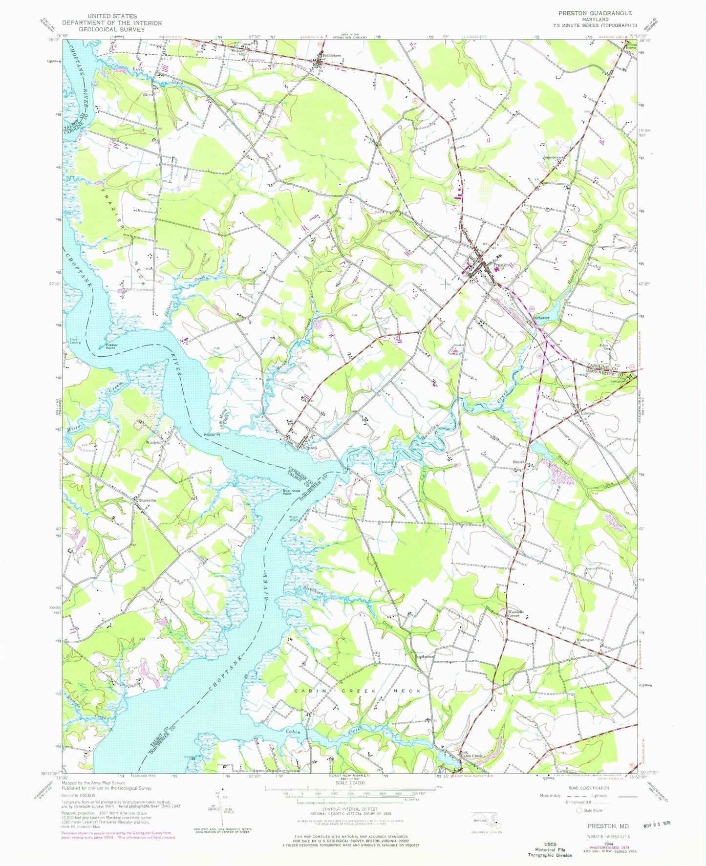
Classic USGS Preston Maryland 7.5'x7.5' Topo Map
Couldn't load pickup availability
Historical USGS topographic quad map of Preston in the state of Maryland. Map scale may vary for some years, but is generally around 1:24,000. Print size is approximately 24" x 27"
This quadrangle is in the following counties: Caroline, Dorchester, Talbot.
The map contains contour lines, roads, rivers, towns, and lakes. Printed on high-quality waterproof paper with UV fade-resistant inks, and shipped rolled.
Contains the following named places: Andertons Point, Back Landing, Bamberry Neck, Barkers Ferry, Belmont Acres, Belmont Cemetery, Bethesda Methodist Cemetery, Bethesda United Methodist Church, Bethlehem, Bethlehem Post Office, Beulah, Beulah Landfill, Blinkhorn Creek, Bow Knee Point, Bruceville, Cabin Creek, Cabin Creek Neck, Chapel of the Epiphany, Choptank, Choptank Census Designated Place, Chriscross Farm, Coppins Chapel, Coppins Chapel Cemetery, Discovery Farm, District 15 Hurlock, District 4 Preston, Eastern Shore Veterans Cemetery, Ellwood, Everlea, Ewens Bay, Faith Chapel United Methodist Church, Fox Creek, Frazier Neck, Frazier Point, Gravel Run, Great Choptank Hundred, Grove, Hog Island Landing, Hunting Creek, Hunting Creek Neck, Immanuel Lutheran Church, Johns Cemetery, Johns Church, Jonestown, Jonestown Community Park, Linchester, Linchester Mill, Linchester Mill Pond, Little Creek, Little Marsh Creek, Lloyd Landing, Mallard Point Farm, Marsh Creek, Maryland Noname 3 Dam, Maryland Noname 3 Reservoir, Miles Creek, Mount Calvary Church, Mount Pleasant Cemetery, Mount Zoar Church, Muskeeta Creek, Nelpine Mobile Home Park, Poplar Neck, Poplar Point, Preston, Preston Branch Library, Preston Cemetery, Preston City Hall, Preston Elementary School, Preston Lions Club Park, Preston Police Department, Preston Post Office, Preston Volunteer Fire Company Station 200, Prettyman Manor, Raccoon Creek, School Number 6, Skeleton Creek, Studd Point, Suicide Bridge, Tanyard Estates, Town of Preston, Waddells Corner, Washington Cemetery, Washington Church, West Haven, West View, Whispering Winds Farm, Windy Hill Cemetery, Windyhill, Wright Wharf, Wrights Wharf, ZIP Code: 21655