MyTopo
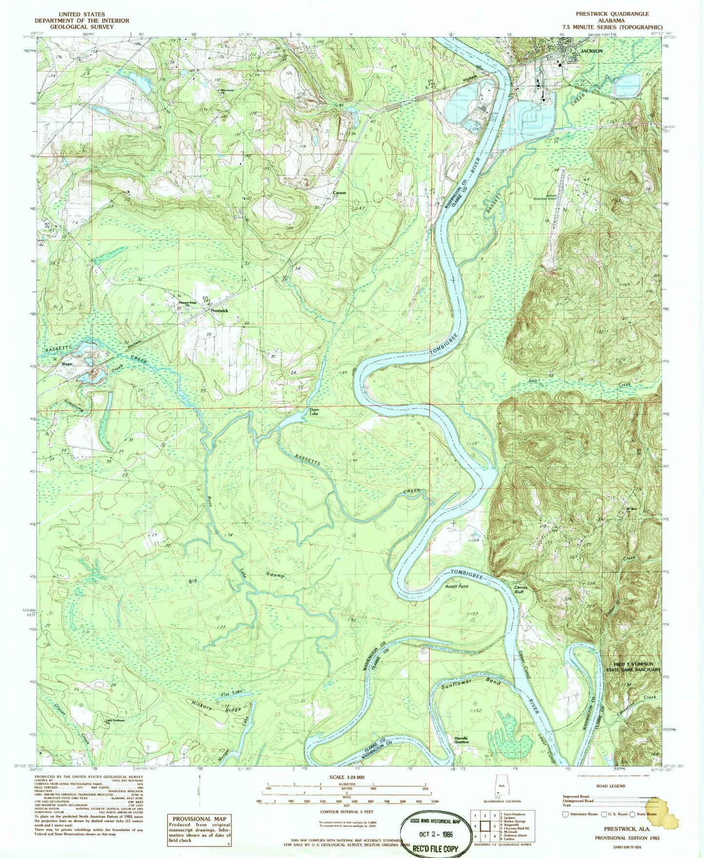
Classic USGS Prestwick Alabama 7.5'x7.5' Topo Map
Couldn't load pickup availability
Historical USGS topographic quad map of Prestwick in the state of Alabama. Map scale may vary for some years, but is generally around 1:24,000. Print size is approximately 24" x 27"
This quadrangle is in the following counties: Clarke, Washington.
The map contains contour lines, roads, rivers, towns, and lakes. Printed on high-quality waterproof paper with UV fade-resistant inks, and shipped rolled.
Contains the following named places: Armstrong Creek, Austill Point, Bassett Creek, Bassetts Creek, Bassetts Field, Big Swamp, Blackwells Bar, Blackwells Landing, Bowlings Ferry, Bowlings Woodyard Landing, Brown Cemetery, Carney Bluff, Carneys Landing, Carson, Caustills Landing, Cedar Grove Church, Christian Valley Church, Christian Valley School, City of Jackson Sewage Lagoon, City of Jackson Sewage Lagoon Dam, Dunn Lake, East Bassetts Bar, East Bassetts Landing, Fisher Creek, Flat Lake, Friendship Church, Gaines Creek, George Gaines Bar, German Ford, Harolds Landing, Harrells Quarters, Harwells Bar, Harwells Landing, Hickory Ridge, J P Mckee Dam, Jackson Ferry, Jackson Landing, Jackson Municipal Airport, Jackson Station, Keiths Gin Landing, Leroy Census Designated Place, Leroy Volunteer Fire Department Station 2, Limestone Creek, Little Sunflower Baptist Church, Lower Cutoff, Lowman Steam Plant, Masons Landing, Masons Lower Landing, Mckee Pond, Milers Gin Bar, Milers Gin Landing, Monger Lake, Mongers Landing, Mount Moriah Church, Mount Olive Baptist Church, Mount Olive Church, Old Sunflower Church, Paynes, Phil Mays Landing, Pine Grove Cemetery, Pine Grove Methodist Church, Platers Fish Camp, Pleasant Ridge Church, Posey Landing, Powells Landing, Prestwick, Prestwick High School, Ryon Lake, S C M Waste Treatment Pond, S C M Waste Treatment Pond Dam, Saint Nicholas Point, Salt Creek, SCM Wastewater Treatment Pond, Singleton Bar, Star Zion African Methodist Episcopal Zion Church, Sunflower Bend, Sunflower Cutoff Bar, Sunflower Landing, Tombigbee Power Plant, Upper Bassett Landing, Upper Cutoff, Vernal Chapel Baptist Church, Vernon Chapel, Wagar, Wings Lower Landing, ZIP Codes: 36548, 36581