MyTopo
Classic USGS Prince Creek Washington 7.5'x7.5' Topo Map
Couldn't load pickup availability
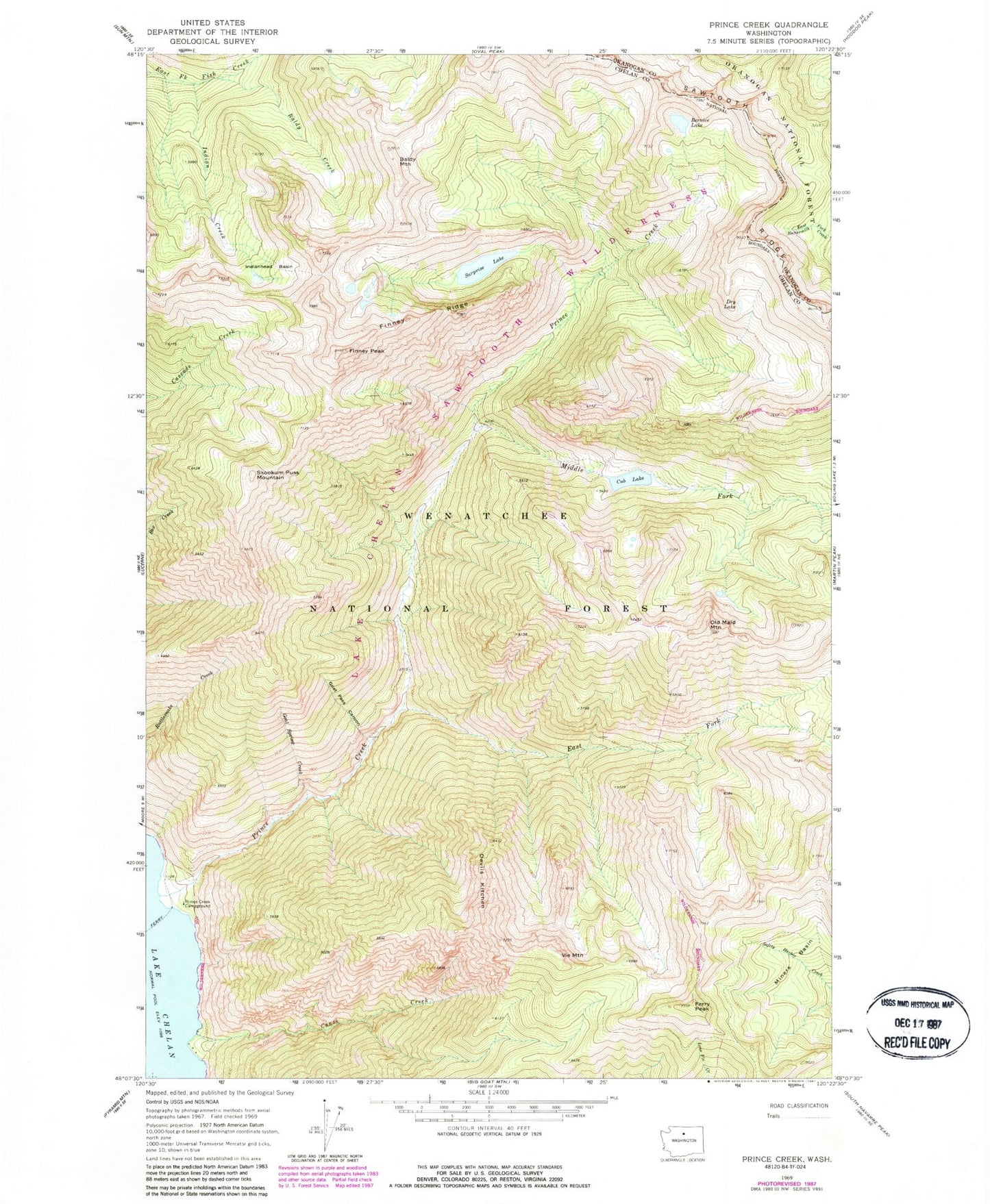
Historical USGS topographic quad map of Prince Creek in the state of Washington. Typical map scale is 1:24,000, but may vary for certain years, if available. Print size: 24" x 27"
This quadrangle is in the following counties: Chelan, Okanogan.
The map contains contour lines, roads, rivers, towns, and lakes. Printed on high-quality waterproof paper with UV fade-resistant inks, and shipped rolled.
Contains the following named places: Baldy Creek, Baldy Mountain, Bernice Lake, Canoe Creek, Cub Lake, Devils Kitchen, Dry Lake, East Fork Prince Creek, Ferry Peak, Finney Peak, Finney Ridge, Goat Pass Canyon, Goat Spring Creek, Indian Creek, Indianhead Basin, Middle Fork Prince Creek, Miners Basin, Old Maid Mountain, Prince Creek, Prince Creek Campground, Skookum Puss Mountain, Surprise Lake, Vie Mountain, Prince Creek Guard Station, Cub Lake Campsite, Surprise Lake Campsite