MyTopo
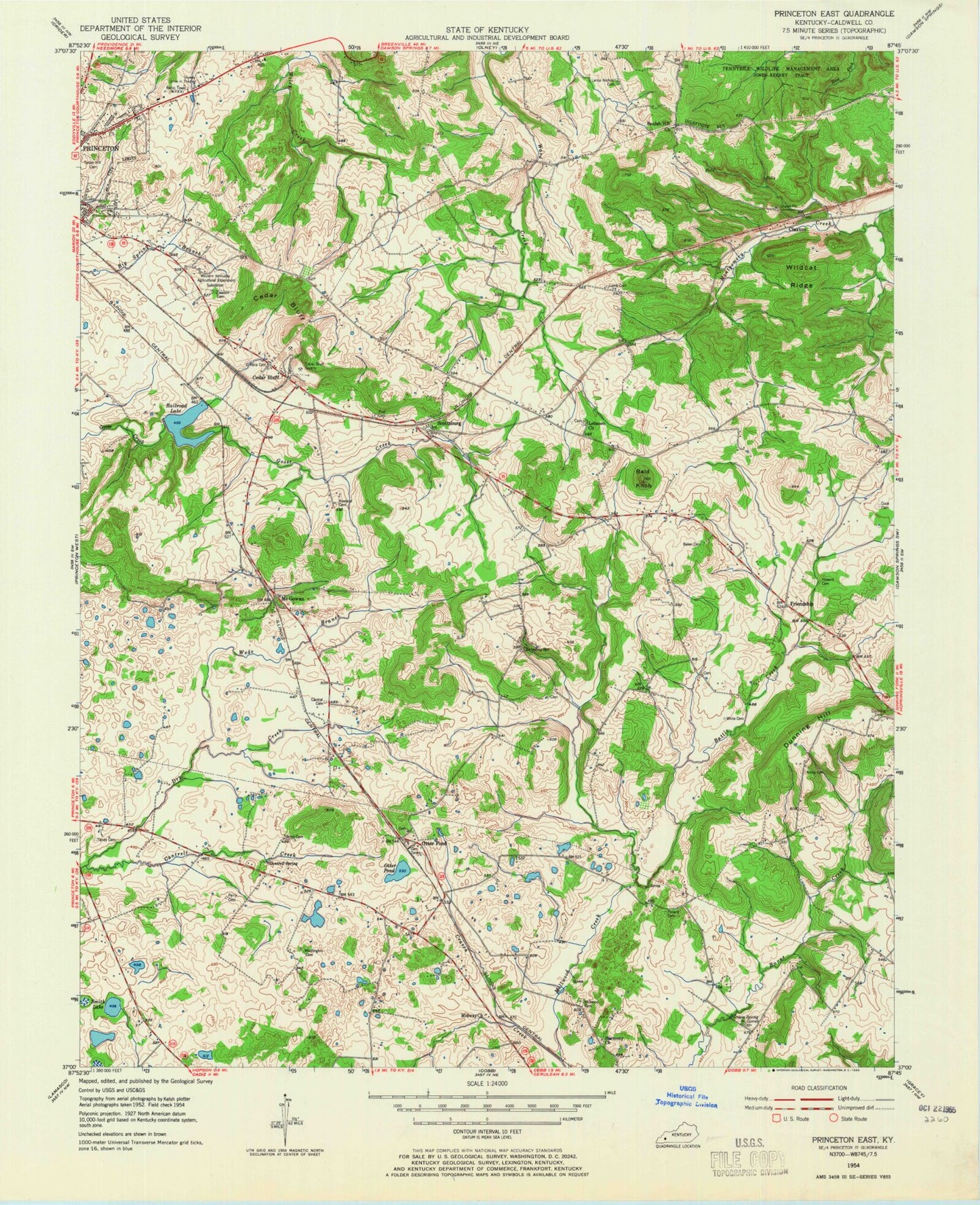
Classic USGS Princeton East Kentucky 7.5'x7.5' Topo Map
Couldn't load pickup availability
Historical USGS topographic quad map of Princeton East in the state of Kentucky. Map scale may vary for some years, but is generally around 1:24,000. Print size is approximately 24" x 27"
This quadrangle is in the following counties: Caldwell.
The map contains contour lines, roads, rivers, towns, and lakes. Printed on high-quality waterproof paper with UV fade-resistant inks, and shipped rolled.
Contains the following named places: Baker Cemetery, Bald Knob, Battle Creek, Beulah Hill Missionary Baptist Church, Bond Cemetery, Cantrell Cemetery, Cantrell Creek, Ceda Bluff, Cedar Bluff, Cedar Hill Cemetery, Claxton, Cook Cemetery, Craven Creek, Dawson Cemetery, Dripping Spring, Dunning Cemetery, Dunning Hill, Eison Branch, Friendship, Glass Cemetery, Groom Spring, Howard Cemetery, Lamb Cemetery, Lance Nichols Cemetery, Lebanon, Lebanon Baptist Church, McConnell Cemetery, McGowan, Midway Church, Millwood Cemetery, O'Hara Cemetery, Otter Pond, Perry Cemetery, Pollard Cemetery, Pool Cemetery, Princeton Division, Princeton-Caldwell County Airport, Pumpkin Center, Railroad Lake, Rowland Cemetery, Scottsburg, Smith Lake, Tandy Cemetery, Wadlington Cemetery, Walche Cut, Wede Branch, Wildcat Ridge, WPKY-AM (Princeton), WPKY-FM (Princeton)