MyTopo
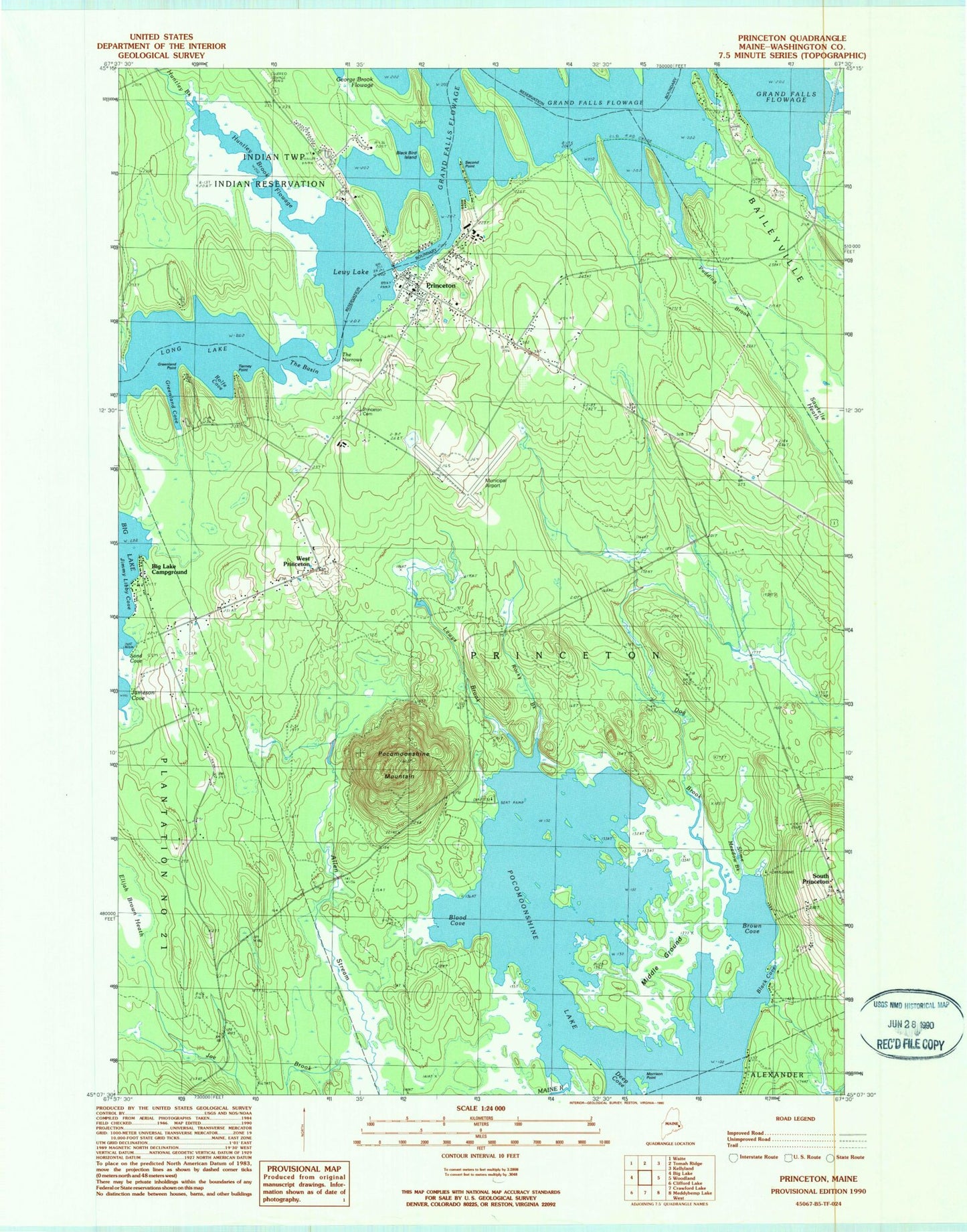
Classic USGS Princeton Maine 7.5'x7.5' Topo Map
Couldn't load pickup availability
Historical USGS topographic quad map of Princeton in the state of Maine. Typical map scale is 1:24,000, but may vary for certain years, if available. Print size: 24" x 27"
This quadrangle is in the following counties: Washington.
The map contains contour lines, roads, rivers, towns, and lakes. Printed on high-quality waterproof paper with UV fade-resistant inks, and shipped rolled.
Contains the following named places: Huntley Brook, Big Lake, Big Lake Campground, Black Bird Island, Black Cove, Blood Cove, Brown Cove, Deep Cove, Dog Brook, Greenland Cove, Greenland Point, Hold Shore, Jameson Cove, Joe Brook, Lakeview Cemetery, Lewy Lake, Lewys Brook, Long Lake, Long Lake Campground, Middle Ground, Morrison Point, Pocomoonshine Mountain, Princeton, Princeton Cemetery, Pudding Brook, Rocky Brook, Rolfe Cove, Sand Cove, Sawtelle Heath, Second Point, Slime Meadow Brook, The Basin, The Narrows, Tierney Point, University of Maine Forestry Camp, West Princeton, South Princeton, Princeton Municipal Airport, Town of Princeton, Princeton Baptist Church, Princeton Congregational Church, Princeton Elementary School, Princeton Post Office, Princeton Fire Department, Princeton Public Library