MyTopo
Classic USGS Promontory Butte Arizona 7.5'x7.5' Topo Map
Couldn't load pickup availability
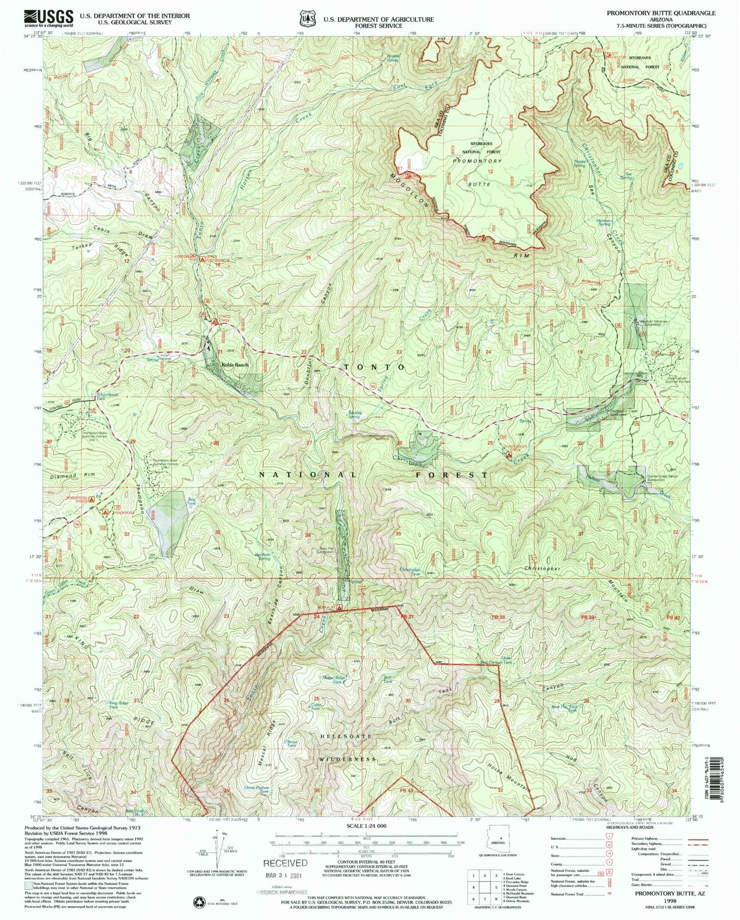
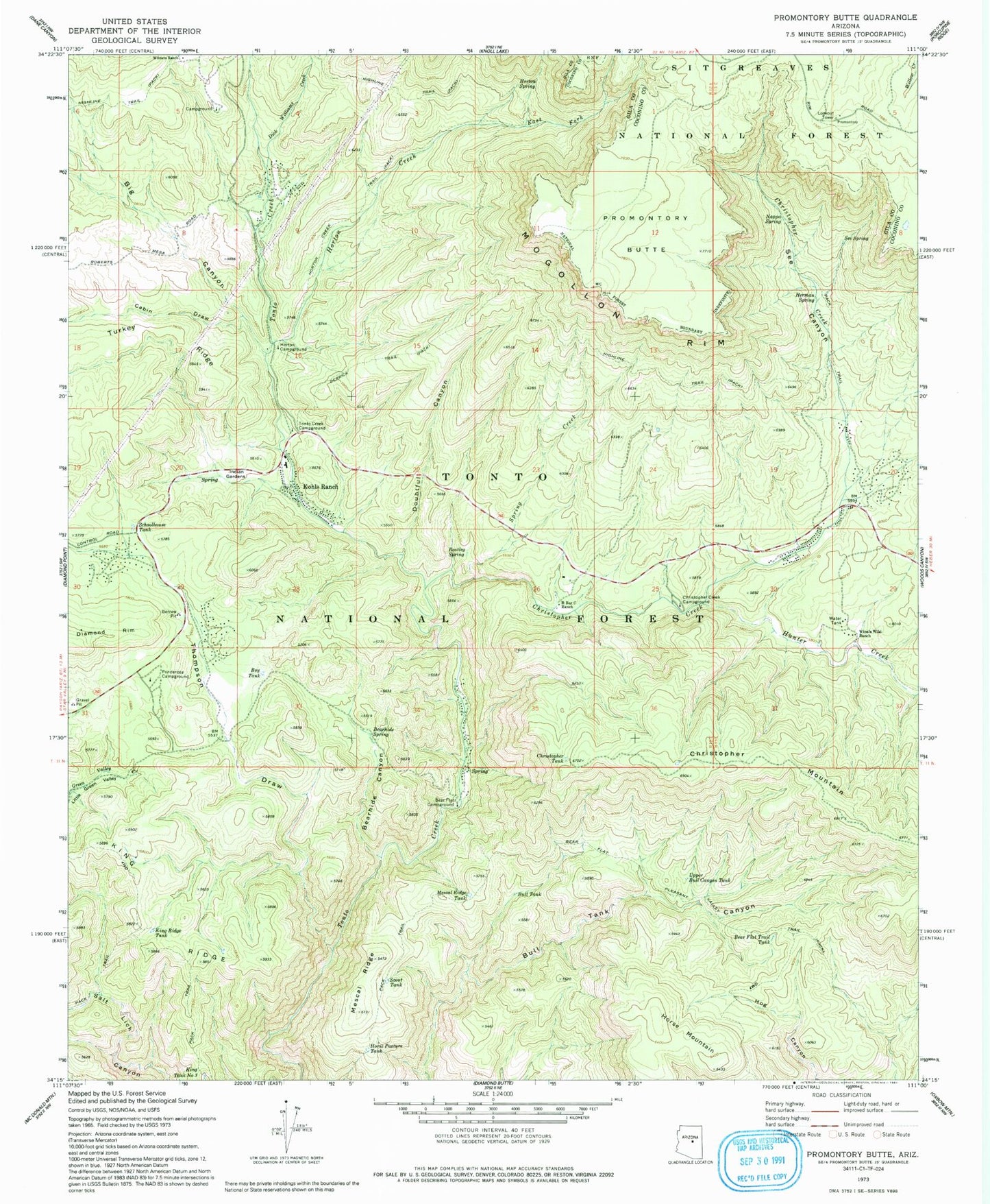
Historical USGS topographic quad map of Promontory Butte in the state of Arizona. Typical map scale is 1:24,000, but may vary for certain years, if available. Print size: 24" x 27"
This quadrangle is in the following counties: Coconino, Gila.
The map contains contour lines, roads, rivers, towns, and lakes. Printed on high-quality waterproof paper with UV fade-resistant inks, and shipped rolled.
Contains the following named places: Bear Flat Campground, Bear Flat Pleasant Valley Trail, Bear Flat Trail Tank, Bearhide Canyon, Bearhide Spring, Big Canyon, Bootleg Spring, Boy Tank, Bull Tank, Cabin Draw, Christopher Creek, Christopher Creek Campground, Christopher Tank, Derrick Trail, Dick Williams Creek, Doubtful Canyon, East Fork Horton Creek, Herman Spring, Horse Mountain, Horse Pasture Tank, Horton Campground, Horton Creek, Horton Creek Trail, Horton Spring, Hunter Creek, Indian Gardens Administrative Site, King Ridge, King Ridge Tank, King Tank Number Three, Kohls Ranch, Mescal Ridge, Mescal Ridge Tank Number Two, Nappa Spring, Ponderosa Campground, Promontory Butte, R Bar C Scout Ranch, Schoolhouse Tank, Scout Tank, See Canyon, See Spring, Spring Creek, Thompson Draw, Tonto Creek Campground, Upper Bull Canyon Tank, Winters Ranch, Wipala Wiki Ranch, Bear Flat, Boy Scout Camp, Camp Tontozona, Mescal Ridge Tank Number One, Mountain Meadow, Ponderosa Group Campground, Twenty Tank, Hunter Creek Ranch, Thompson Draw Summer Homes Unit Two, Thompson Draw Summer Homes Unit One, Tonto Estate, Horton Picnic Area, Bush Cabin, See Canyon Summer Homes, Mountain Meadows, Christopher Creek, Cabin Tank, Bear Flat, Box Canyon, Kushs Mountain, Kohls Ranch Post Office (historical), See Canyon Trailhead, Spring Group Campground, Promontory Trailhead, Upper Tonto Creek Campground, Bear Flat Census Designated Place, Christopher Creek Census Designated Place, Hunter Creek Census Designated Place, Kohls Ranch Census Designated Place, Christopher Kohl's Fire Department Kohl's Ranch Station 52, Christopher Kohl's Fire Department Christopher Creek Station 51