MyTopo
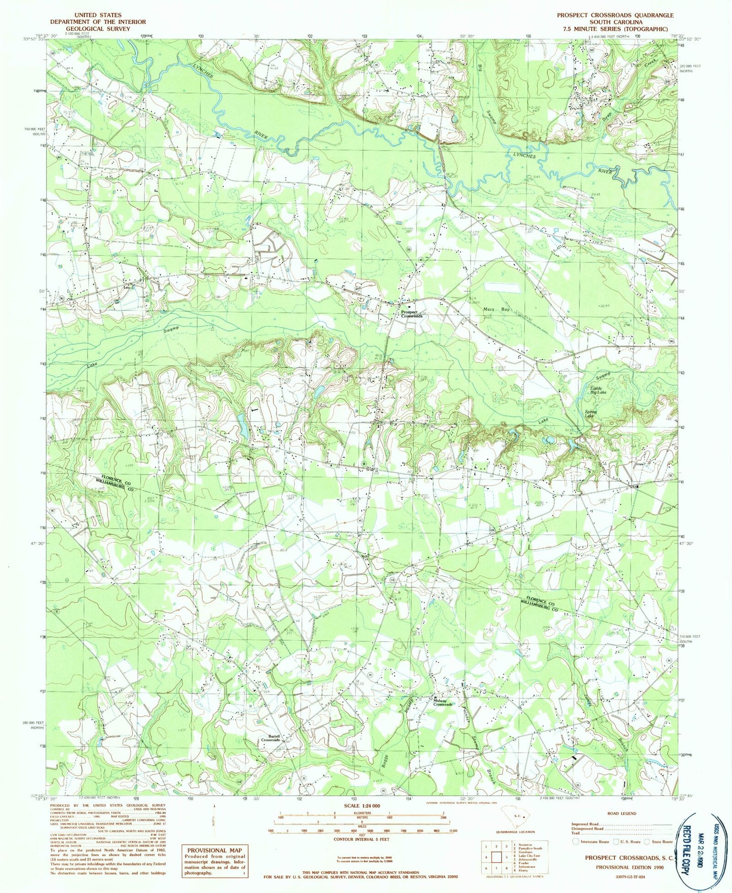
Classic USGS Prospect Crossroads South Carolina 7.5'x7.5' Topo Map
Couldn't load pickup availability
Historical USGS topographic quad map of Prospect Crossroads in the state of South Carolina. Map scale may vary for some years, but is generally around 1:24,000. Print size is approximately 24" x 27"
This quadrangle is in the following counties: Florence, Williamsburg.
The map contains contour lines, roads, rivers, towns, and lakes. Printed on high-quality waterproof paper with UV fade-resistant inks, and shipped rolled.
Contains the following named places: Bartell Crossroads, Baxley Cemetery, Bens Lake, Beulah Church, Big Swamp Branch, Carter Cemetery, Cooper School, Deep Creek, Eaddy - Ford Cemetery, Eaddy Big Lake, Eaddy Cemetery, Gaskins Cemetery, Gum Branch, Half Moon, Hanna Cemetery, Hannah Chapel, Holiness Church, House of Prayer, Indiantown Division, Jeremiah Church, Johnsonville Fire Department Station 2, Leo, Leo Cemetery, Leo Hanna Pond, Leo Hanna Pond Dam D-3567, Leo School, Little Bethel Church, Little Star Church, Macs Bay, Midway Baptist Church, Midway Cemetery, Midway Crossroads, Midway School, New Prospect Christian School, New Prospect Church, Ninevah School, Nineveh Church, Ola Neck Cemetery, Powell Cemetery, Power - DuRant Cemetery, Prospect Church, Prospect Crossroads, Prospect School, Raccoon Lake, Saint James Church, Saint Marks Church, Saint Marks School, Saint Marys Church, Saint Paul School, Spring Lake, Turner Cemetery, Vox Church, Vox School