MyTopo
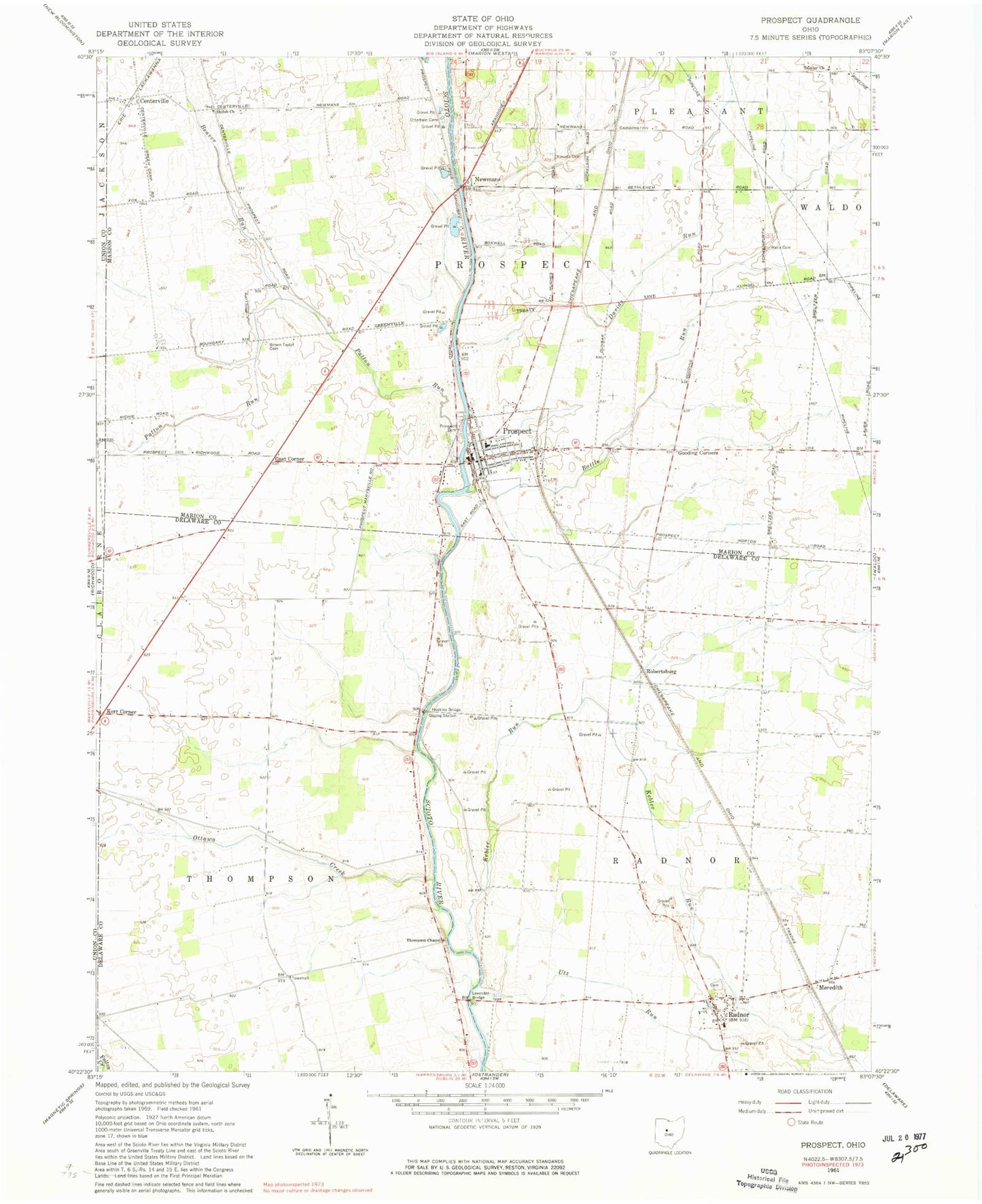
Classic USGS Prospect Ohio 7.5'x7.5' Topo Map
Couldn't load pickup availability
Historical USGS topographic quad map of Prospect in the state of Ohio. Map scale may vary for some years, but is generally around 1:24,000. Print size is approximately 24" x 27"
This quadrangle is in the following counties: Delaware, Marion, Union.
The map contains contour lines, roads, rivers, towns, and lakes. Printed on high-quality waterproof paper with UV fade-resistant inks, and shipped rolled.
Contains the following named places: Battle Run, Battle Run Fire Department, Beaver Run, Bethlehem, Brown Taylor Cemetery, Buckeye Valley Middle School, Centerville, Davids Run, Drumm School, Elgin South Elementary School, Gast Corner, Gooding Corners, Hoskins Bridge, Kebler Run, Kerr Corner, Lavender Bridge, Markel-Kirts Cemetery, Meredith, Mooney Cemetery, Mount Union Church of the United Brethren in Christ, Mounts Cemetery, Newman Bridge, Newmans, Norton Post Office, Ottawa Creek, Ottawa School, Otterbein Cemetery, Otterbine Church, Packer Airport, Patton Run, Prospect, Prospect Cemetery, Prospect Post Office, Radnor, Radnor Cemetery, Radnor Census Designated Place, Radnor Post Office, Radnor Township Volunteer Fire Department, Robertsburg, Schweinfurth Cemetery, Shiloh Church, Shoup Cemetery, Thompson Chapel, Township of Prospect, Township of Radnor, Township of Thompson, Trinity Evangelical Lutheran Church, Utz Run, Village of Prospect, Walls Cemetery, Williams School, ZIP Codes: 43066, 43342