MyTopo
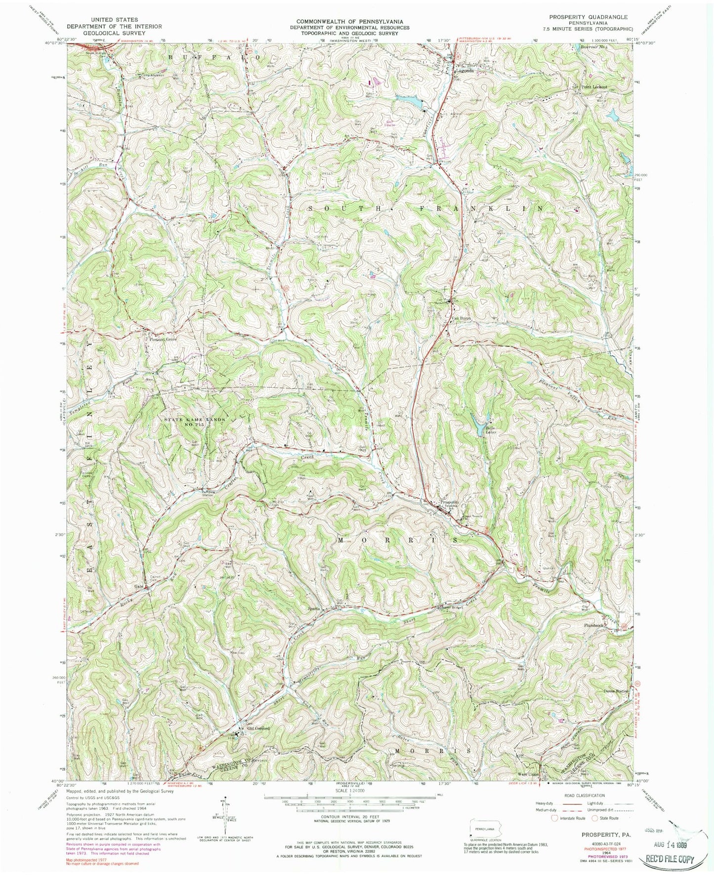
Classic USGS Prosperity Pennsylvania 7.5'x7.5' Topo Map
Couldn't load pickup availability
Historical USGS topographic quad map of Prosperity in the state of Pennsylvania. Map scale may vary for some years, but is generally around 1:24,000. Print size is approximately 24" x 27"
This quadrangle is in the following counties: Greene, Washington.
The map contains contour lines, roads, rivers, towns, and lakes. Printed on high-quality waterproof paper with UV fade-resistant inks, and shipped rolled.
Contains the following named places: Bells Lakes, Bethel Church, Borough of Green Hills, Camp Adelawan, Carroll Cemetery, Crafts Creek, Day Covered Bridge, Elliott Cemetery, Enlow Fork Mine, Fairview Cemetery, Gale, Green Hills, Hamestring Run, Jameson Memorial Hospital Heliport, Joint School, Lagonda, Lick Run, Lindley Schoolhouse, Lone Pine Golf Course, Morris Township Volunteer Fire Department Station 42, Mount Zion Cemetery, Neal Dam, Neal Lake, Old Concord, Pleasant Grove, Plumbsock, Point Lookout, Prosperity, Prosperity Post Office, Sawhill Run, Short Creek, South Buffalo Cemetery, South Franklin Township Municipal Building, South Franklin Volunteer Fire Department Station 32, Sparta, Sparta Post Office, Township of Morris, Township of South Franklin, Upper Tenmile Church, Van Buren, Van Buren Post Office, West Union, Wilson Schoolhouse, ZIP Code: 15329