MyTopo
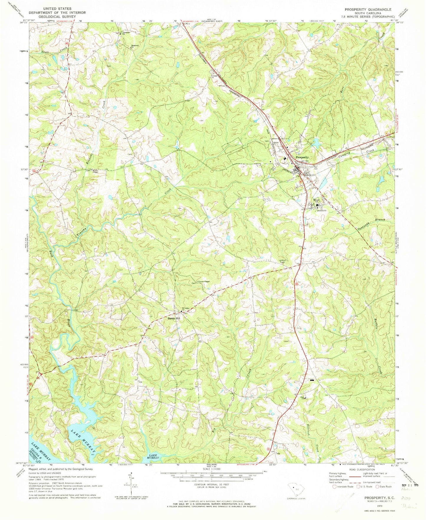
Classic USGS Prosperity South Carolina 7.5'x7.5' Topo Map
Couldn't load pickup availability
Historical USGS topographic quad map of Prosperity in the state of South Carolina. Map scale may vary for some years, but is generally around 1:24,000. Print size is approximately 24" x 27"
This quadrangle is in the following counties: Newberry, Saluda.
The map contains contour lines, roads, rivers, towns, and lakes. Printed on high-quality waterproof paper with UV fade-resistant inks, and shipped rolled.
Contains the following named places: Antioch Church, Big Creek School, Boozer Chapel, Boyd, Caldwells Pond, Caldwells Pond D-1671 Dam, Colony Cemetery, Colony Lutheran Church, Crofts Mill Bridge, Ebenezer Cemetery, Ebenezer Church, Hartford School, Hopewell Church, Howard School, Kinards Creek, Kinards School, Lever Chapel, Lever Chapel School, Little Creek, Monticello School, Newberry County Rural Fire Department Prosperity Station 2, O'Neal High School, Prosperity, Prosperity Cemetery, Prosperity Elementary School, Prosperity High School, Prosperity Lookout Tower, Prosperity Police Department, Rikard School, Saint Lukes Cemetery, Saint Lukes Lutheran Church, Saluda Academy, Schumpert Mill, Shiloh Cemetery, Shiloh Church, Shiloh School, Stoney Hill, Stoney Hill Fire Department Sub - Station, Stoney Hill School, Timothy Creek, Town of Prosperity, Zion Cemetery, Zion Church, ZIP Code: 29127