MyTopo
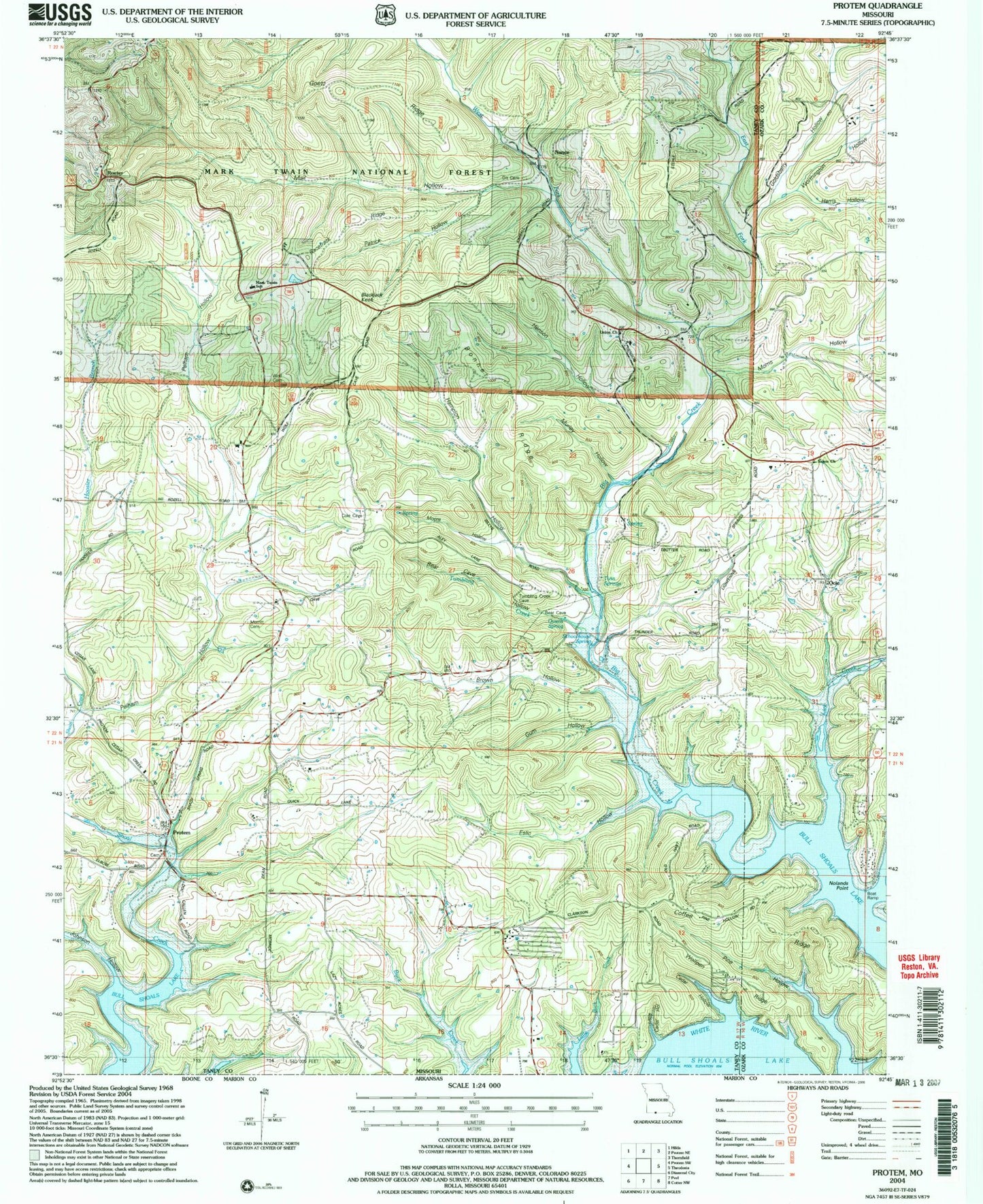
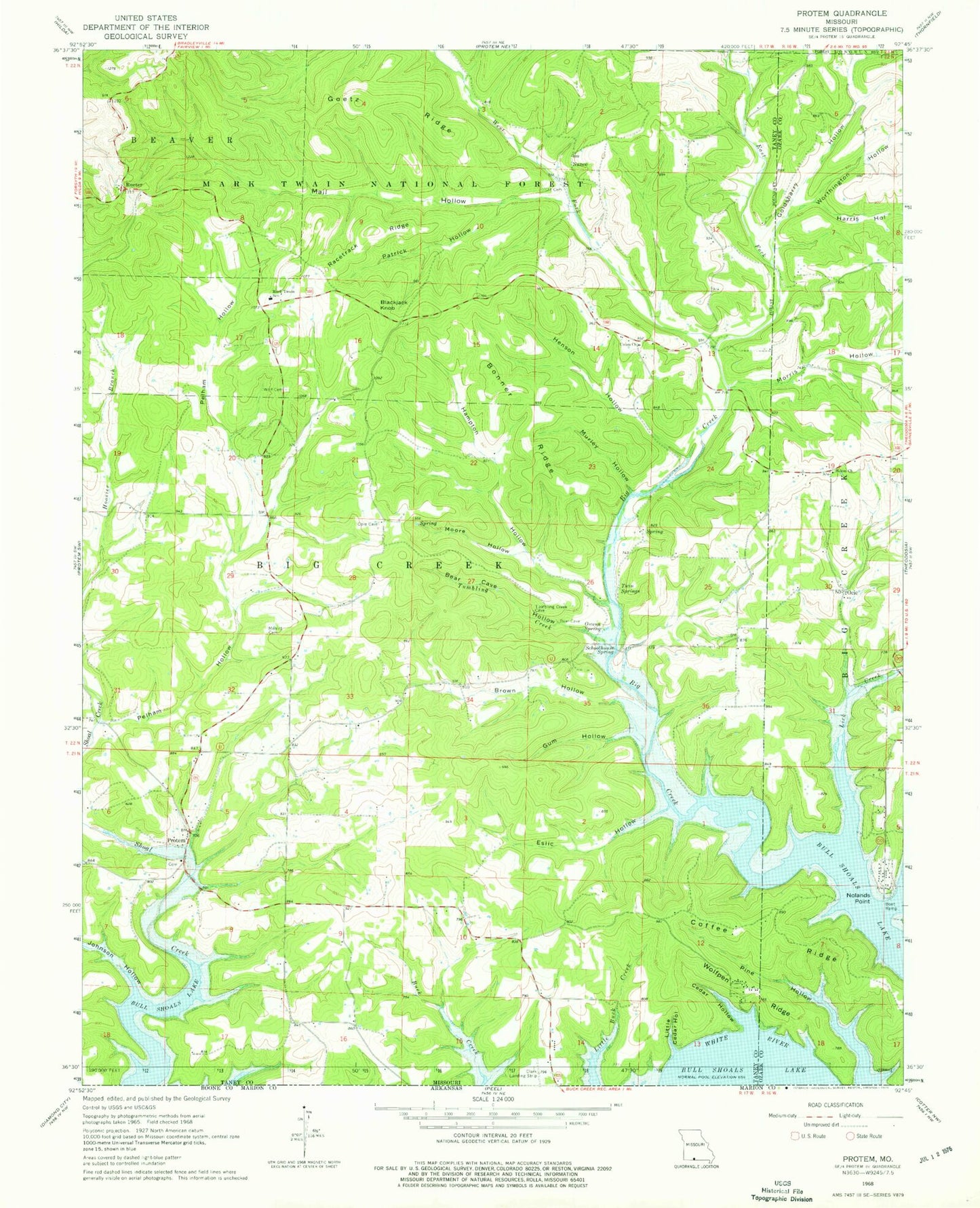
Classic USGS Protem Missouri 7.5'x7.5' Topo Map
Couldn't load pickup availability
Historical USGS topographic quad map of Protem in the state of Missouri. Map scale may vary for some years, but is generally around 1:24,000. Print size is approximately 24" x 27"
This quadrangle is in the following counties: Ozark, Taney.
The map contains contour lines, roads, rivers, towns, and lakes. Printed on high-quality waterproof paper with UV fade-resistant inks, and shipped rolled.
Contains the following named places: Bear Cave Hollow, Big Creek, Big Creek School, Blackjack Knob, Bonner Ridge, Brown Hollow, Cedar Hollow, Coffee Ridge, Dit Cemetery, East Fork Big Creek, Eslic Hollow, Goetz Ridge, Goldsbarry Hollow, Gum Hollow, Hampton Hollow, Harris Hollow, Helster School, Henson Hollow, Johnson Hollow, Lick Creek, Little Cedar Hollow, Mail Hollow, Mark Twain School, Merritt Cemetery, Moore Hollow, Morris Hollow, Murley Hollow, Nance, Nance School, Nolands Point, Nolands Point Seaplane Base, Ocie, Owens Spring, Patrick Hollow, Pelham Hollow, Pelham School, Protem, Protem Fire Protection District Station 1, Protem Fire Protection District Station 2, Protem Post Office, Racetrack Ridge, Rueter, Salem Church, Schoolhouse Spring, Taber Field, Township of Big Creek, Tumbling Creek, Twin Springs, Union Church, West Fork Big Creek, Wolf Cemetery, Wolfpen Ridge, Worthington Hollow, ZIP Code: 65733