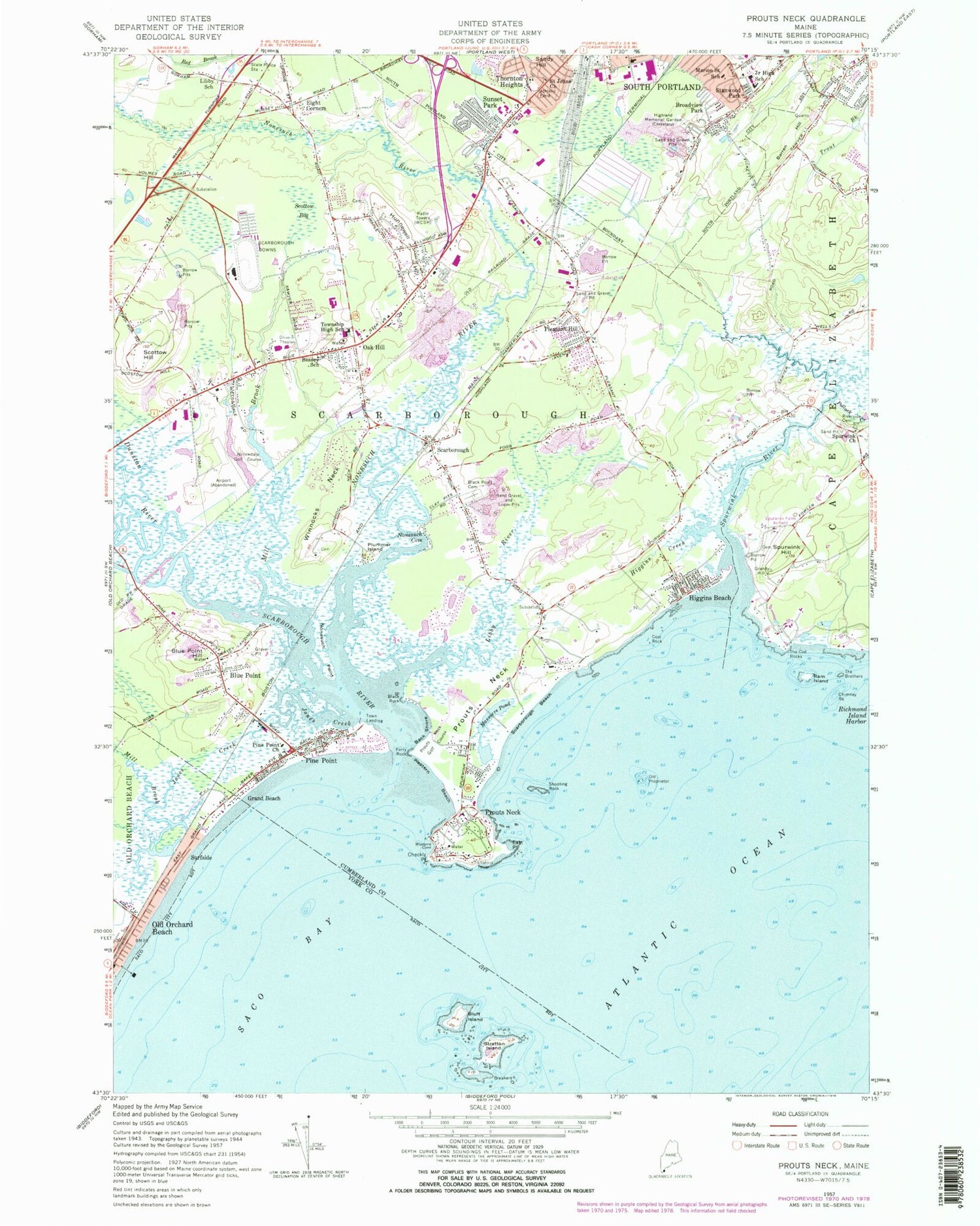
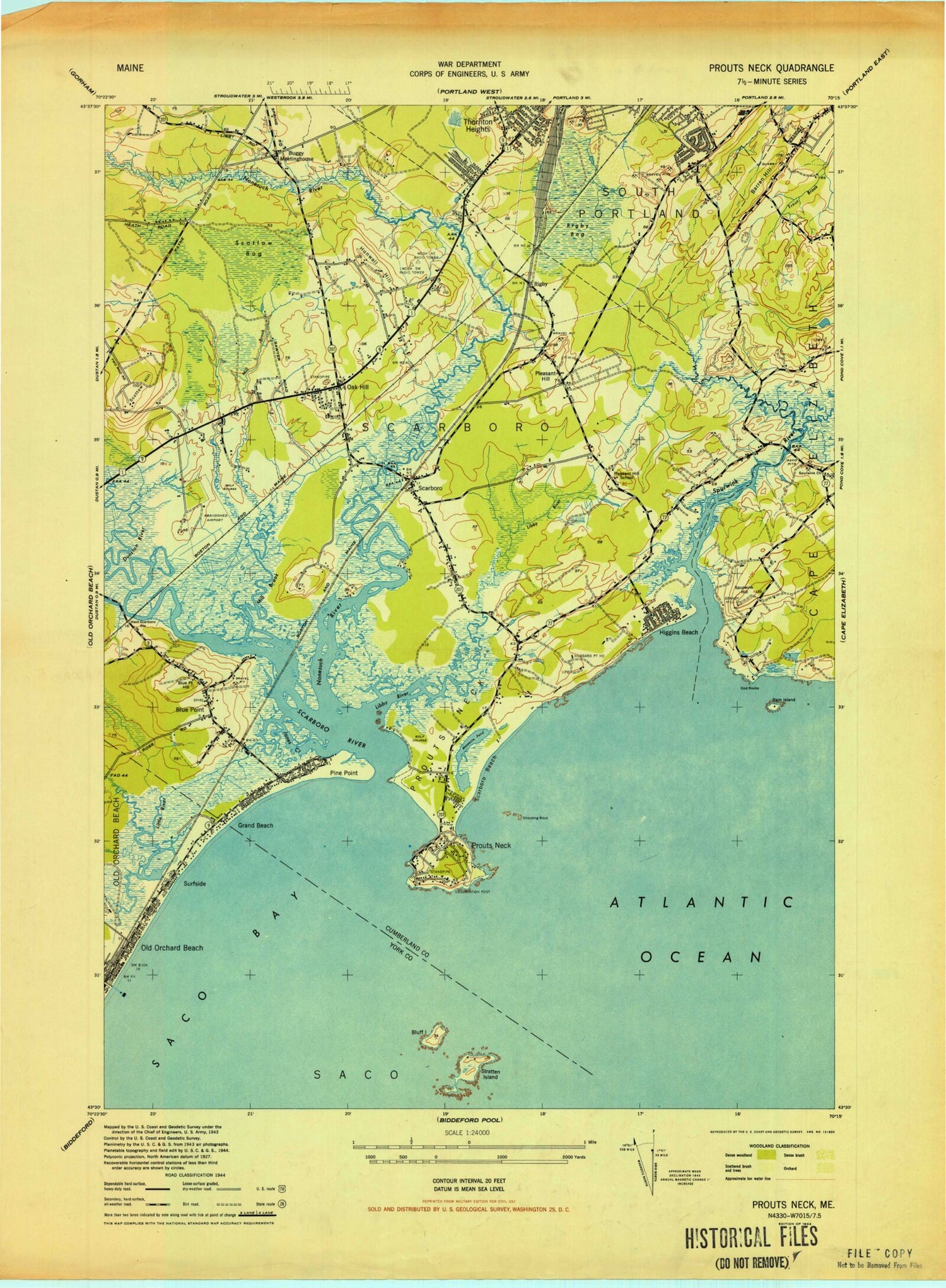
MyTopo
Classic USGS Prouts Neck Maine 7.5'x7.5' Topo Map
Couldn't load pickup availability
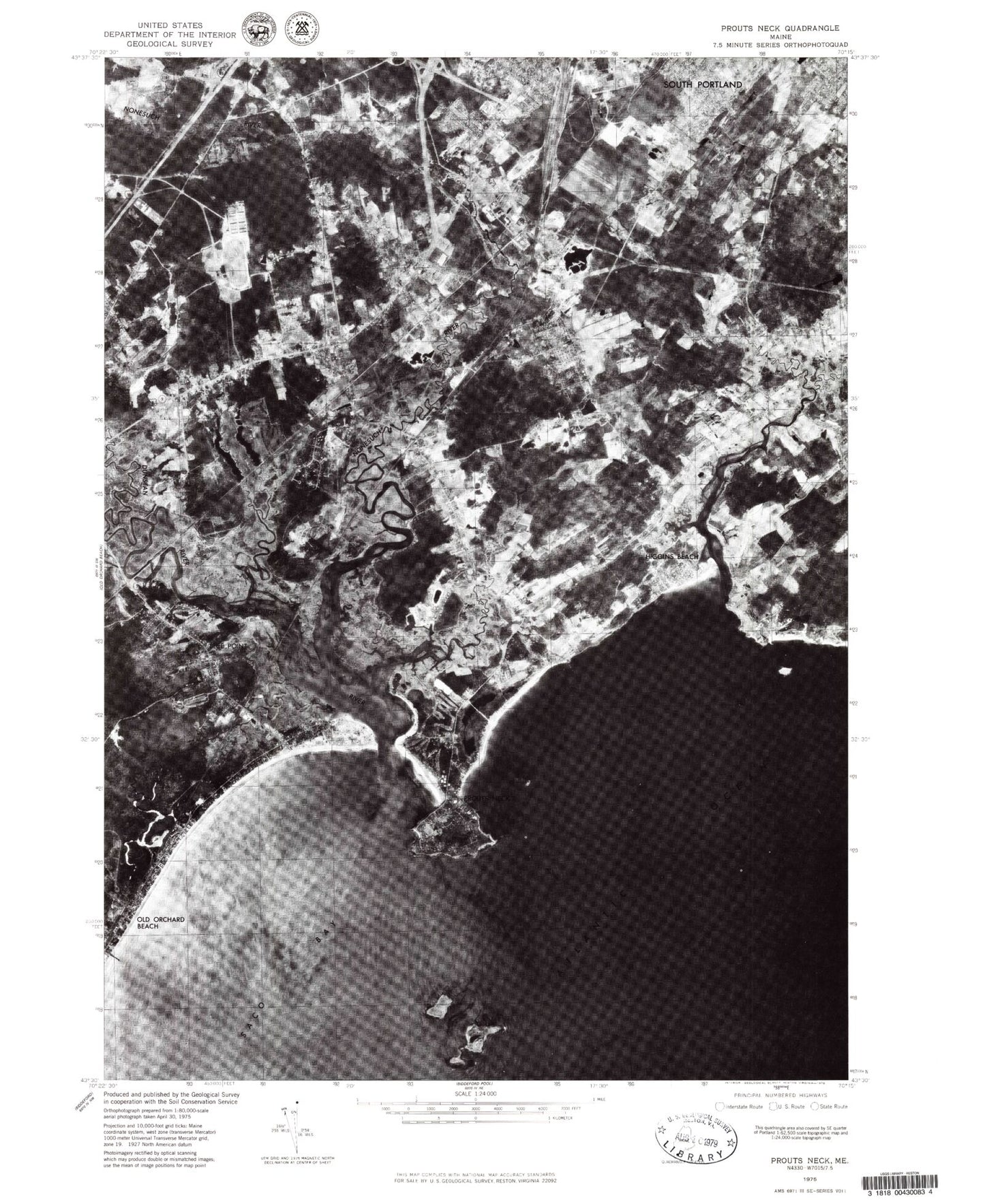
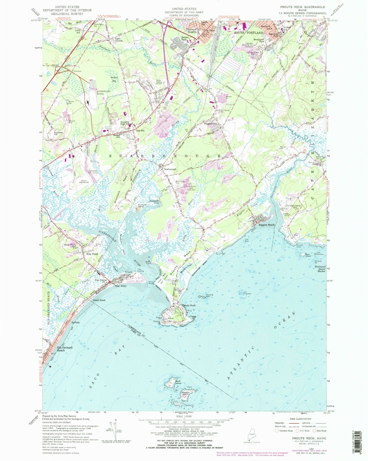
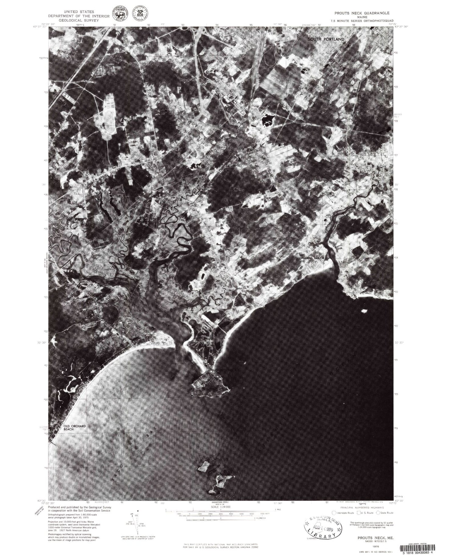
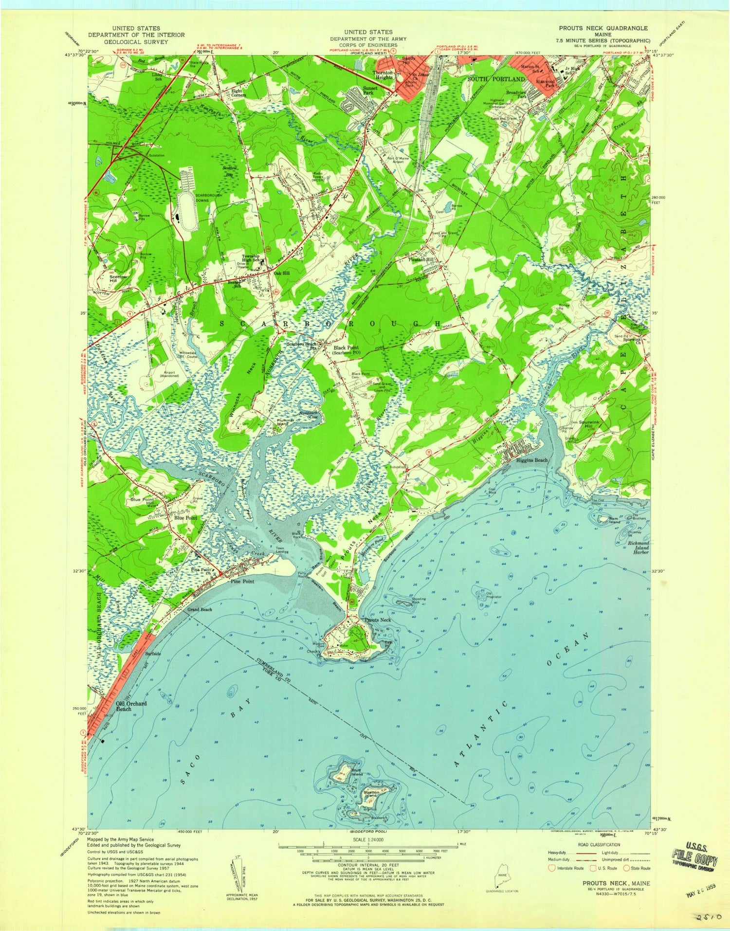
Historical USGS topographic quad map of Prouts Neck in the state of Maine. Typical map scale is 1:24,000, but may vary for certain years, if available. Print size: 24" x 27"
This quadrangle is in the following counties: Cumberland, York.
The map contains contour lines, roads, rivers, towns, and lakes. Printed on high-quality waterproof paper with UV fade-resistant inks, and shipped rolled.
Contains the following named places: Back Shore, Barren Hill, Elwood G Bessey School, Black Point Cemetery, Black Rock, Blue Point, Blue Point Hill, Bluff Island, Broadview Park, Cascade Brook, Checkly Point, Chimney Rock, Cool Rock, Dunstan River, East Point, Eight Corners, Ferry Rock, Grand Beach, Higgins Beach, Higgins Creek, Highland Memorial Cemetery, Hunnewell Hill, Jones Creek, Libby River, Libby School, Dyer Elementary School, Massacre Pond, Mill Brook, Mill Brook, Nonesuch Cove, Nonesuch Point, Nonesuch River, Oak Hill, Old Proprietor, Phillips Brook, Pine Point, Pine Point Church, Pleasant Hill, Plummer Island, Pollack Creek, Prouts Neck, Ram Island, Riverside Cemetery, Saint Johns Church, Sandy Hill, Scarborough, Scarborough Beach, Scarborough River, Scottow Bog, Scottow Hill, Shooting Rock, Spurwink Church, Spurwink Hill, Spurwink River, Stanwood Park, Stratton Island, Sunset Park, Surfside, The Brothers, The Cod Rocks, Thornton Heights, Township High School, Western Beach, Western Cove, Winnocks Neck, Town Landing, WCSH Radio Tower (Havre De Grace), Spurwink Farm Airfield (historical), Prouts Neck, Prouts Neck Golf Course, Scarborough Downs, Willowdale Golf Course, Bar Ledge, Little River Rock, WZAN-AM (Portland), WDCS-FM (Scarborough), Royal Anchor Heliport, Oak Knoll Airport (historical), Scottow Bog Flightpark Ultralight Flightpark (historical), Town of Old Orchard Beach, Town of Scarborough, Mill Brook Dam, Mill Brook, Phineas W Sprague Memorial Sanctuary, The Pier, Old Orchard Beach, Surfside Beach, Bayleys Camping Resort, Blue Point Congregational Church, Blue Point School, Church of the Nazarene, Church of the Nazarene of South Portland, Danish Village (historical), Eight Corners School, First Congregational Church, Gorham High School, Greater Grace Bible Church, Greater Portland Church of Christ, Lighthouse Day School, Oak Hill Community Church, Oakhill Plaza Shopping Center, Pine Point Beach, Pine Point Beach, Pleasant Hill Country Club, Pleasant Hill School, Pleasant Hill School (historical), Port O'Maine Airport (historical), Prouts Neck Bird Sanctuary, Rigby (historical), Rigby Bog (historical), Royal Ridge Church of God, Saint Jude Chapel, Saint Maximillian Parish Church, Saint Nicholas Episcopal Church, Scarboro Beach Station, Scarboro Marshes, Scarborough Beach State Park, Scarborough Free Baptist Church, Scarborough High School, Scarborough Post Office, Scarborough Marsh Nature Center, Scarborough Public Library, South Portland High School, West Scarboro Station (historical), Old Orchard Beach Census Designated Place, Oak Hill Census Designated Place, Dyer Brook, Scarborough Fire Department Oak Hill Station, Scarborough Fire Station - Pine Point, Scarborough Fire Station, South Portland Fire Department Union Street, Scarborough Pleasant Hill Road Fire Station, Scarborough Downs Emergency Medical Services Ambulance, American Medical Response, Northeast Mobile Health Service Ambulance, American Medical Response Ambulance Service, North East Mobile Ambulance Service, Scarborough Police Department, Eben Libby Farm Cemetery, Harmon Family Graves near Scottow Hill, Harty Cemetery, Hasty Cemetery, Hunnewell Cemetery, Indian Cemetery, Indian Cemetery, King Cemetery, Libby Cemetery, Libby Cemetery, Libby Cemetery, Major John Waterhouse Cemetery, Plummer Cemetery, Plummer Family Cemetery, Plummer Libby Cemetery, The Great Grave, Tibbetts Hunnewell Cemetery, Harmon - Waterhouse Cemetery, Toddle Inn School, Scarborough Middle School, Cornerstone Baptist School, Wentworth School, New England Bible College, New England Bible College Library, Foundation for Blood Research, Olde Spurwink Plantation Cemetery, Skilling Cemetery, Back Shore, Barren Hill, Elwood G Bessey School, Black Point Cemetery, Black Rock, Blue Point, Blue Point Hill, Bluff Island, Broadview Park, Cascade Brook, Checkly Point, Chimney Rock, Cool Rock, Dunstan River, East Point, Eight Corners, Ferry Rock, Grand Beach, Higgins Beach, Higgins Creek, Highland Memorial Cemetery, Hunnewell Hill, Jones Creek, Libby River, Libby School, Dyer Elementary School, Massacre Pond, Mill Brook, Mill Brook, Nonesuch Cove, Nonesuch Point, Nonesuch River, Oak Hill, Old Proprietor, Phillips Brook, Pine Point, Pine Point Church, Pleasant Hill, Plummer Island, Pollack Creek, Prouts Neck, Ram Island, Riverside Cemetery, Saint Johns Church, Sandy Hill, Scarborough, Scarborough Beach, Scarborough River, Scottow Bog, Scottow Hill, Shooting Rock, Spurwink Church, Spurwink Hill, Spurwink River, Stanwood Park, Stratton Island, Sunset Park, Surfside, The Brothers, The Cod Rocks, Thornton Heights, Township High School, Western Beach, Western Cove, Winnocks Neck, Town Landing, WCSH Radio Tower (Havre De Grace), Spurwink Farm Airfield (historical), Prouts Neck, Prouts Neck Golf Course, Scarborough Downs