MyTopo
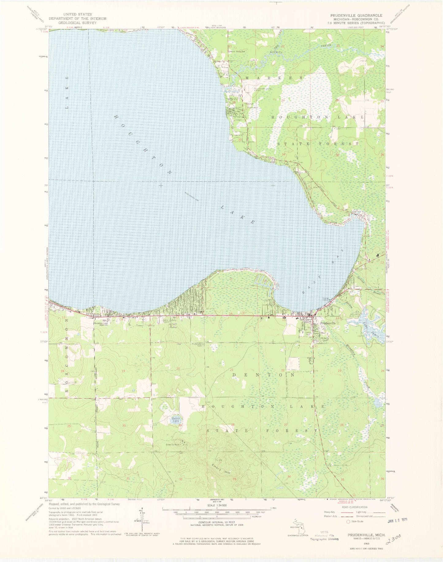
Classic USGS Prudenville Michigan 7.5'x7.5' Topo Map
Couldn't load pickup availability
Historical USGS topographic quad map of Prudenville in the state of Michigan. Map scale may vary for some years, but is generally around 1:24,000. Print size is approximately 24" x 27"
This quadrangle is in the following counties: Roscommon.
The map contains contour lines, roads, rivers, towns, and lakes. Printed on high-quality waterproof paper with UV fade-resistant inks, and shipped rolled.
Contains the following named places: Abundant Grace Assembly of God Church, Backus Creek, Camp Co Be Ac, Collins Elementary School, Denton Creek, Denton Park, Denton Township Ambulance Service, Denton Township Fire Department, Denton Township Police Department, Denton Township Trailer Park, East Bay, East Bay Medical Center, Emery Hill, First Baptist Church, Houghton Lake, Houghton Lake Area Historical Village, Houghton Lake Census Designated Place, Houghton Lake High School, Houghton Lake Middle School, Jehovah's Witnesses Hall, Knappen Creek, Lake Co-Be-Ac, Markey Park, Markey Township Fire Department, Markey Township Hall, Mercy Family Care, North Shore School, Our Lady of the Lake Catholic Church, Our Lady of the Lake School, Pathway Southern Baptist Church, Pineview Highlands Golf Course, Prudenville, Prudenville Cemetery, Prudenville Census Designated Place, Prudenville Elementary School, Prudenville Post Office, Roscommon County - Blodgett Memorial Airport, Saint Johns Lutheran Church, Sandyoak RV Park, Songers Point, Spring Brook, The Cut, Township of Denton, WHGR-AM (Houghton Lake), White Deer Country Club, WUPS-FM (Houghton Lake)