MyTopo
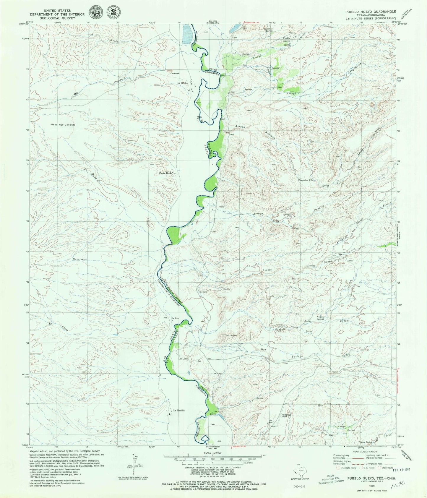
Classic USGS Pueblo Nuevo Texas 7.5'x7.5' Topo Map
Couldn't load pickup availability
Historical USGS topographic quad map of Pueblo Nuevo in the state of Texas. Map scale may vary for some years, but is generally around 1:24,000. Print size is approximately 24" x 27"
This quadrangle is in the following counties: Presidio.
The map contains contour lines, roads, rivers, towns, and lakes. Printed on high-quality waterproof paper with UV fade-resistant inks, and shipped rolled.
Contains the following named places: Arroyo Chupaderos, Arroyo Palo Blanco, Arroyo Panales, Arroyo Tinaja Blanca, Chupadera Pila, El Muerto Arroyo, Hot Springs Airport, Hot Springs Creek, La Cienega, Las Lulas, Las Palomas Wildlife Management Area - Ocotillo Unit, Naegele Creek, Naegele Springs, Prietos Bar, Pueblo Nuevo, Ranchita Spring, Sanguijuela Arroyo, Tijeras Spring