MyTopo
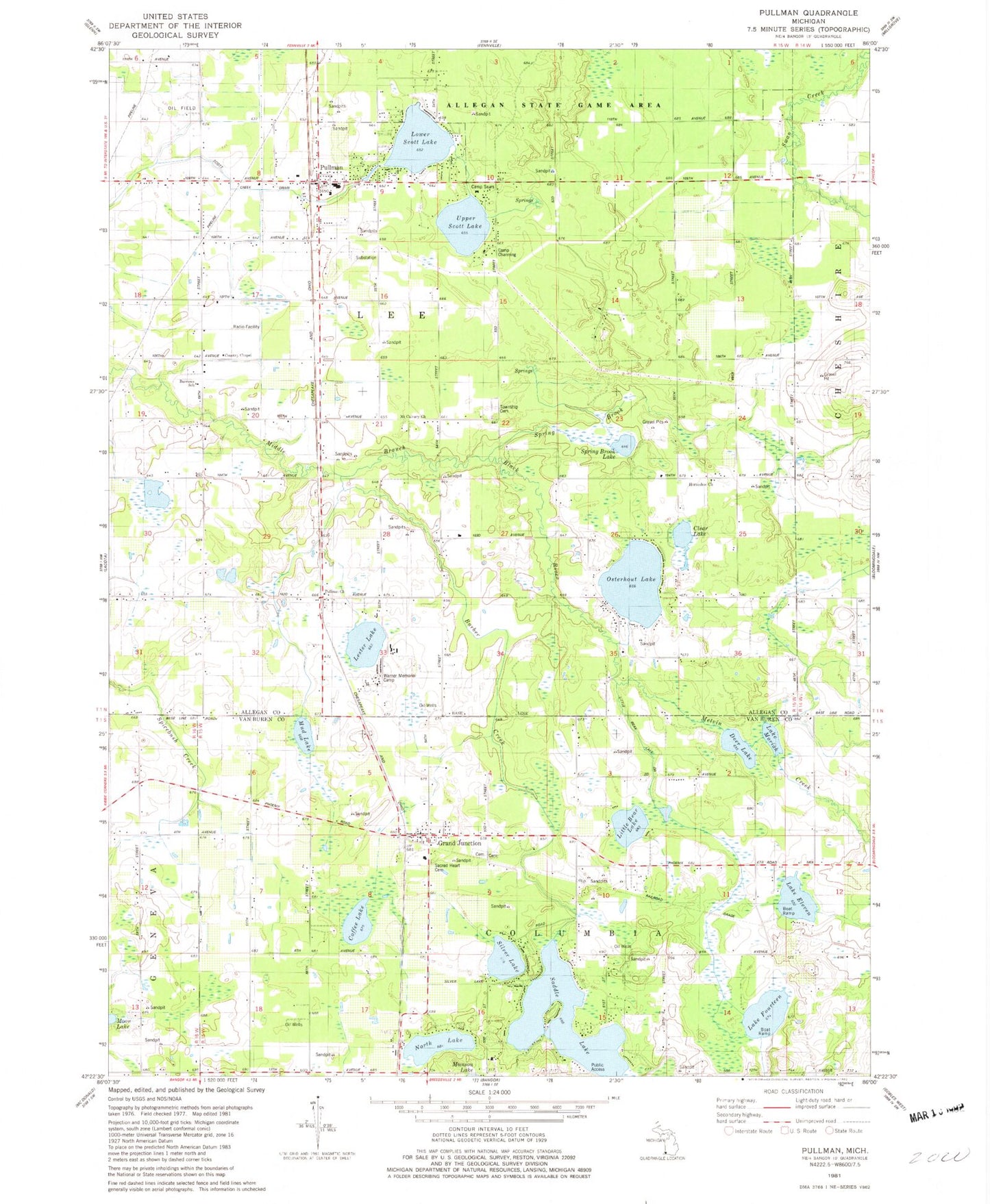
Classic USGS Pullman Michigan 7.5'x7.5' Topo Map
Couldn't load pickup availability
Historical USGS topographic quad map of Pullman in the state of Michigan. Typical map scale is 1:24,000, but may vary for certain years, if available. Print size: 24" x 27"
This quadrangle is in the following counties: Allegan, Van Buren.
The map contains contour lines, roads, rivers, towns, and lakes. Printed on high-quality waterproof paper with UV fade-resistant inks, and shipped rolled.
Contains the following named places: Bakersville, Barber Creek, Barrow School, Bronson School, Camp Channing, Clear Lake, Coffee Lake, Columbia School, Deer Lake, Drum Ditch, Lake Eleven, Lake Fourteen, Gingerbread Church, Grand Junction, Hilton School, Horseshoe School, Lester Lake, Little Bear Lake, Lower Scott Lake, Melvin Creek, Lake Moriah, Mud Lake, North Lake, Osterhout Lake, Pullman, Pullman School, Saddle Lake, Sherman Park, Silver Lake, Smith School, Spring Brook, Spring Brook Lake, Upper Scott Lake, Wildwood School, Lee, Little Bear Lake Drain, Township of Columbia, Township of Lee, Warner Memorial Camp, Horseshoe Church, Pullman Church, Lee Township Cemetery, Mount Calvary Church, Camp Sears, Burrows School, Country Chapel, Sacred Heart Cemetery, Lee Post Office (historical), Horseshoe Post Office (historical), Avis Post Office (historical), Pullman Library, Pullman Post Office, Pullman Elementary School, Pullman Station, Saints Cemetery, Pullman Bible Church, New Hope Missionary Baptist Church, Christ Gospel Church, Saddle Lake Post Office (historical), First Congregational Church, Grand Junction Post Office, Grand Junction, Grand Junction Cemetery, Lee Township Fire Department Station 1, Columbia Township Fire Department