MyTopo
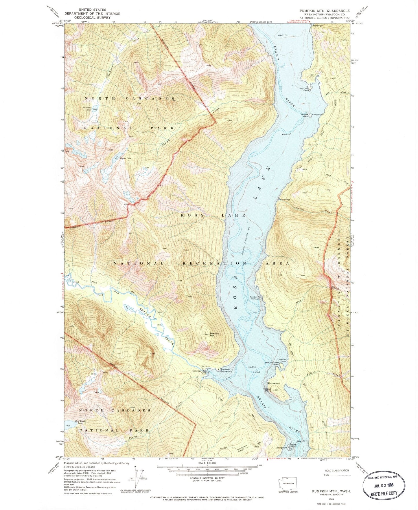
Classic USGS Pumpkin Mountain Washington 7.5'x7.5' Topo Map
Couldn't load pickup availability
Historical USGS topographic quad map of Pumpkin Mountain in the state of Washington. Typical map scale is 1:24,000, but may vary for certain years, if available. Print size: 24" x 27"
This quadrangle is in the following counties: Whatcom.
The map contains contour lines, roads, rivers, towns, and lakes. Printed on high-quality waterproof paper with UV fade-resistant inks, and shipped rolled.
Contains the following named places: Big Bear Campground, Big Beaver Creek, Cougar Island, Devils Creek, Dry Creek, Dry Creek Camp, East Bank Trail, Lightning Creek, Little Jerusalem Island, May Creek, Noname Lake, Pierce Creek, Pumpkin Mountain, Rainbow Point Campground, Roland Creek, Roland Point, Skymo Creek, Skymo Lake, Sourdough Lake, Spencer Camp, Tenmile Island, Ross Lake National Recreation Area, Cougar Island Campground, Tenmile Island Campground