MyTopo
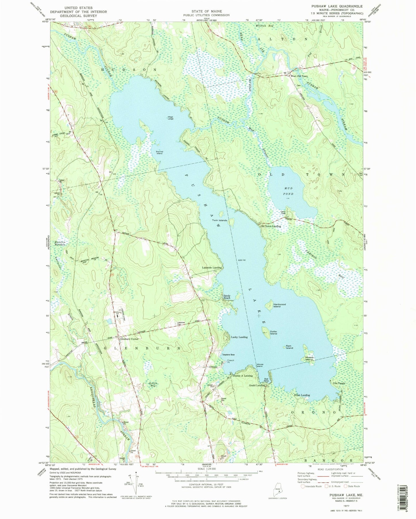
Classic USGS Pushaw Lake Maine 7.5'x7.5' Topo Map
Couldn't load pickup availability
Historical USGS topographic quad map of Pushaw Lake in the state of Maine. Map scale may vary for some years, but is generally around 1:24,000. Print size is approximately 24" x 27"
This quadrangle is in the following counties: Penobscot.
The map contains contour lines, roads, rivers, towns, and lakes. Printed on high-quality waterproof paper with UV fade-resistant inks, and shipped rolled.
Contains the following named places: Camp Telok, Caribou Bog, Cunningham Landing, Dead Stream, Dollar Island, Double A Landing, Double A Seaplane Base, Dufour Landing, Elliot Landing, French Point, Glenburn and Hudson Ambulance Service, Glenburn Center, Glenburn Elementary School, Glenburn Evangelical Church, Glenburn Fire Department, Glenburn Library, Gould Landing, Hardwood Island, Hollis Bog, Lakeside Landing, Lakeview Cemetery, Lancaster Brook, Lucky Landing, Lucky Landing Marina and Seaplane Base, Mags Ledge, Marston Meadow, Moose Island, Mouse Island, Mud Stream, Old Town Landing, Perch Pond, Pug Brook, Pushaw Lake, Pushaw Lake Dam, Ram Island, Sandy Beach, Squirrel Island, Town of Glenburn, Twin Islands, Villa Vaughn, West Old Town