MyTopo
Classic USGS Puuanahulu Hawaii 7.5'x7.5' Topo Map
Couldn't load pickup availability
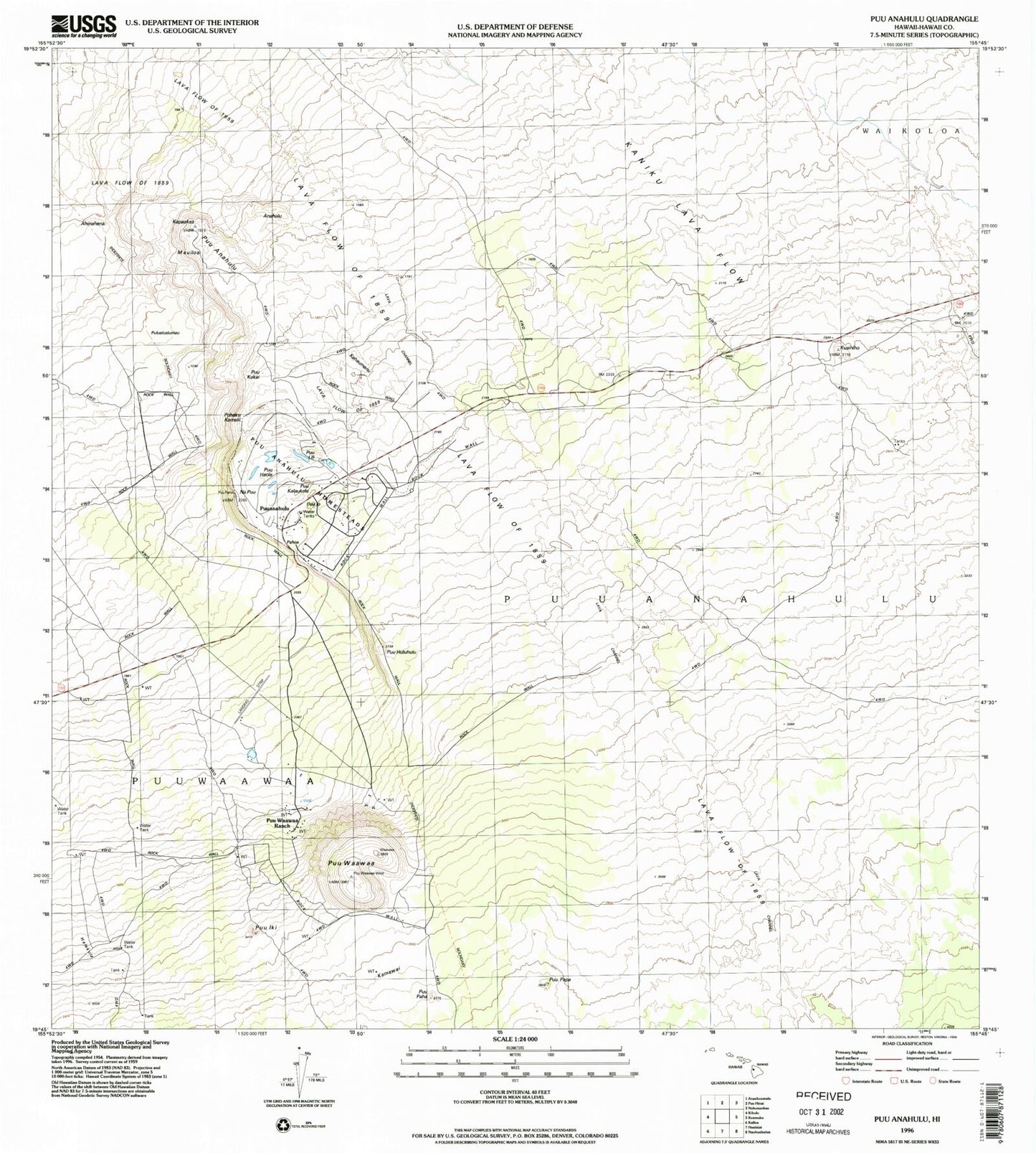
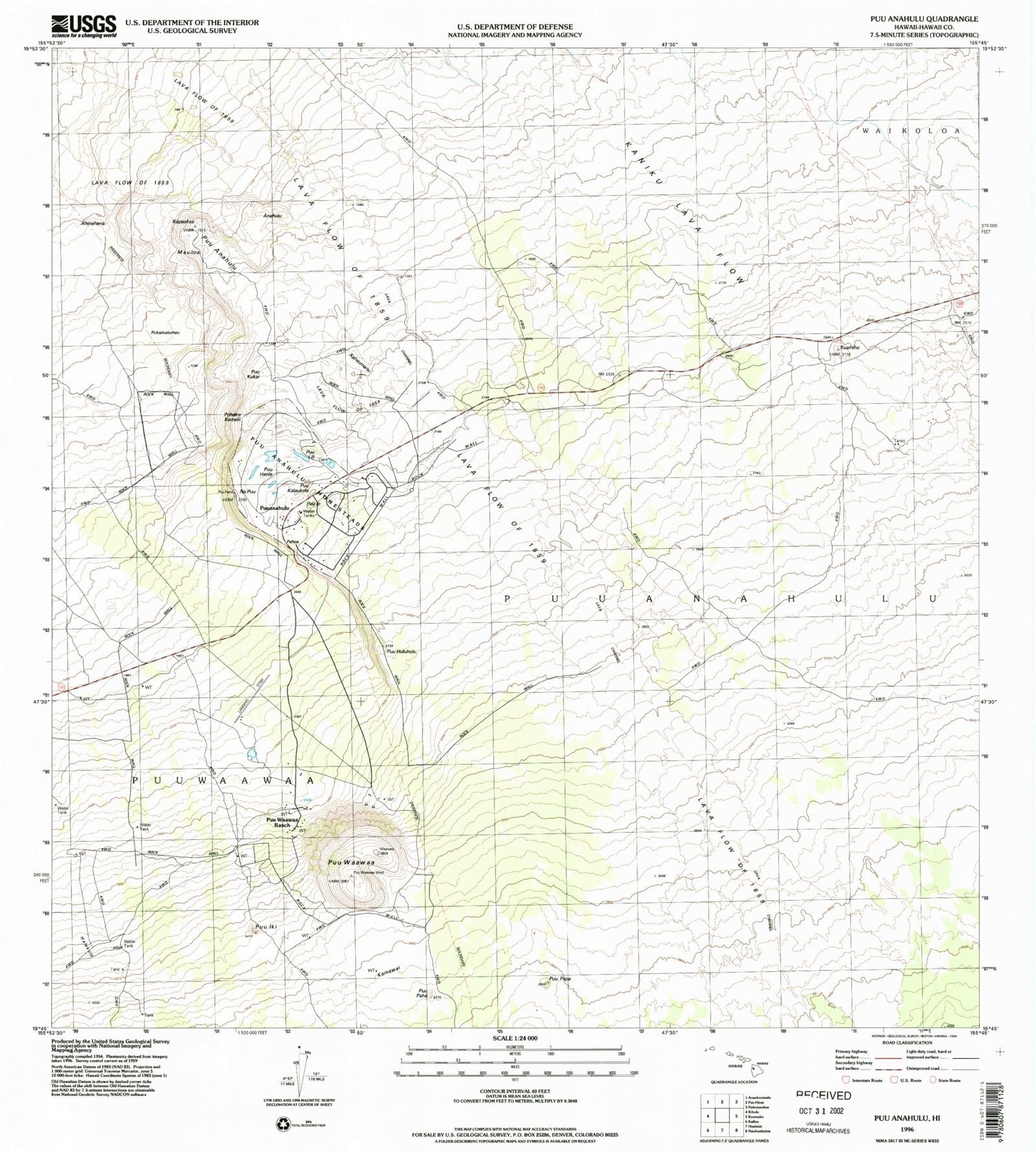
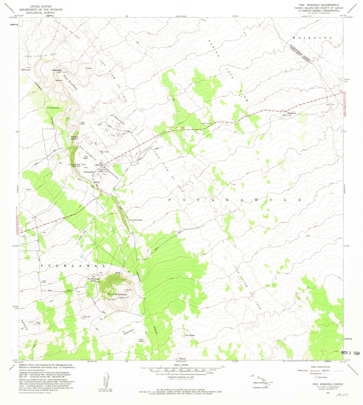
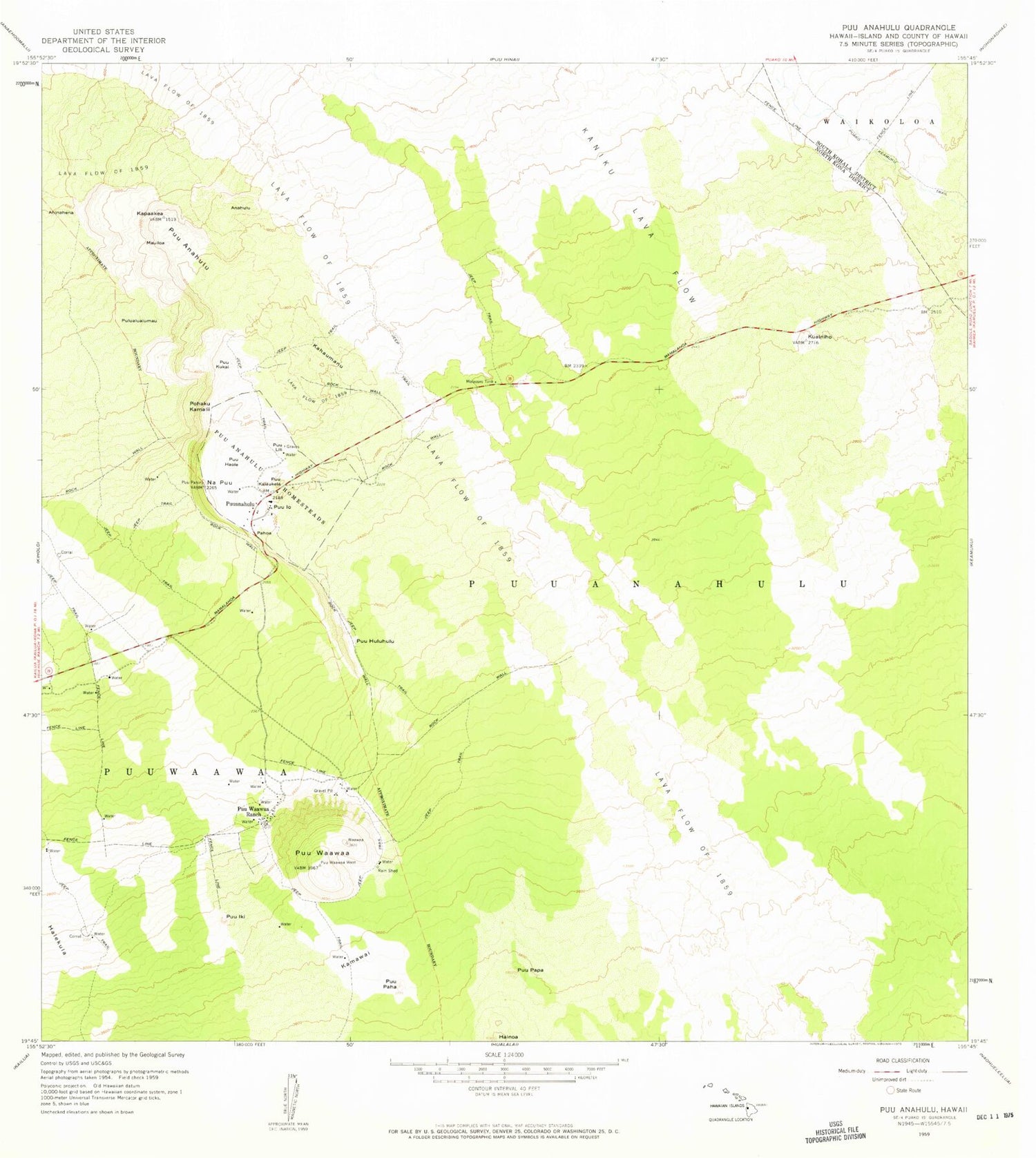
Historical USGS topographic quad map of Puuanahulu in the state of Hawaii. Map scale may vary for some years, but is generally around 1:24,000. Print size is approximately 24" x 27"
This quadrangle is in the following counties: Hawaii.
The map contains contour lines, roads, rivers, towns, and lakes. Printed on high-quality waterproof paper with UV fade-resistant inks, and shipped rolled.
Contains the following named places: Ahinahina, Anahulu, Halekula, Kahaumanu, Kamawai, Kapaakea, Kuainiho, Mauiloa, Napu'u, Pahoa, Pohaku Kamalii, Pulualualumau, Puu Haole, Puu Kalaukela, Puu Kukai, Puu Lili, Puu Paha, Puu Papa, Puu Waa Waa Ranch Airport, Pu'uanahulu, Pu'uhuluhulu, Pu'uiki, Pu'u'io, Pu'uwa'awa'a, Pu'uwa'awa'a Ranch, ZIP Code: 96738