MyTopo
Classic USGS Puuoo Hawaii 7.5'x7.5' Topo Map
Regular price
$16.95
Regular price
Sale price
$16.95
Unit price
per
Couldn't load pickup availability
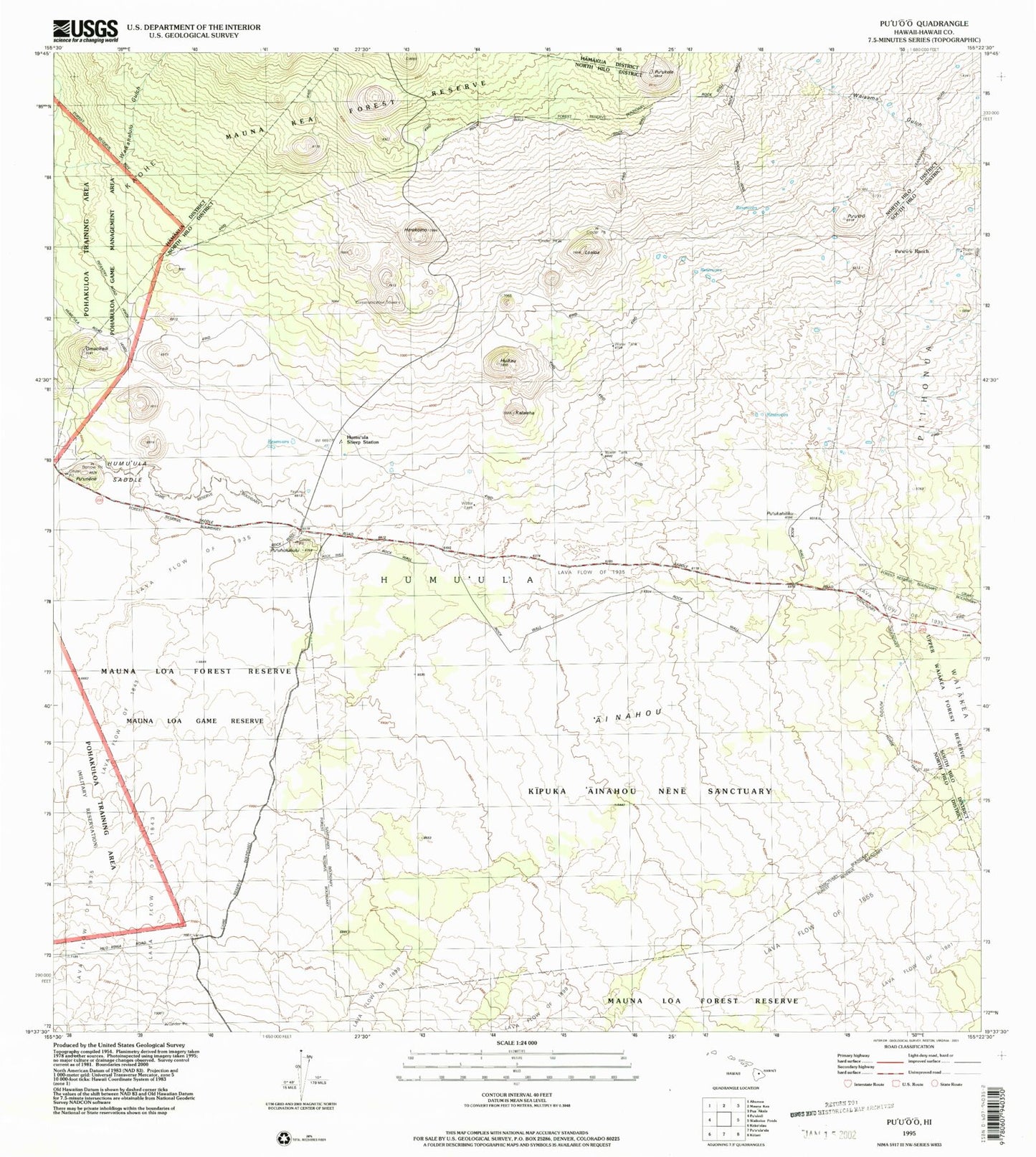
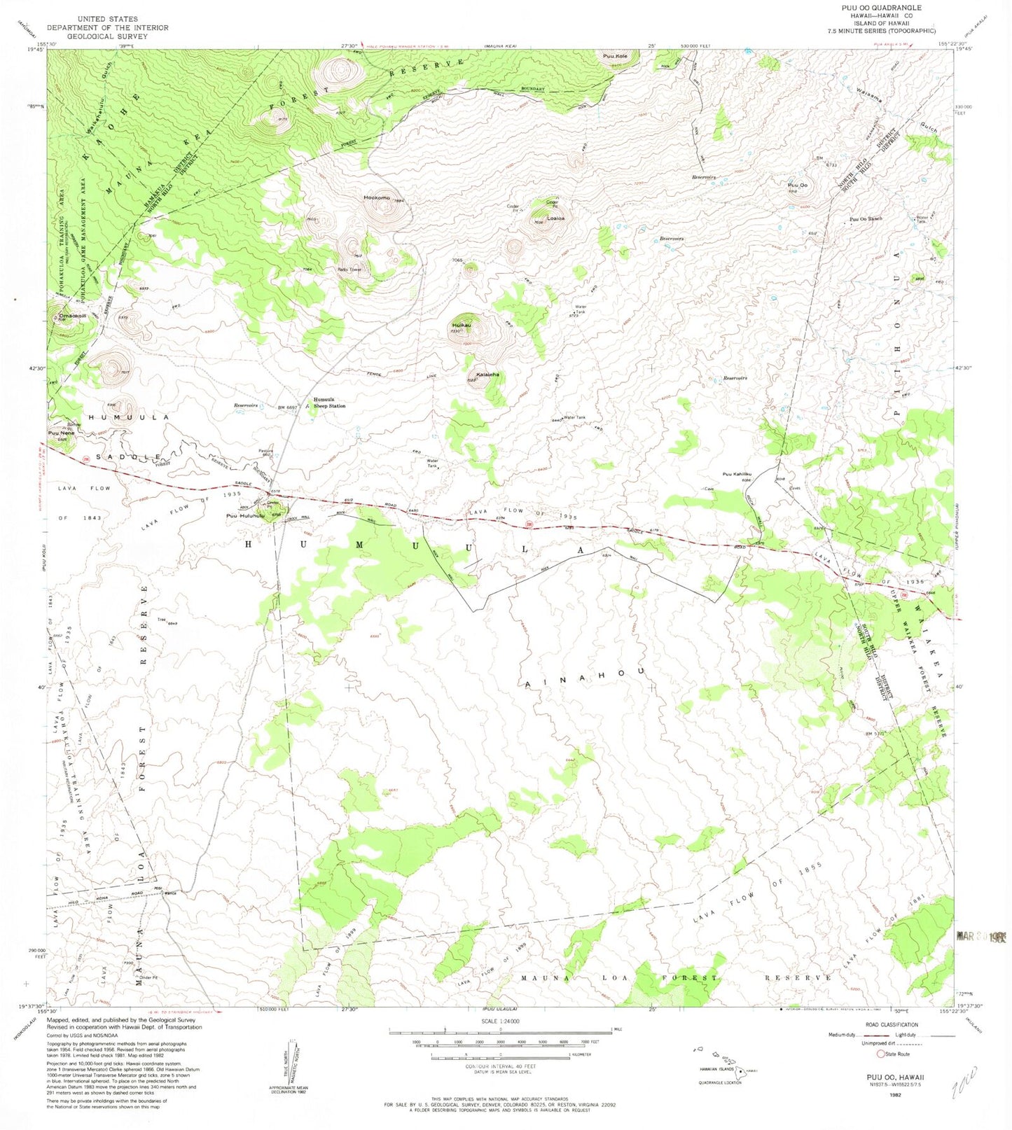
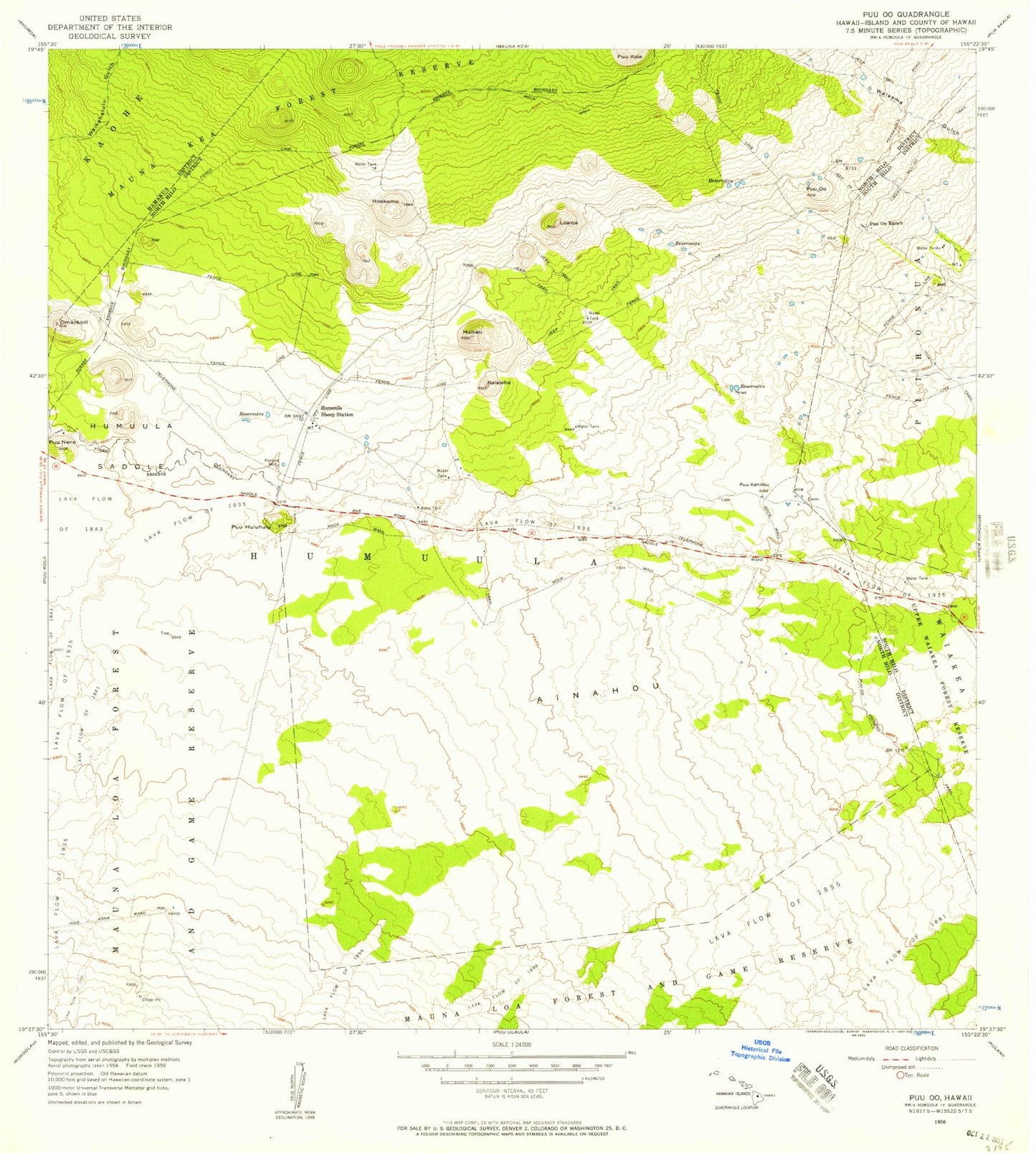
Historical USGS topographic quad map of Puuoo in the state of Hawaii. Map scale may vary for some years, but is generally around 1:24,000. Print size is approximately 24" x 27"
This quadrangle is in the following counties: Hawaii.
The map contains contour lines, roads, rivers, towns, and lakes. Printed on high-quality waterproof paper with UV fade-resistant inks, and shipped rolled.
Contains the following named places: Ainahou, Hilo Trail, Homu'ula-Upper Pi'ihonua Hawaiian Home Land, Ho'okomo, Huikau, Humu'ula Saddle, Humu'ula Sheep Station, Kalaieha, Loaloa, Omaokoili, Pu'uhuluhulu, Pu'ukahiliku, Pu'ukole, Pu'unene, Pu'u'o'o, Pu'u'o'o Horse Trail, Pu'u'o'o Ranch