
MyTopo
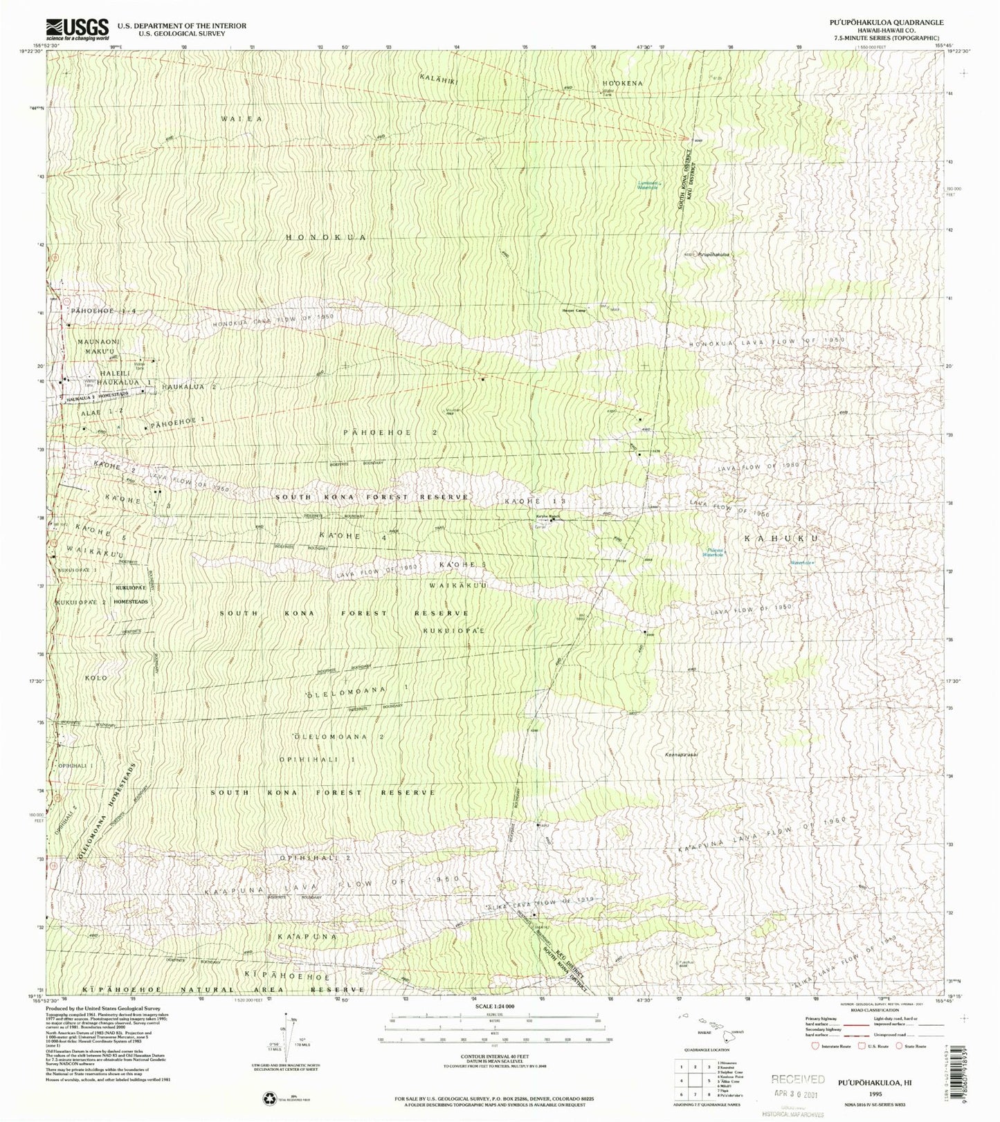
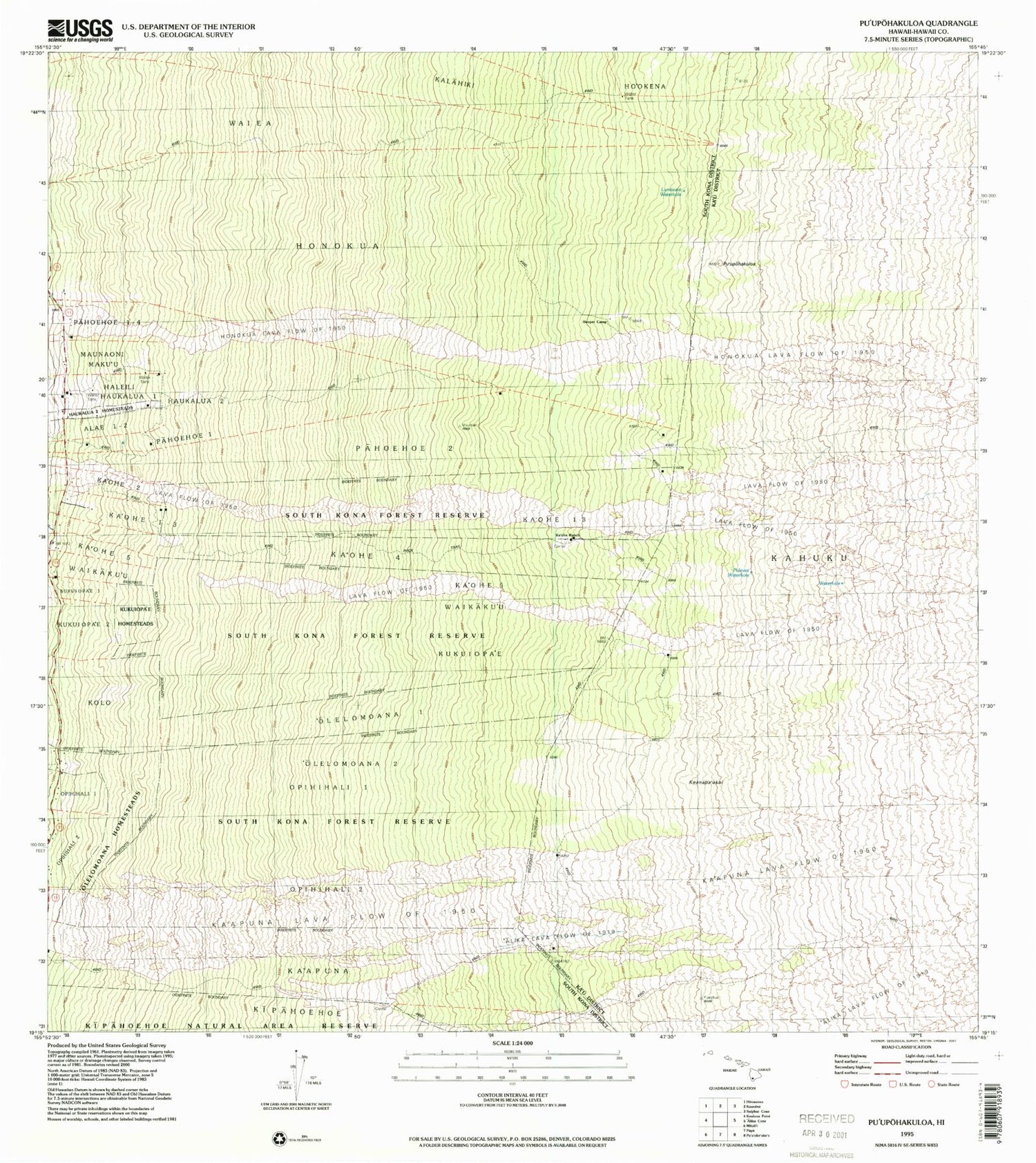
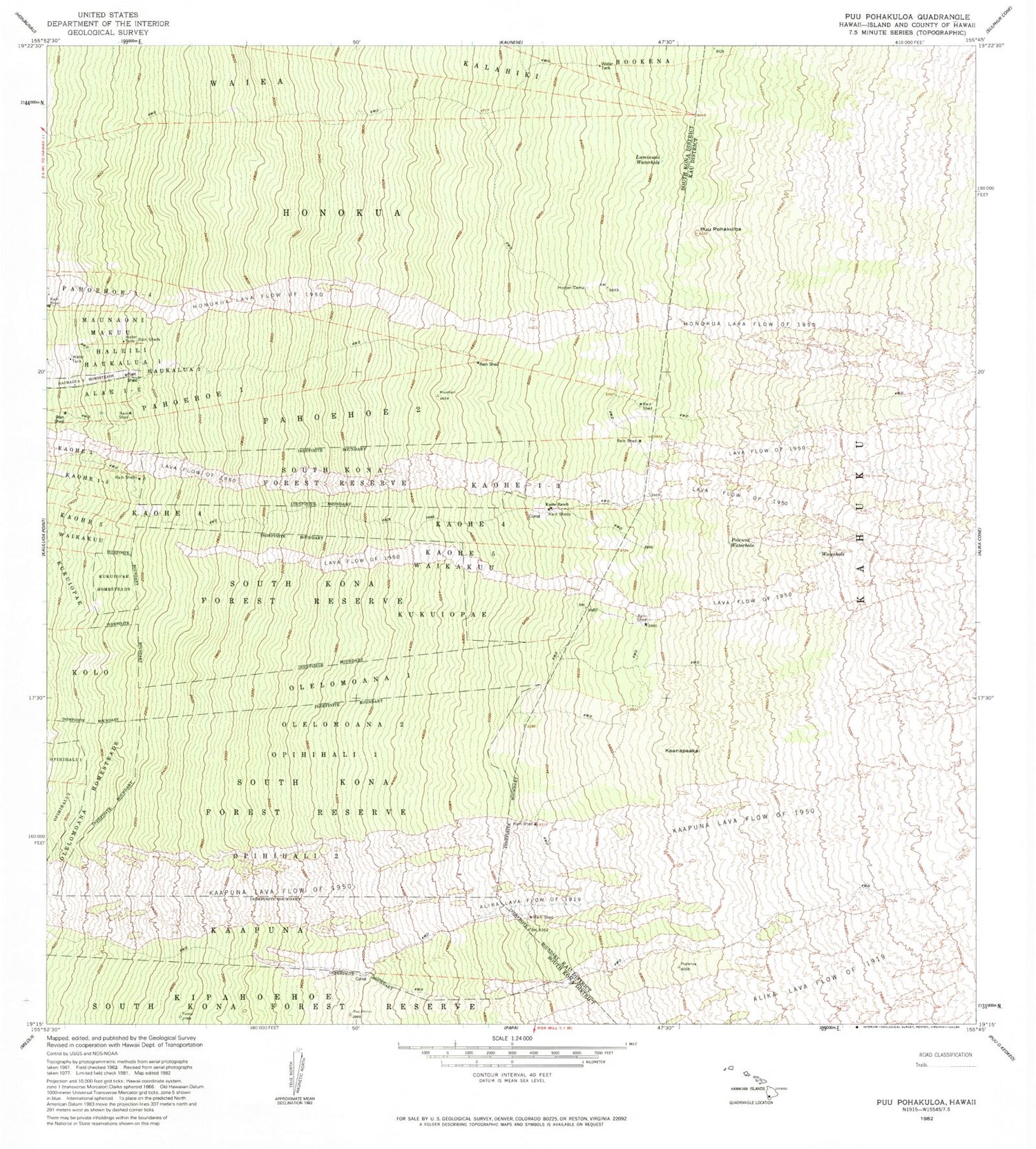
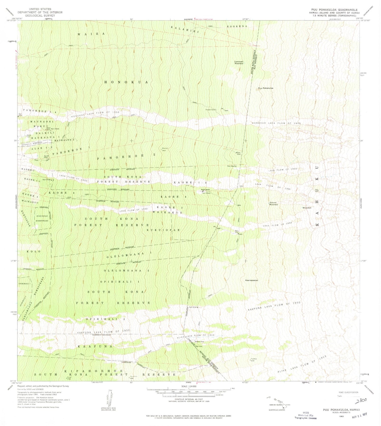
Classic USGS Puupohakuloa Hawaii 7.5'x7.5' Topo Map
Couldn't load pickup availability
Historical USGS topographic quad map of Puupohakuloa in the state of Hawaii. Map scale may vary for some years, but is generally around 1:24,000. Print size is approximately 24" x 27"
This quadrangle is in the following counties: Hawaii.
The map contains contour lines, roads, rivers, towns, and lakes. Printed on high-quality waterproof paper with UV fade-resistant inks, and shipped rolled.
Contains the following named places: Haukalua, Honokua, Honokua Lava Flow of 1950, Hooper Camp, Ka'apuna, Ka'apuna Lava Flow of 1950, Ka'ohe 1-3, Ka'ohe 4, Ka'ohe 5, Ka'ohe Ranch, Keanapa'akai, Kona Paradise Volunteer Fire Station 06B, Kukuiopa'e, Kukuiopa'e Homesteads, Lumiawai Waterhole, Maunaoni, 'Olelomoana 1, 'Olelomoana 2, 'Olelomoana Homesteads, Olelomoana-Opihihali Tract, Opihihali One, Opihihali Two, Pahoehoe 1, Pahoehoe 1-4, Pahoehoe 2, Polewai Waterhole, Pu'upohakuloa, South Kona Division, South Kona Forest Reserve, Waiea, Waikaku'u, ZIP Code: 96704