MyTopo
Classic USGS Puzzle Mountain Maine 7.5'x7.5' Topo Map
Couldn't load pickup availability
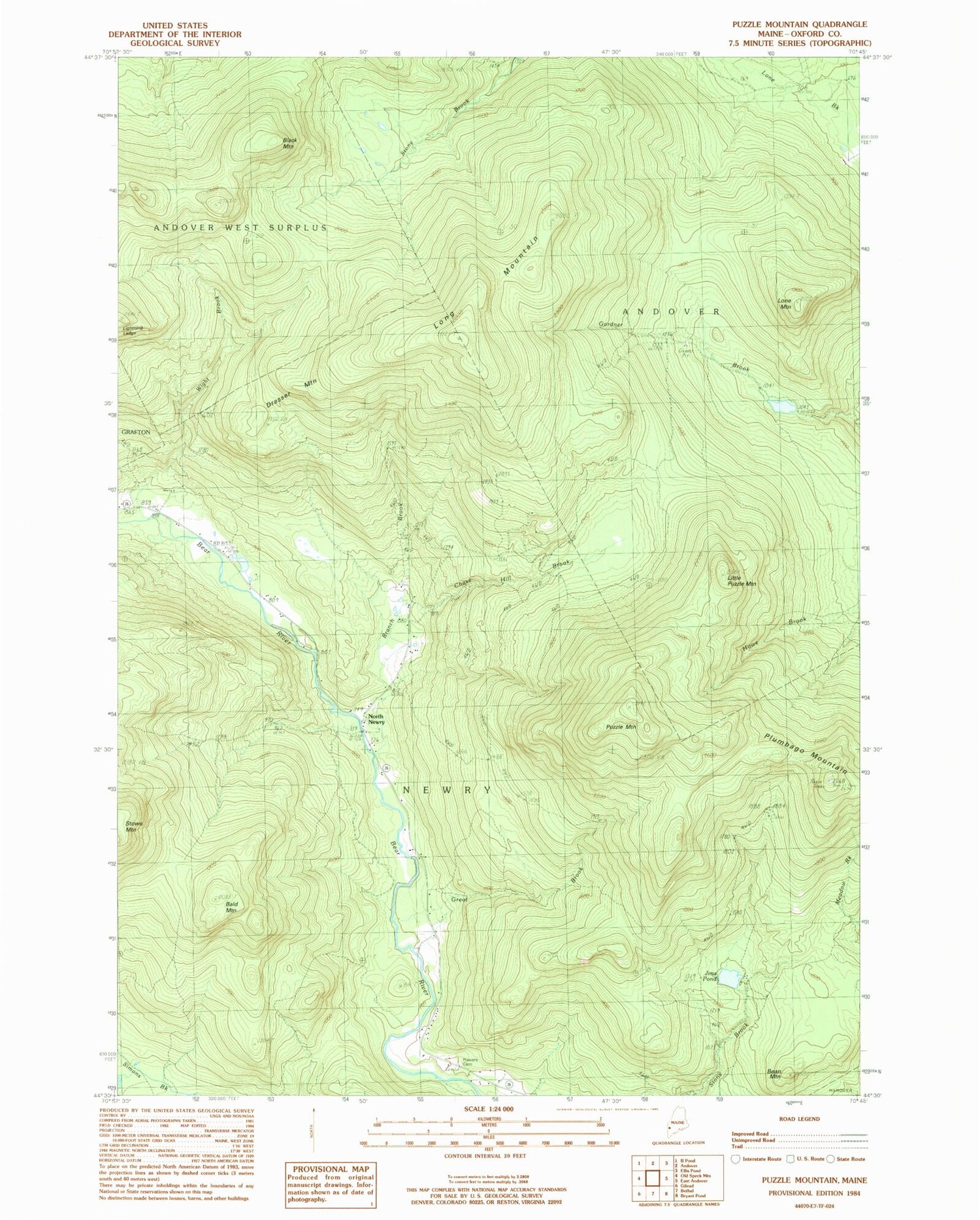
Historical USGS topographic quad map of Puzzle Mountain in the state of Maine. Typical map scale is 1:24,000, but may vary for certain years, if available. Print size: 24" x 27"
This quadrangle is in the following counties: Oxford.
The map contains contour lines, roads, rivers, towns, and lakes. Printed on high-quality waterproof paper with UV fade-resistant inks, and shipped rolled.
Contains the following named places: Bald Mountain, Bean Mountain, Black Mountain, Branch Brook, Chase Hill Brook, Dresser Mountain, Great Brook, Lightning Ledge, Little Puzzle Mountain, Lone Mountain, Long Mountain, North Newry, Plumbago Mountain, Powers Cemetery, Puzzle Mountain, Wight Brook, North Newry Post Office, Town of Andover, Town of Newry, Jims Pond, Step Falls Preserve, Andover West Surplus Township, Newry Fire Department