MyTopo
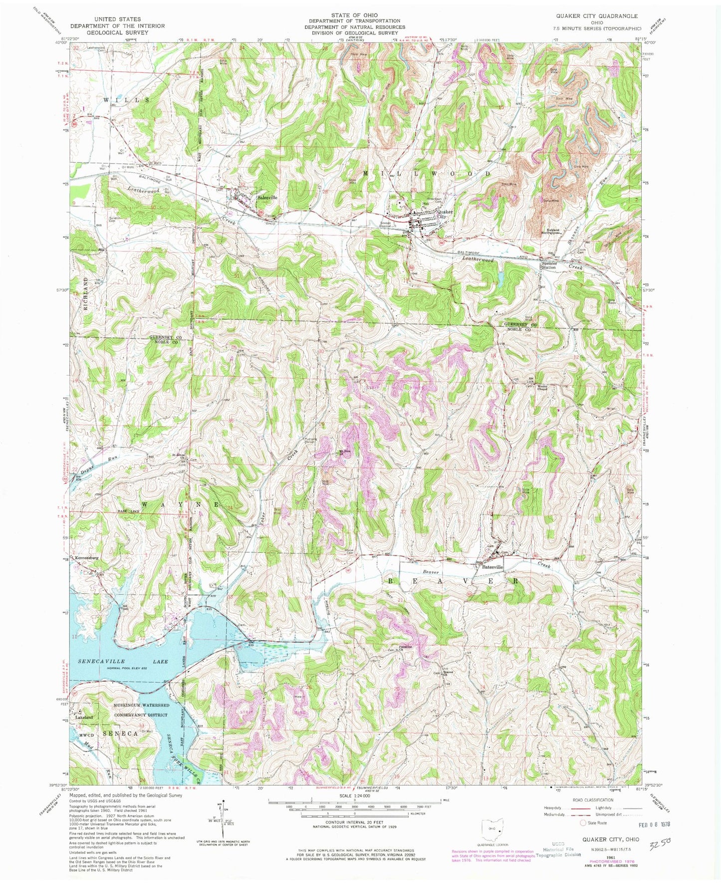
Classic USGS Quaker City Ohio 7.5'x7.5' Topo Map
Couldn't load pickup availability
Historical USGS topographic quad map of Quaker City in the state of Ohio. Map scale may vary for some years, but is generally around 1:24,000. Print size is approximately 24" x 27"
This quadrangle is in the following counties: Guernsey, Noble.
The map contains contour lines, roads, rivers, towns, and lakes. Printed on high-quality waterproof paper with UV fade-resistant inks, and shipped rolled.
Contains the following named places: B & O Railroad Pond, B & O Railroad Pond Dam, Batesville, Batesville Post Office, Beaver Baptist Cemetery, Beaver Baptist Church, Beaver Creek, Beaver School, Deal School, Eldon Cemetery, Friends Cemetery, Glady Run, Greenlawn Cemetery, Griggs School, Hague School, Hall School, House Cemetery, Jones School, Lakeland, Leatherwood Cemetery, Leatherwood Valley Farms, Longs School, Mount Zion Church, Mud Run, Mud Run School, Palestine Cemetery, Palestine Church of Christ, Quaker City, Quaker City Elementary School, Quaker City Fire Department, Quaker City Post Office, Renner School, Richland Meetinghouse, Saint Johns Cemetery, Saint Johns Church, Salesville, Salesville Census Designated Place, Salesville Post Office, Sandhill Cemetery, Science Hill School, Shannon Run, Spencer Station, Spencer's Station Post Office, Sue-Lin Acres, Township of Beaver, Township of Millwood, Tuckyno School, Village of Batesville, Village of Quaker City, Village of Salesville, Wesley Chapel, Wyscarver Cemetery, Wyscarver School, Yoker Creek, Yoker Valley, ZIP Code: 43773