MyTopo
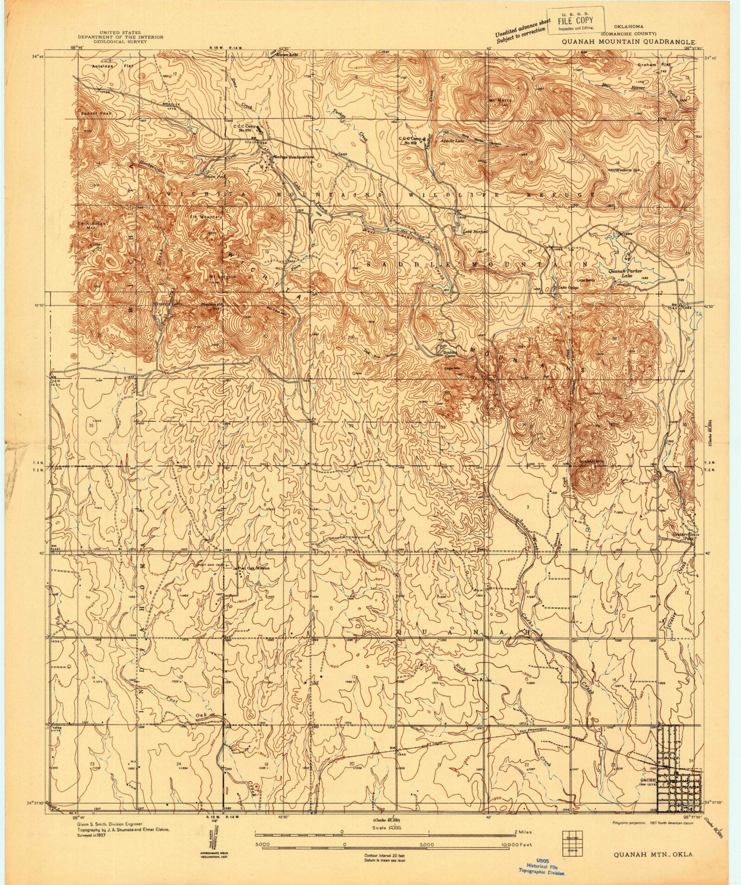
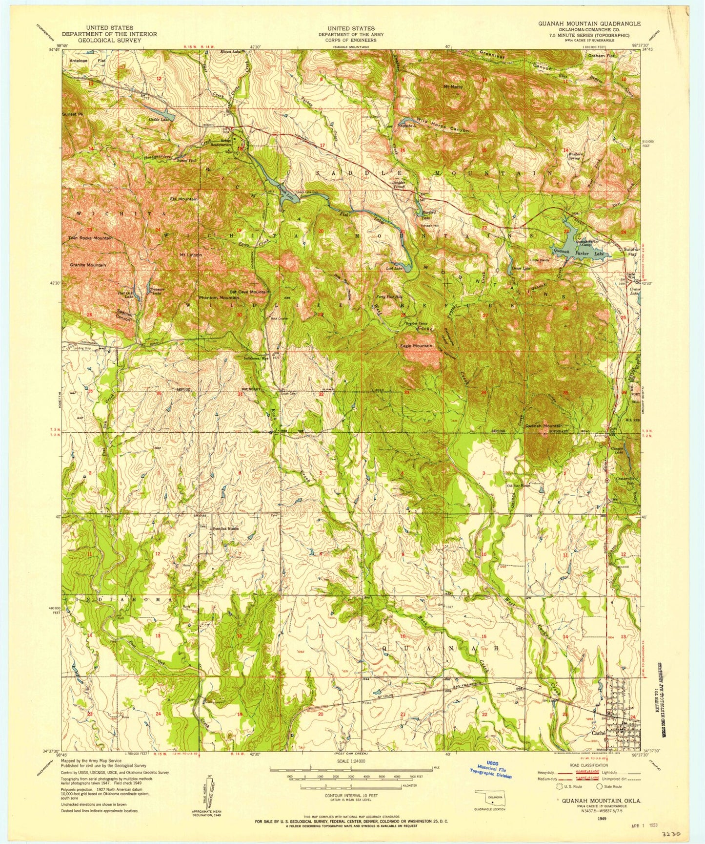
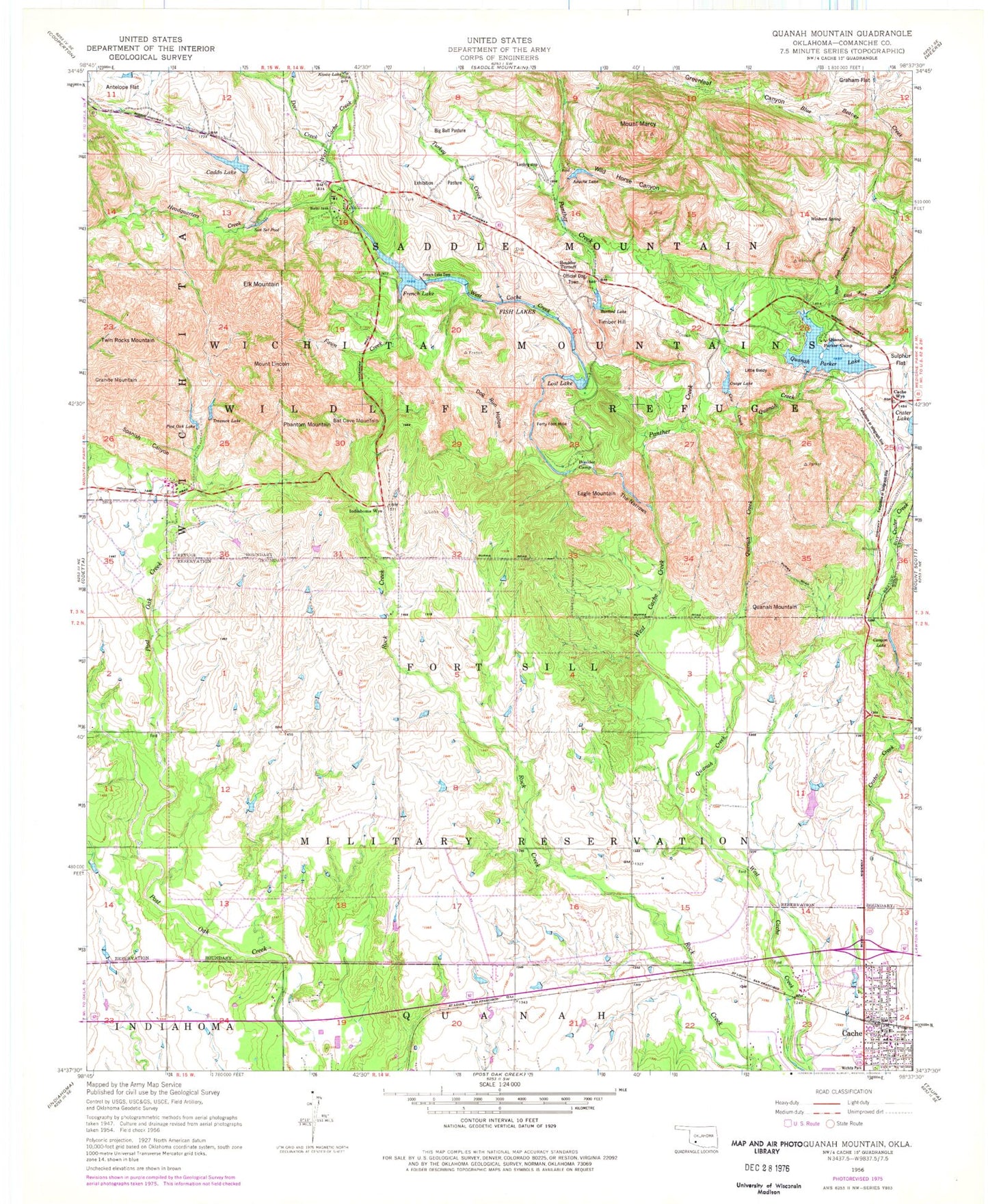
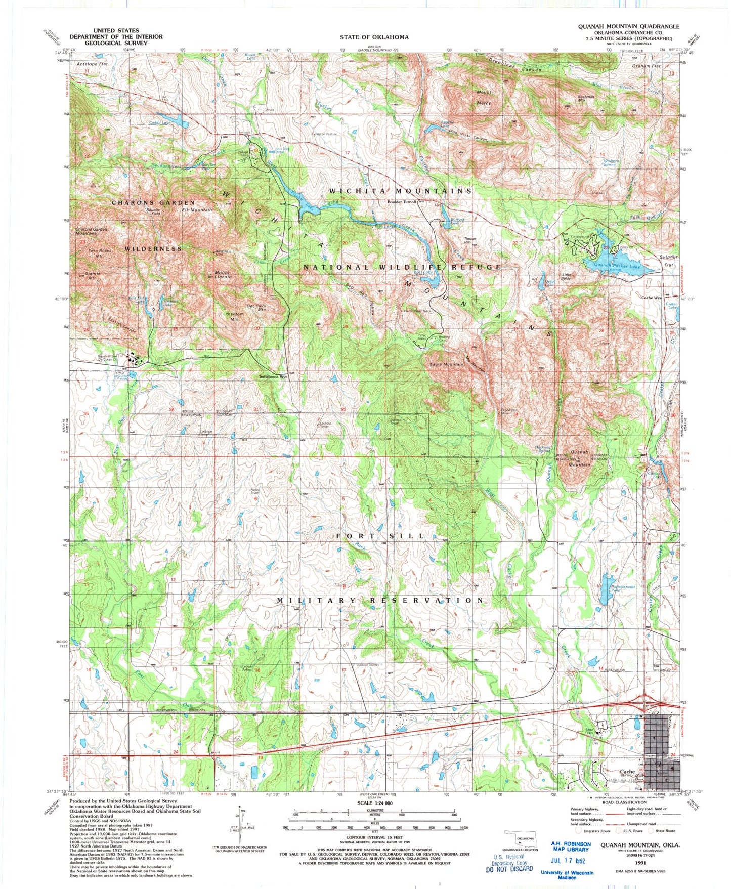
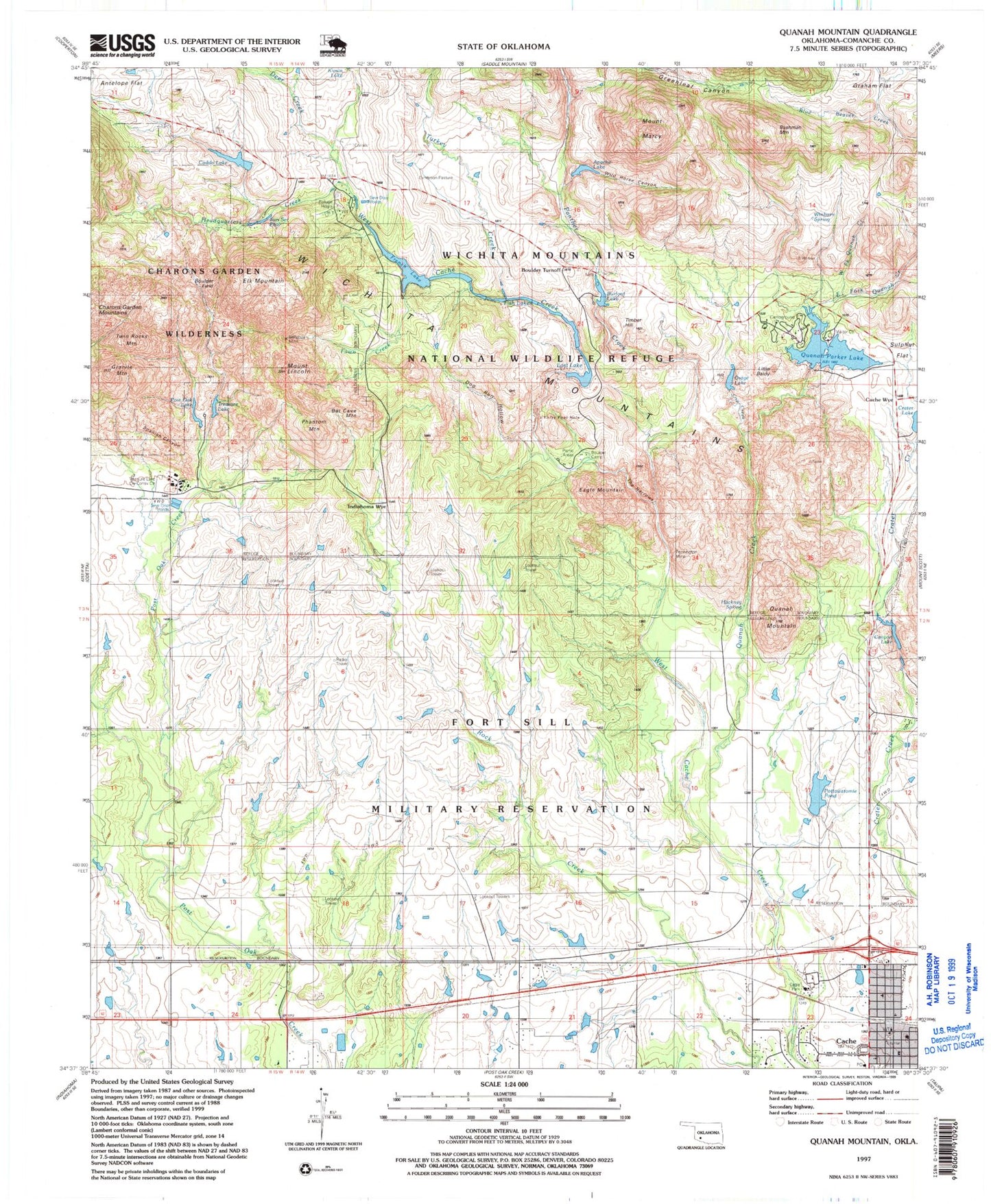
USGS Classic Quanah Mountain Oklahoma 7.5'x7.5' Topo Map
Couldn't load pickup availability
Historical USGS topographic quad map of Quanah Mountain in the state of Oklahoma. Scale: 1:24000. Print size: 24" x 27"
This quadrangle is in the following counties: Comanche.
The map contains contour lines, roads, rivers, towns, lakes, and grids including latitude / longitude and UTM / MGRS. Printed on high-quality waterproof paper with UV fade-resistant inks.
Contains the following named places: Antelope Flat, Apache Lake, Bat Cave Mountain, Boulder Camp, Boulder Turnoff, Burford Lake, Cache, Caddo Lake, Canyon Lake, Cow Creek, Crater Lake, Deer Creek, Dog Run Hollow, Eagle Mountain, East Fork Quanah Creek, Elk Mountain, Exhibition Pasture, Fawn Creek, Fish Lakes, French Lake, French Lake Dam, Granite Mountain, Headquarters Creek, Little Baldy, Lost Lake, Osage Lake, Panther Creek, Phantom Mountain, Post Oak Lake, Quanah Creek, Quanah Mountain, Quanah Parker Lake, Spanish Canyon, Sun Set Pool, The Narrows, Timber Hill, Treasure Lake, Turkey Creek, West Fork Quanah Creek, Wild Horse Canyon, Winborn Spring, Cache Wye, Indiahoma Wye, Hackney Spring, Pottawatomie Pond, Pete Coffey Church, Bushman Mountain, Boulder Field, Wichita Mountains National Wildlife Refuge Headquarters, Bonanza Mine, Doris Campground, Quanah Parker Lake Visitor Center, Treasure Lake Civilian Conservation Center, Pennington Mine, Eagle Park, Wichita Mountains Wilderness (Charons Garden Unit), Big Bull Pasture, Forty Foot Hole, Official Dog Town (historical), Wichita Park (historical), Mount Lincoln, Mount Marcy, Twin Rocks Mountain, Lost Lake Dam, Lost Lake, Burford Lake Dam, Post Oak Lake Dam, Caddo Lake Dam, Caddo Lake, Potawatomi Twins Dam, Potawatomi Twins Reservoir, Upper Canyon Lake Dam, Upper Canyon Lake, Crater Lake Dam, French Lake Dam, Quanah Parker Lake, Cache Post Office, Wichita Mountains Wilderness (Charons Garden Unit), Cache Volunteer Fire Department, Centennial Arch, Cache Ambulance Service, Cache Police Department