MyTopo
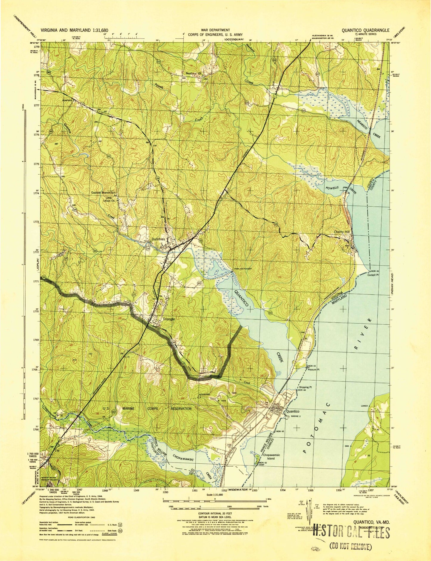
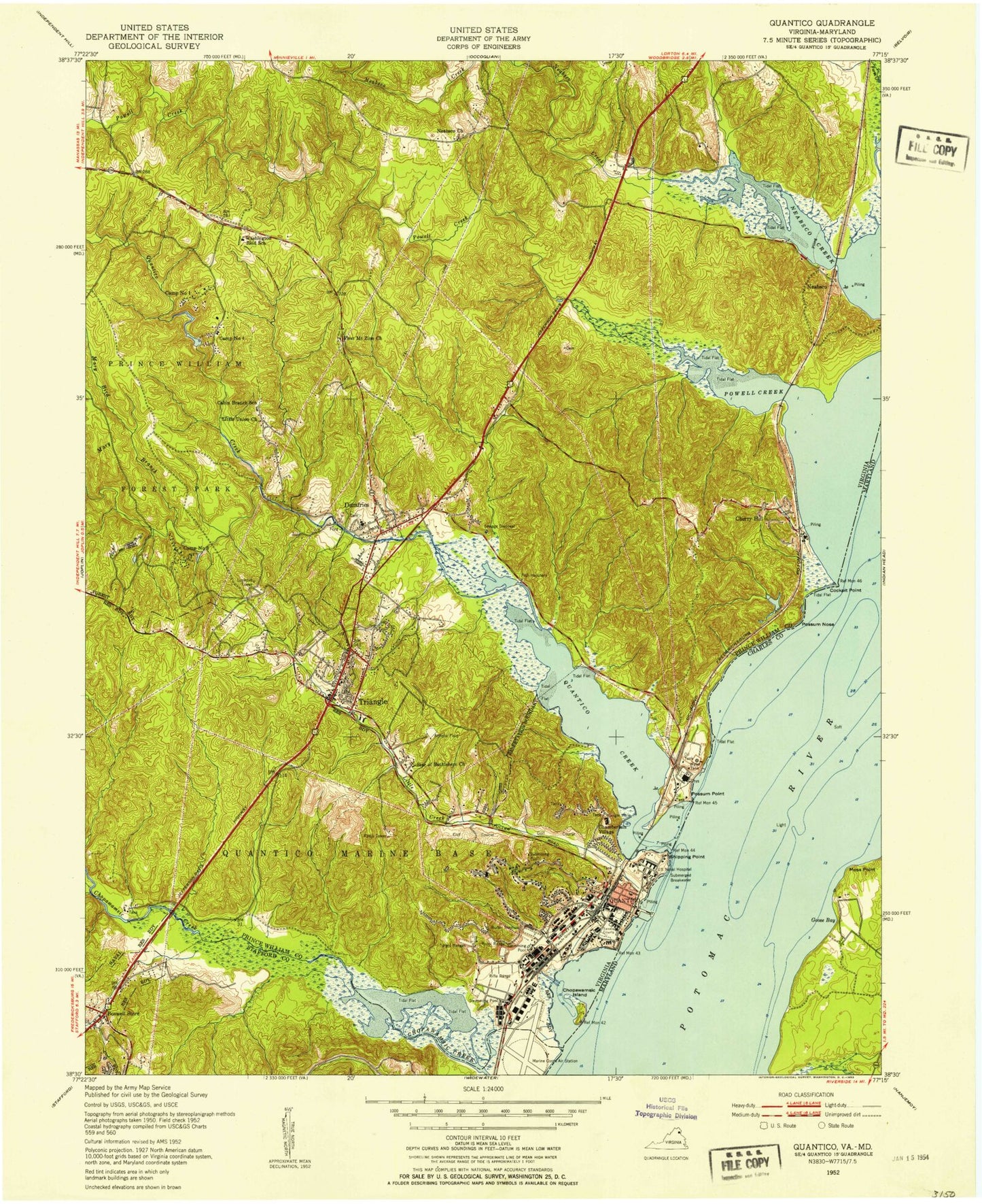
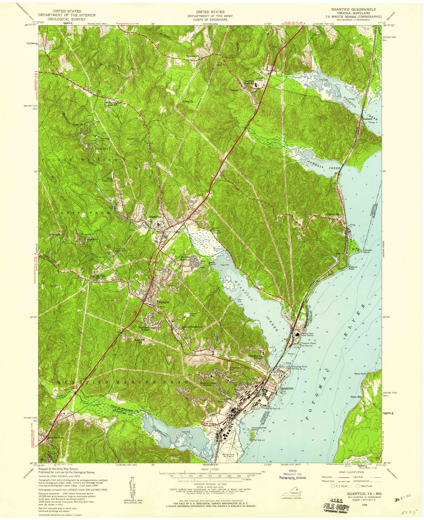
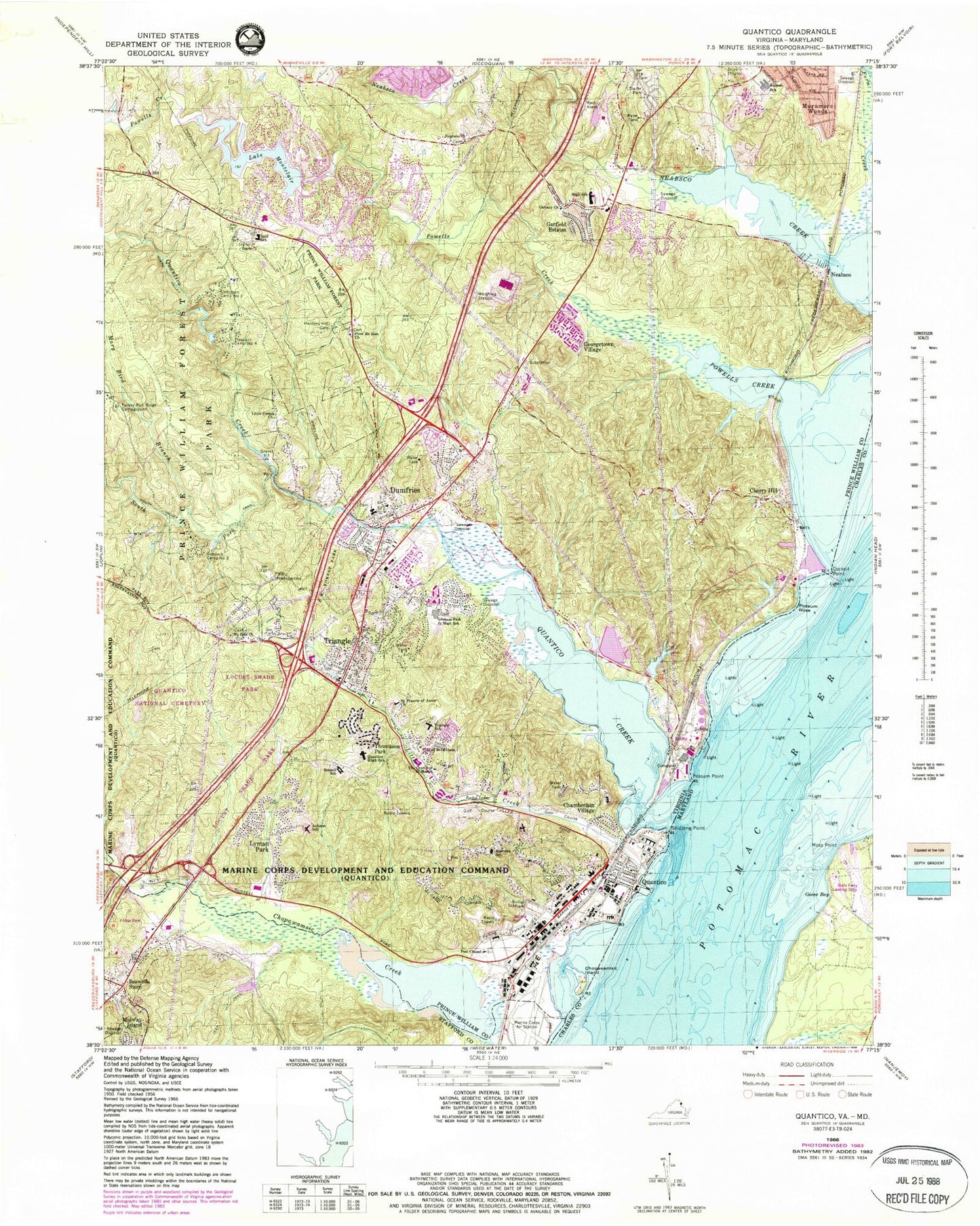
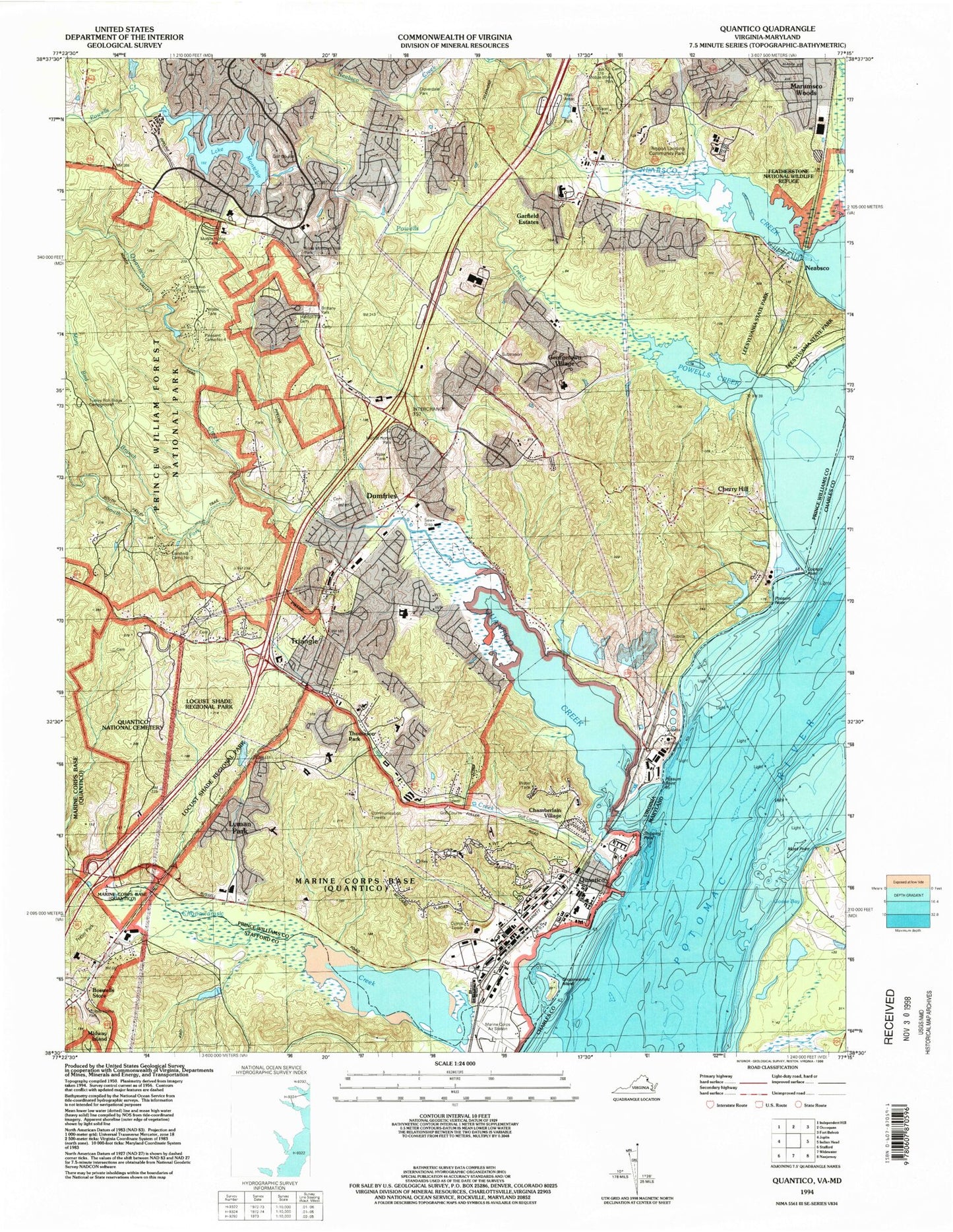
USGS Classic Quantico Virginia 7.5'x7.5' Topo Map
Couldn't load pickup availability
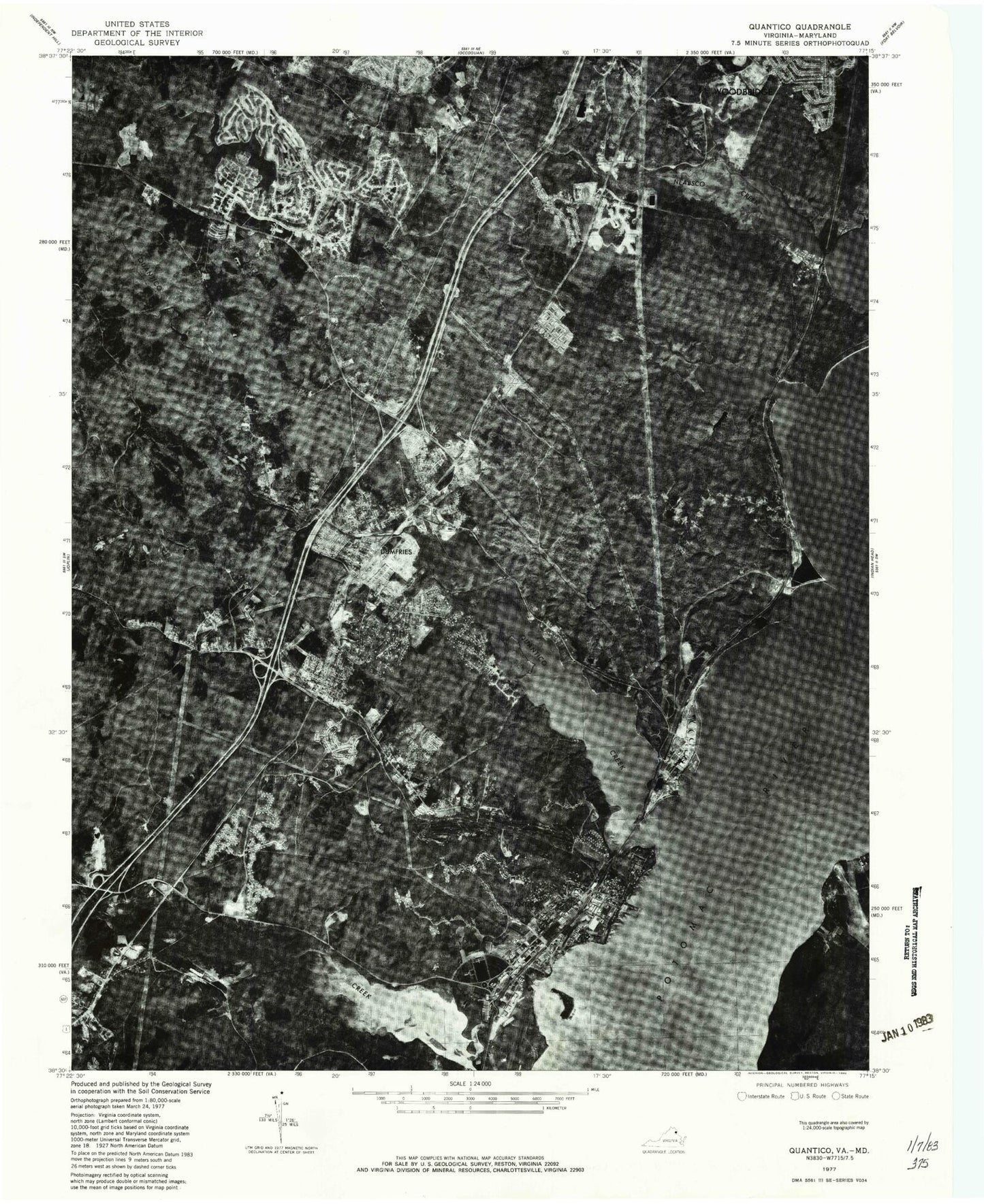
Historical USGS topographic quad map of Quanticoin the states of Virginia, Maryland. Scale: 1:31680. Print size: 24" x 27"
This quadrangle is in the following counties: Charles, Prince William, Stafford.
The map contains contour lines, roads, rivers, towns, lakes, and grids including latitude / longitude and UTM / MGRS. Printed on high-quality waterproof paper with UV fade-resistant inks.
Contains the following named places: W W Ashurst Elementary School, Boswells Store, W W Burrows Elementary School, Calvary Church, Chopawamsic Island, Cockpit Point, First Mount Zion Baptist Church, Graham Park Middle School, Hardens Hill Cemetery, Little Creek, Little Union Church, Lyman Park, Mary Bird Branch, Mount Zion Baptist Church, Neabsco Church, Neabsco Creek, Possum Nose, Possum Point, Post Chapel, Powells Creek, Quantico Creek, Quantico Middle / High School, Quantico Marine Corps Schools, Washington - Reid Elementary School, Rippon Middle School, John H Russell Elementary School, Saint Francis of Assisi Church, Shipping Point, South Fork Quantico Creek, Star of Bethlehem Church, The Church of Saint Martin, Triangle Elementary School, Turkey Run Ridge Campground, Hunter Run, Quantico Marine Corps Air Facility/Turner Field, Lake Montclair Dam, Camp Four Dam, Camp Four Lake (historical), Camp One Dam, Camp One Lake (historical), Camp Three Dam, Camp Three Lake (historical), Carters Day Camp Pond Dam, Carters Day Camp Pond, Butler Stadium, Goodwill Camp Number 3, Lichtman Camp Number 1, Pleasant Camp Number 4, Possum Point Power Station, Chamberlain Village, Cherry Hill, Dumfries, Garfield Estates, Georgetown Village, Marumsco Woods, Quantico, Thomason Park, Triangle, Lake Montclair, WPWC-AM (Dumfries-Triangle), A Henderson Elementary School, Anden at the Woods, Captain Branch School (historical), Cardinal Heights, Cecil W Garrison Park, Cloverdale, Cloverdale Park, Cockpit Point Industrial Park, Concordia Lutheran Church, Dumfries Elementary School, Dumfries Mini Library, Dumfries Plaza Shopping Center, Dumfries Public Cemetery, Dumfries Town Hall, Dumfries United Methodist Church, Good Shepherd Lutheran Church, Goodwill Historic District, Graham Park Shores, Grayson Village Mobile Home Park, John F Pattie Senior Elementary School, Leesylvania State Park, Locust Shade Park, Neabsco Cemetery, Pleasant Historic District, Potomac Senior High School, Quantico National Cemetery, Quantico Post Office, Quantico Town Hall, Rose Hill, Triangle Baptist Church, Triangle Post Office, Triangle Public Cemetery, Tripoli Heights, Vaughnland, Northern Virginia Community College Woodbridge Campus, Woodlea, Montclair, Woodbridge District, Pine Grove Forest Trail, Quantico Falls Trail, Turkey Run Ridge Trail, The Crossing Trail, Birch Bluff Trail, Calvin Branch Mine Trail, Laurel Trail Loop, Little Run Loop, North Valley Trail, Mary Bird Branch Trail, Leesylvania Elementary School, Swans Creek Elementary School, John F Pattie Elementary School, River Oaks Elementary School, Forest Park High School, Freedom High School, Dumfries Neighborhood Library, Prince William County Police Department Eastern District Station, Quantico Police Department, Dumfries Police Department, Dumfries - Triangle Volunteer Fire Department Station 3F, Dumfries-Triangle Rescue Squad, The National Museum of the Marine Corps, Dumfries - Triangle Rescue Squad Station 3R, Prince William County Juvenile Court Service Unit - Woodbridge Office, Prince William County Criminal Court, Potomac Middle School, Montclair Census Designated Place, Quantico Base Census Designated Place, Town of Dumfries, Triangle Census Designated Place, Town of Quantico, Marsh Road Baptist Church, Fritter Park, Dogwoods, Mavel Manor, Richard M Milburn High School, Star of Bethlehem Christian Academy, Minnieland Academy, Saint Francis of Assisi Catholic School, Clairmont School and Child Care, Marine Corps University, United States Marine Corps College of Continuing Education, Mary F Williams Elementary School, Mary G Porter Traditional School, Dumfries Shopping Center, Hampton's Landing Marina, Forest Greens Golf Club, Medal of Honor Golf Course, Montclair Country Club, Rippon Landing Park, Rippon Virginia Railway Express Station, Rippon Landing, Rippon Landing Apartments, H. L. Mooney Water Reclamation Facility, Neabsco Eagles Park, C. Lacey Compton Neighborhood Park, Anne Moncure Wall Park, Rippon Lodge, Boswell's Corner Census Designated Place, Leesylvania Census Designated Place, Newport Census Designated Place, Cherry Hill Census Designated Place, Quantico Fire and Emergency Services Station 31, Marine Air Corps Facility - Quantico Aircraft Rescue and Firefighting, Quantico Fire and Emergency Services Station 52, Church on the Rock Ministries, Featherstone National Wildlife Refuge, Dumfries Post Office, Dumfries - Triangle Volunteer Fire Department Station 23, Goose Bay, Moss Point, Buds Ferry Airport, Budds Ferry (historical)