
MyTopo
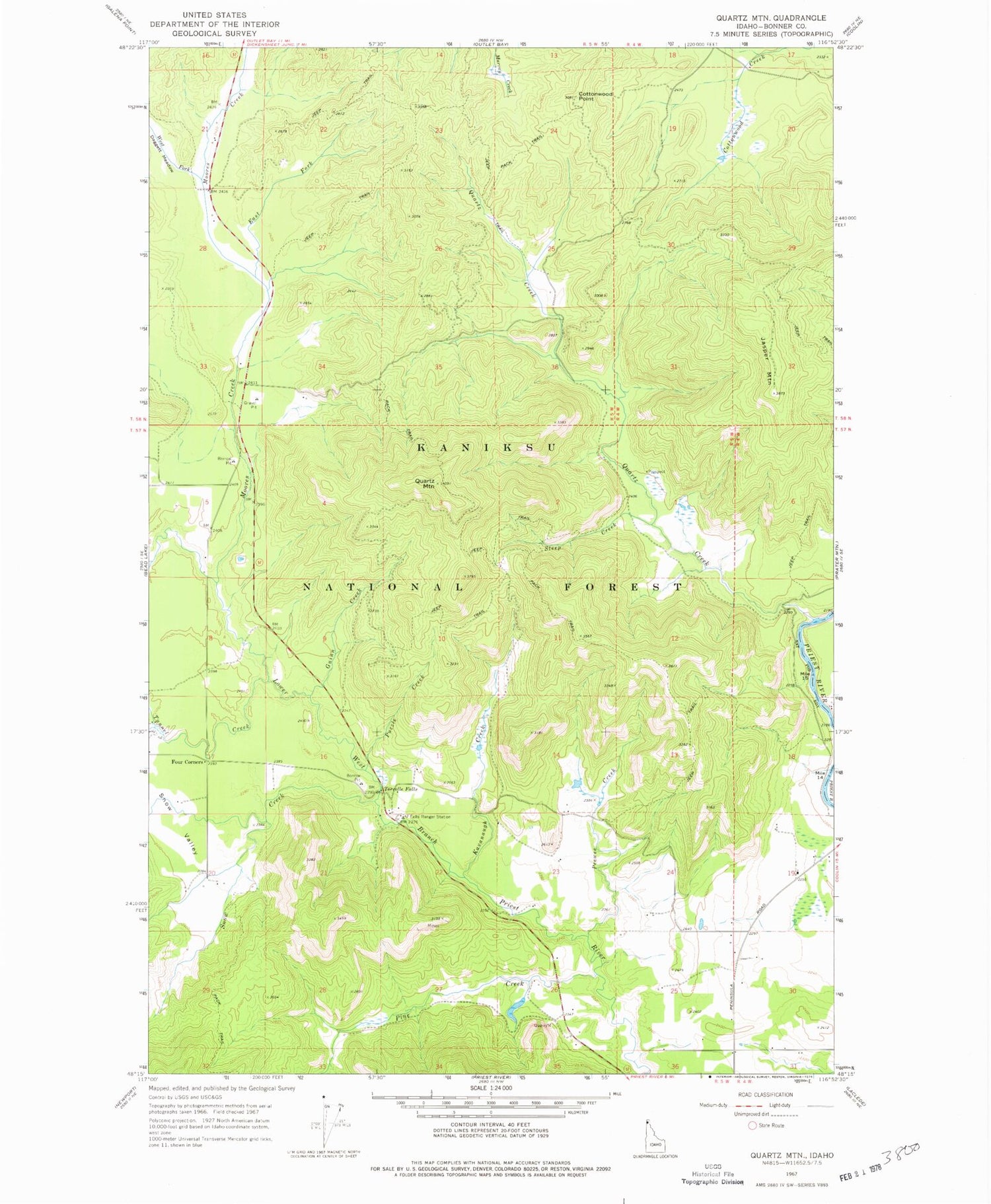
Classic USGS Quartz Mountain Idaho 7.5'x7.5' Topo Map
Couldn't load pickup availability
Historical USGS topographic quad map of Quartz Mountain in the states of Idaho, Washington. Typical map scale is 1:24,000, but may vary for certain years, if available. Print size: 24" x 27"
This quadrangle is in the following counties: Bonner.
The map contains contour lines, roads, rivers, towns, and lakes. Printed on high-quality waterproof paper with UV fade-resistant inks, and shipped rolled.
Contains the following named places: Cottonwood Point, East Fork Moores Creek, Guinn Creek, Kavanaugh Creek, Moores Creek, Peewee Creek, Pine Creek, Puzzle Creek, Quartz Creek, Snow Creek, Snow Valley, Steep Creek, Tunnel Creek, West Fork Moores Creek, Pewee Peak, Falls Ranger Station, Four Corners, Jasper Mountain, Quartz Mountain, Torrelle Falls, Snow Valley Academy, Snow Valley Grange, Tunnel Creek


