MyTopo
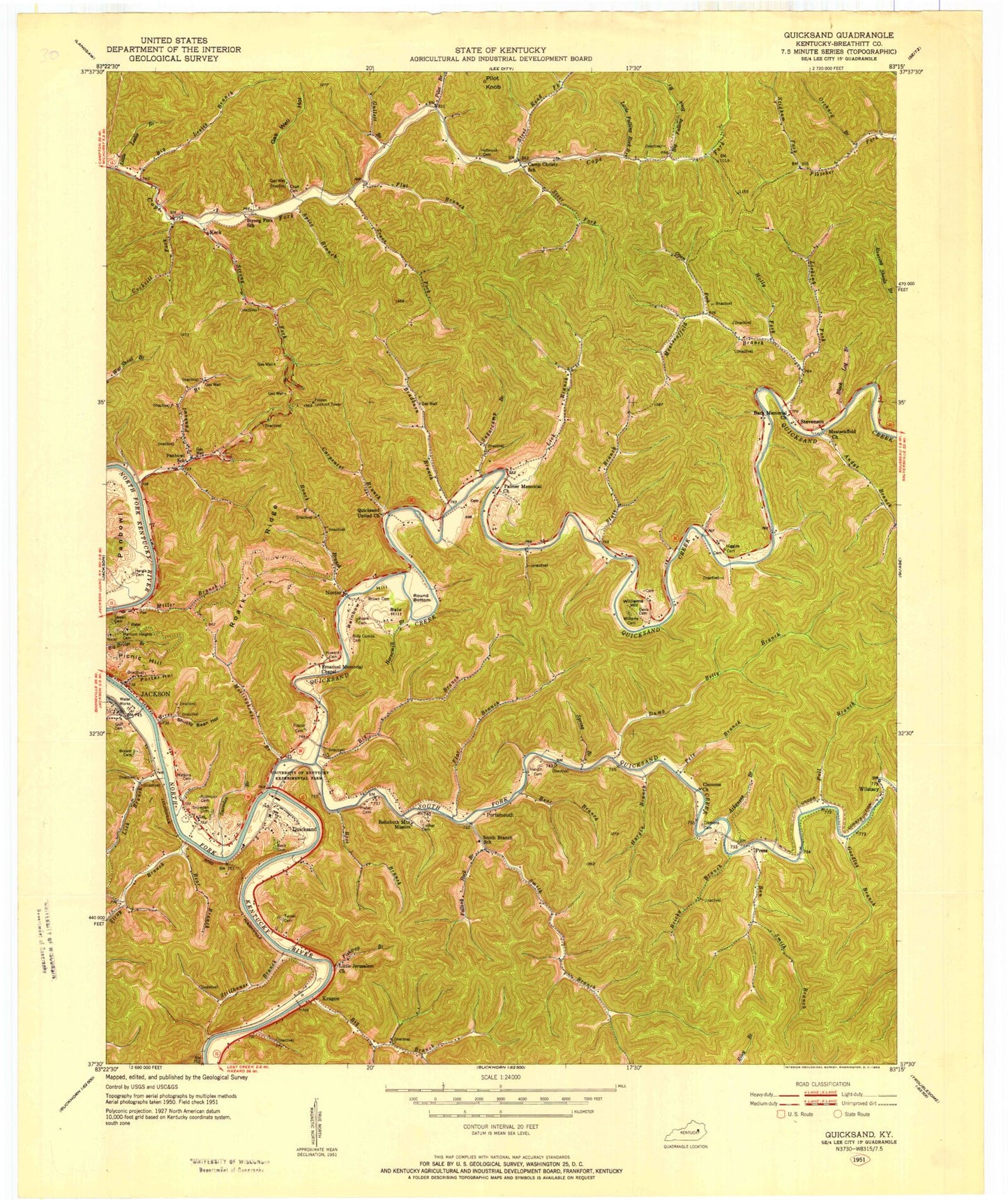
Classic USGS Quicksand Kentucky 7.5'x7.5' Topo Map
Couldn't load pickup availability
Historical USGS topographic quad map of Quicksand in the state of Kentucky. Map scale may vary for some years, but is generally around 1:24,000. Print size is approximately 24" x 27"
This quadrangle is in the following counties: Breathitt.
The map contains contour lines, roads, rivers, towns, and lakes. Printed on high-quality waterproof paper with UV fade-resistant inks, and shipped rolled.
Contains the following named places: Andys Branch, Arkansas Branch, Bach Cemetery, Bach Memorial Church, Bald Hill, Bear Branch, Ben Smith Branch, Bethlehem Church, Big Branch, Big Falling Rock Branch, Big Leslie Branch, Black Log Branch, Bradburn Branch, Breathitt County, Brewer Cemetery, Bricky Branch, Carpenter Branch, Clemons Church, Cockrill Fork, Dumb Betty Branch, Falcon Heliport, Falling Rock Branch, Fishtrap Branch, Flat Branch, Frozen Lookout Tower, Gas Well Hollow, Goodloe Branch, Grace Chapel, Gullett Branch, Hargis Branch, Holly Fork, Horsemill Branch, Julian Carroll Airport, Keck, Kentucky River Medical Center, Kings Branch, Kragon, Lick Branch, Licking Fork, Little Falling Rock Branch, Little Jerusalem Church, Little Leslie Branch, McIntosh Ambulance, Meatscaffold Branch, Meatscaffold Church, Meetinghouse Branch, Miller Branch, Noctor, Open Fork, Orchard Branch, Palmer Memorial Church, Panbowl, Panbowl Branch, Panbowl Church, Pete Branch, Picnic Hill, Pilot Branch, Pilot Knob, Poll Branch, Porter Hollow, Portsmouth, Press, Press Howard Fork, Quicksand, Quicksand Church, Quicksand Creek, Quicksand Fire Department, Rainbow Hill, Rehoboth Mountain Mission, Roaring Shoals Branch, Roark Branch, Roark Ridge, Rose Branch, Round Bottom, Shucky Bean Hollow, Slate Branch, Smith Branch, Snowden Branch, Snowden Cemetery, South Fork Quicksand Creek, Spice Branch, Spring Branch, Steel Road Fork, Steer Fork, Stevenson, Stidham Fork, Stillhouse Branch, Stray Branch, Strong Fork, Sugarcamp Branch, Trace Fork, Turner Cemetery, University of Kentucky Experimental Farm, Williams Cemetery, Williams Hill, Wilstacy, ZIP Code: 41339