MyTopo
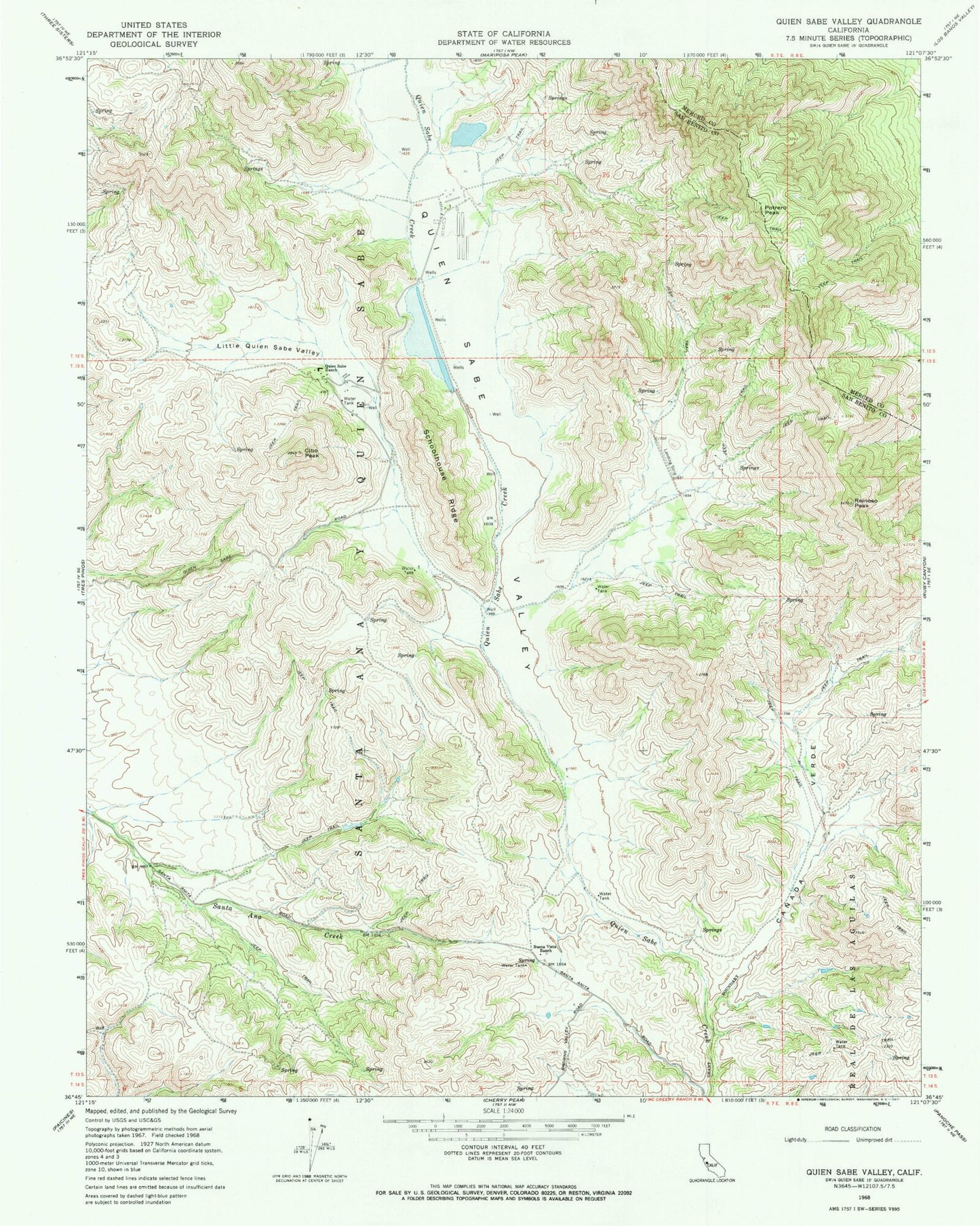
Classic USGS Quien Sabe Valley California 7.5'x7.5' Topo Map
Couldn't load pickup availability
Historical USGS topographic quad map of Quien Sabe Valley in the state of California. Map scale may vary for some years, but is generally around 1:24,000. Print size is approximately 24" x 27"
This quadrangle is in the following counties: Merced, San Benito.
The map contains contour lines, roads, rivers, towns, and lakes. Printed on high-quality waterproof paper with UV fade-resistant inks, and shipped rolled.
Contains the following named places: Buena Vista Ranch, Canada Verde, Cibo Peak, J V De Laveaga 653 Dam, Little Quien Sabe Valley, Percolation Area 653-002 Dam, Potrero Peak, Quien Sabe Ranch, Quien Sabe School, Quien Sabe Valley, Reinoso Peak, Santa Ana Y Quien Sabe, Schoolhouse Ridge, ZIP Code: 95075