MyTopo
Classic USGS Quigley Coulee Montana 7.5'x7.5' Topo Map
Regular price
$16.95
Regular price
Sale price
$16.95
Unit price
per
Couldn't load pickup availability
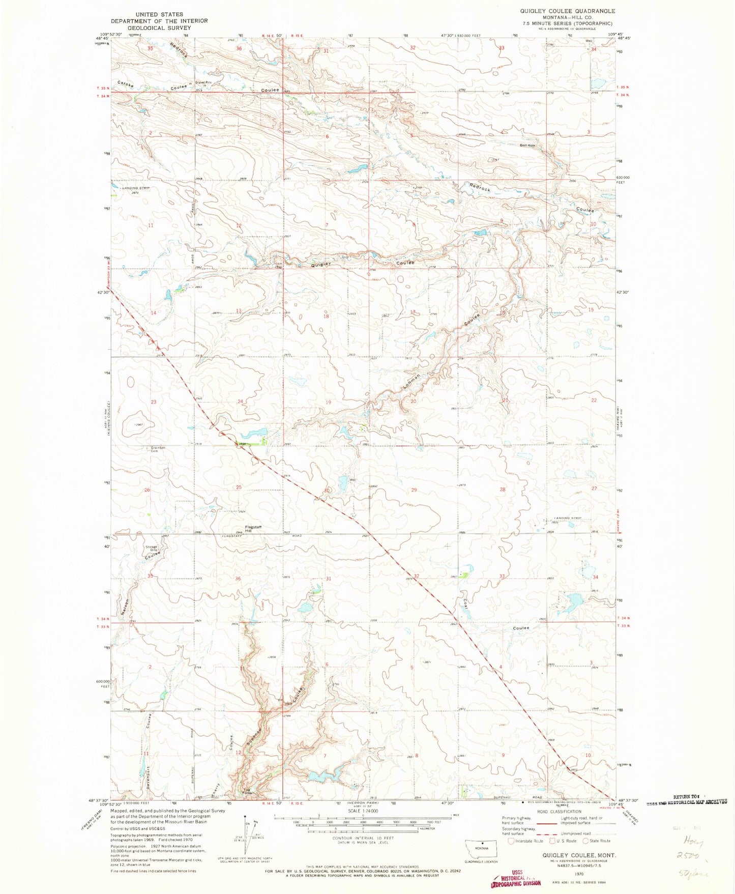
Historical USGS topographic quad map of Quigley Coulee in the state of Montana. Map scale may vary for some years, but is generally around 1:24,000. Print size is approximately 24" x 27"
This quadrangle is in the following counties: Hill.
The map contains contour lines, roads, rivers, towns, and lakes. Printed on high-quality waterproof paper with UV fade-resistant inks, and shipped rolled.
Contains the following named places: 33N15E07DBDA01 Well, 34N15E28DDDA01 Well, 35N15E34ACCB01 Well, 59501, Carske Coulee, Flagstaff Hill, Grainbelt Cemetery, Lohman Coulee, Lohman Dam, Lohman Reservoir, Michigan Dam, Morse D Dam, Quigley Coulee, Supenau Lake Dam, The Forks, Tosland Post Office, Velk Dam