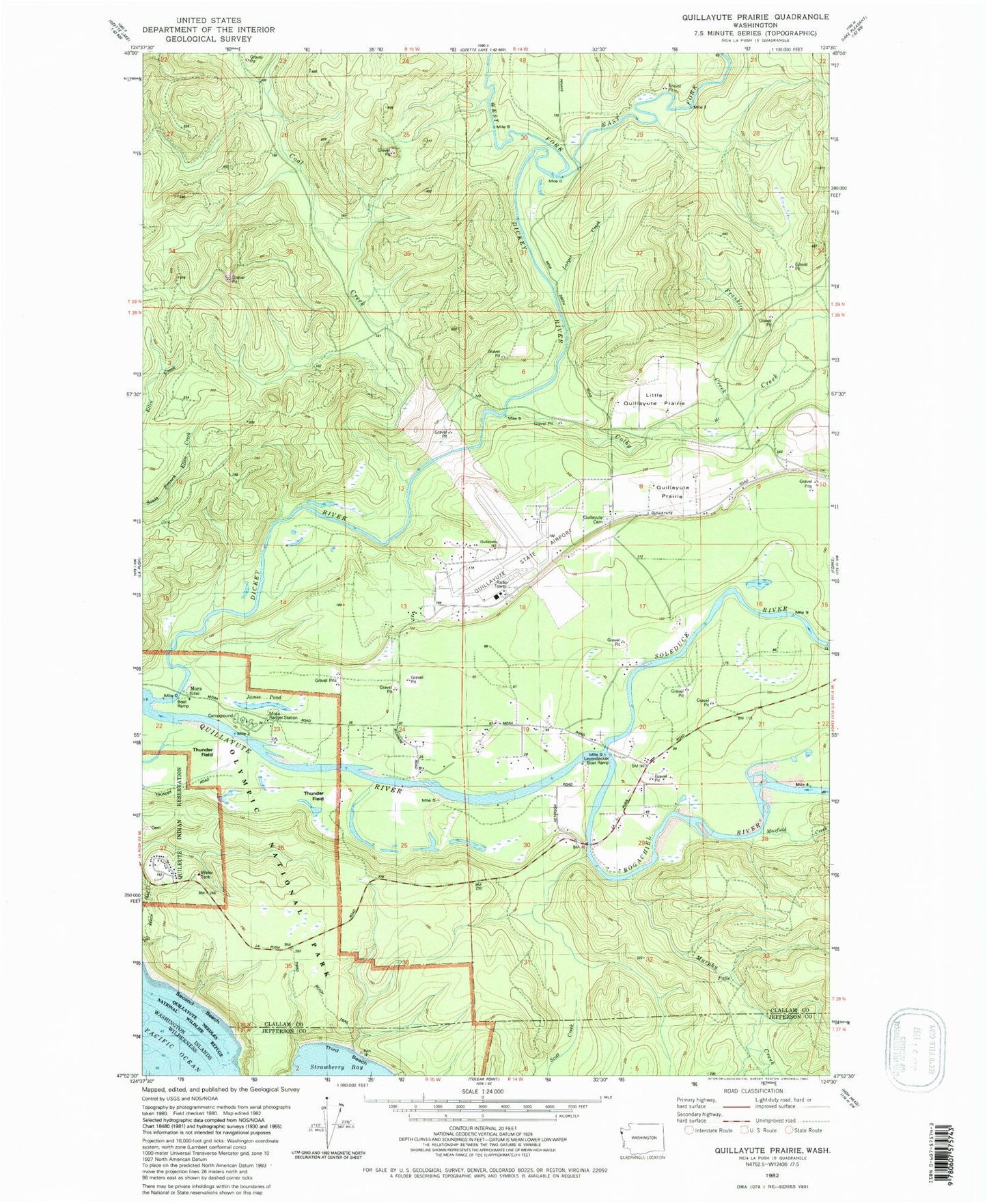
MyTopo
Classic USGS Quillayute Prairie Washington 7.5'x7.5' Topo Map
Couldn't load pickup availability
Historical USGS topographic quad map of Quillayute Prairie in the state of Washington. Typical map scale is 1:24,000, but may vary for certain years, if available. Print size: 24" x 27"
This quadrangle is in the following counties: Clallam, Jefferson.
The map contains contour lines, roads, rivers, towns, and lakes. Printed on high-quality waterproof paper with UV fade-resistant inks, and shipped rolled.
Contains the following named places: Coal Creek, Dickey River, Franklin Creek, James Park, Larger Creek, Quillayute Prairie, Three D Beach, West Fork Dickey River, Newbert Creek, Little Quillayute Prairie, Leyendecker Boat Ramp, Mora Ranger Station, James Pond, Quillayute Prairie Cemetery, Quillayute, Thunder Field, Mora, Quileute Reservation, Leyendecker Picnic Area, Mora Campground, Bogachiel River, Colby Creek, East Fork Dickey River, Maxfield Creek, Murphy Creek, Sol Duc River, Quillayute Airport, Naval Auxiliary Air Station Quillayute (historical), Quillayute Quarry