MyTopo
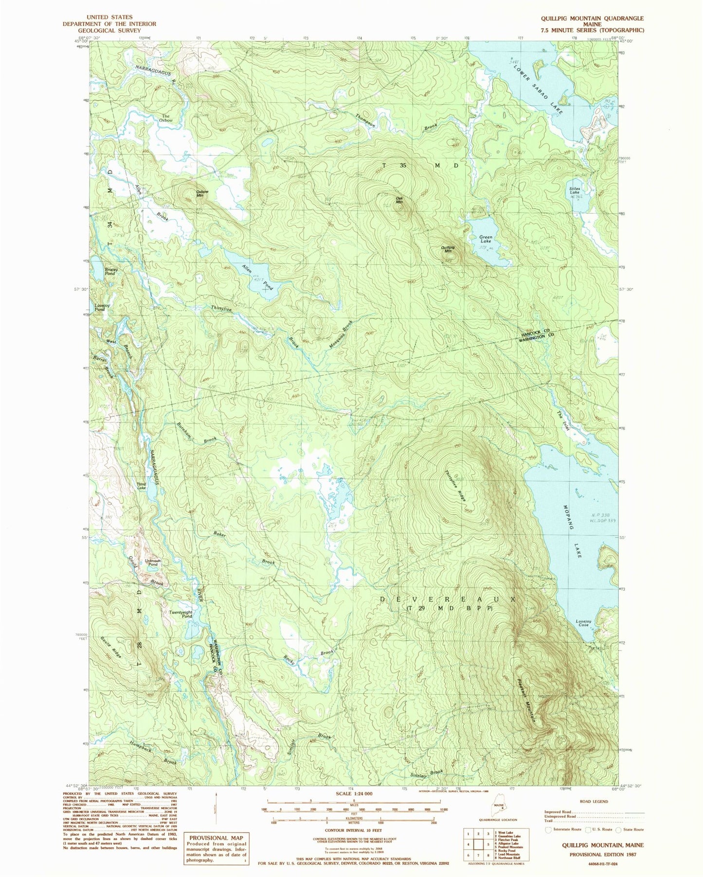
Classic USGS Quillpig Mountain Maine 7.5'x7.5' Topo Map
Couldn't load pickup availability
Historical USGS topographic quad map of Quillpig Mountain in the state of Maine. Map scale may vary for some years, but is generally around 1:24,000. Print size is approximately 24" x 27"
This quadrangle is in the following counties: Hancock, Washington.
The map contains contour lines, roads, rivers, towns, and lakes. Printed on high-quality waterproof paper with UV fade-resistant inks, and shipped rolled.
Contains the following named places: Allen Brook, Allen Pond, Baker Brook, Barrel Brook, Bowers Pitch, Bracey Pond, Burnham Brook, Devereaux Township, Gould Brook, Gould Ridge, Green Lake, Lovejoy Cove, Lower Sabao Lake, Mopang Lake, Mosquito Brook, Oak Mountain, Oxbow Mountain, Pleasant Mountain, Quillpig Mountain, Rocky Brook, Stiles Lake, T35 MD BPP, The Inlet, The Oxbow, Third Lake, Thirtyfive Brook, Thirtyfive Ridge, Thompson Brook, Twentyeight Pond, Unknown Pond, West Branch Narraguagus River