MyTopo
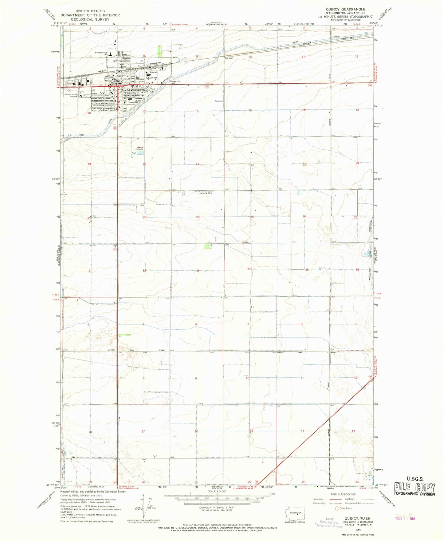
Classic USGS Quincy Washington 7.5'x7.5' Topo Map
Couldn't load pickup availability
Historical USGS topographic quad map of Quincy in the state of Washington. Map scale may vary for some years, but is generally around 1:24,000. Print size is approximately 24" x 27"
This quadrangle is in the following counties: Grant.
The map contains contour lines, roads, rivers, towns, and lakes. Printed on high-quality waterproof paper with UV fade-resistant inks, and shipped rolled.
Contains the following named places: Ancient Lakes Elementary School, City of Quincy, Grant County Fire District 3, Grant County Fire District 3 Quincy Station 30 - 31, Mountain Valley School, Mountain View Elementary School, Pioneer Elementary School, Quincy, Quincy Golf Course, Quincy High School, Quincy Municipal Airport, Quincy Police Department, Quincy Post Office, Quincy Valley Medical Center, Qunicy Valley Ambulance - Quincy Valley Medical Center Emergency Medical Services, Thrifty Villa Shopping Center, West Canal, ZIP Code: 98848