MyTopo
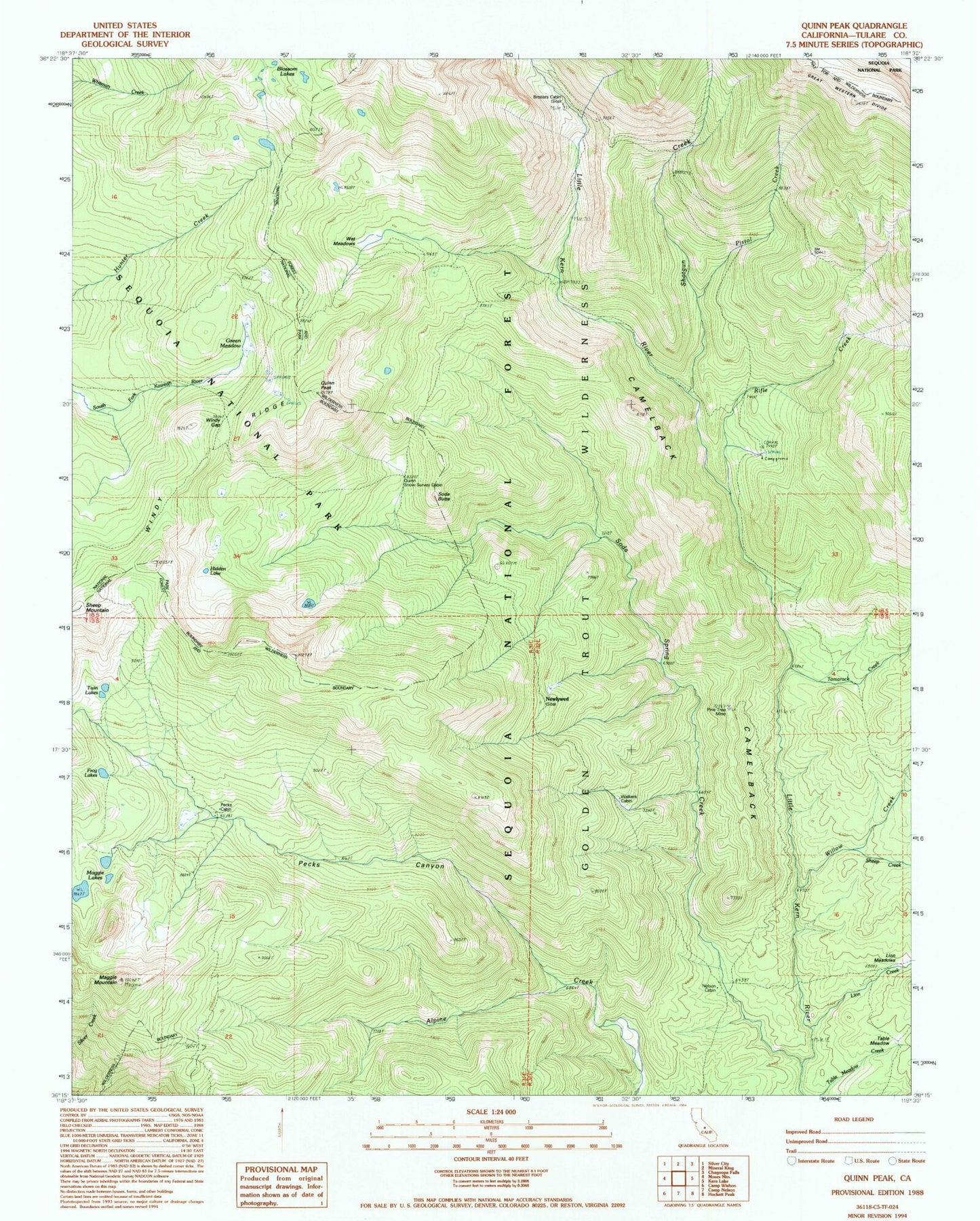
Classic USGS Quinn Peak California 7.5'x7.5' Topo Map
Couldn't load pickup availability
Historical USGS topographic quad map of Quinn Peak in the state of California. Typical map scale is 1:24,000, but may vary for certain years, if available. Print size: 24" x 27"
This quadrangle is in the following counties: Tulare.
The map contains contour lines, roads, rivers, towns, and lakes. Printed on high-quality waterproof paper with UV fade-resistant inks, and shipped rolled.
Contains the following named places: Blossom Lakes, Frog Lakes, Green Meadow, Hidden Lake, Lion Creek, Maggie Lakes, Maggie Mountain, Pecks Canyon, Pistol Creek, Quinn Snow Survey Cabin, Quinn Peak, Rifle Creek, No Name Creek, Shotgun Creek, Soda Spring Creek, Tamarack Creek, Twin Lakes, Wet Meadows, Willow Creek, Windy Gap, Windy Ridge, Pecks Cabin, Table Meadow, Nelson Cabin, Walkers Cabin, Newlywed, Broders Cabin, Sheep Creek, Soda Butte, Camelback, Pine Tree Mine